Brian's Journal - Summer 2010 - Britain
Brianpen Home | Journal Home | Previous | Next (1) End of page
06/14/2010 Southampton to Oxford
We all slept in, especially the boys, who slept through two calls from me and three from the front desk as well as two sessions of me knocking on their door before finally waking up just 10 minutes before our taxi to Portsmouth showed up. We found Mom and John easily at the disembarkation lounge for the QM2. The challenge turned out to be fitting us all into the rental car. I'd reserved a Vauxhall Kafira minivan at Avis which promised to seat 7, and it did, barely, and with a very small amount of room left over for luggage. Fortunately there were only six of us; even so, we only just managed to get us all in with our gear. I was a little apprehensive about driving on the right but it wasn't too bad. The more difficult part was shifting, not so much because I had to use my left hand (at least the clutch pedal was on the left as in the USA) but because the van was a six-speed. I tended to mix up the pairs of middle gears, 2 and 4, and 3 and 5. Mom sat in front to navigate; John sat in back because I don't think he could stand to be in the front and not be driving.
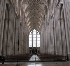
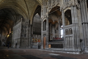
Avis apparently had misplaced our van because it took them an hour or two to get it to our pick-up point at Dock Gate 8. That combined with our late start meant we had to stop for lunch before we made it to Oxford. Winchester, with its famous cathedral, made a good stopping point. We at a very nice lunch (English food has apparently improved ahead of its reputation). I had haddock. While we ate a Woodpigeon cleaned up the crumbs around our feet and a Blue Tit fed young in the bushes hanging over the courtyard wall. The cathedral was impressive, its stonework less obscured by embellishment than the Spanish cathedrals, though like them it houses a collection of bishops' tombs. The boys and I enjoyed taking photos of the interior, propping our cameras at various angles on the floor and pillars to hold them steady.
We had a nice view of a Red Kite right above the shoulder of the M3 on the way up to Oxford. It's a large scavenger with reddish body, prominent forked tail and long narrow wings with a pattern of light and dark underneath, formerly rare in England but apparently more common now as a result of successful reintroduction efforts.
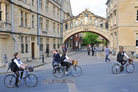
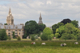
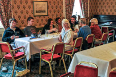
Oxford is a maze of one-way streets clogged with bicycles bearing students in formal black and white attire. The buildings all look like a Harry Potter movie set, and in fact, Hogwarts was modeled after some of them. On first impression it did not appear possible to get to our B&B, the Bath Place Hotel on Holywell street, but we eventually managed to get there. It's a crooked little place which originated in the early 1600's as a cluster of weavers' cottages built against the outside of the medieval city wall. The bedroom floors tilt at different angles inducing a feeling of inebriation as you walk across them, appropriate perhaps since the city's oldest drinking establishment, the Turf Tavern, is right next door. Sarah and Rose were already there when we arrived. Having no reservations, we had a bit of trouble finding a place to eat but got some decent pizza and salad nearby. Bridget, our reason for visiting Oxford, joined us for supper before returning to her studies.
06/15/2010 Oxford Oxford Bird list
After breakfast downstairs in the dining room with everyone - coffee & croissants most memorably but there were eggs and such as well - I walked over to the rose garden with Mom, John and Rose, then while they went into the Christ Church Botanical Garden I walked south about a half mile on a broad path with the Christ Church meadow on my right and the placid River Cherwell on my left, down to where the Cherwell joins the larger Thames/Isis. A footbridge crosses the Cherwell to a row of boathouses which sit on a triangular island on the west side of the Thames. Behind the boathouses the rest of the island is a patch of mixed deciduous woods, brushy enough to be impassable were it not for several bulldozed tracks through it. I wandered around there for quite a while trying to photograph, or at least identify, some of the singing birds. Tree species included cottonwood, ash, maple, beech, cherry, willow, hawthorne, elderberry and others with stinging nettle and blackberry among other understory species. Birds were difficult to spot but easy to hear - Robin, Song Thrush, Chiffchaff, Blue and Great Tits, Wrens, Magpies, Chaffinches and Blackcaps all singing and calling in the woods, and both Stock Doves and Woodpigeons flying between the trees overhead. The Robin songs were particularly striking, a plaintive mix of clear notes and stuttering/shivery trills quite unlike anything I've ever heard before. I spent an hour or more trying unsuccessfully to track down the source of that song; it wasn't until the next day that a woman whom I met out walking her dog suggested that it might be a Robin. Once I knew what it was I was able to spot it right away.
We met at the Ashmolean museum for tea, preceded by an hour or so of touring the museum. Susan rested in the cafe while I explored the Egyption exhibits. I was too tired to enjoy them much but Susan had an interesting conversation with the curator for the Near Eastern exhibits. Before he had to go he suggested that I try birding out towards University Park on the northeast side of town. After our individual museum explorations we in the cafe up on the roof of the museum and ate tea and scones, my first and only English tea during our visit. On the way back from the museum the boys and I took photos, including a number of hip shots of people passing by on the sidewalk. Daniel does particularly well at that.
This morning while the rest of the family toured the botanical garden Susan had visited the New College, which having been founded in 1380 is not exactly new though the buildings just down Holyoke Street from the Bath Place Hotel date back only to the mid-19th century. While there she met a young woman named Suzanne who'd invited her to the evensong service in the chapel at 6:15PM. Having spent too much time taking pictures, Daniel, David and I arrived late but were able to enter and find seats. The service, a structured arrangement of readings, solos and choruses, was more moving than I expected. Hearing the clear voices of the young choristers echoing under the stone arches of the ancient chapel, it was as if we'd stepped through the massive chapel doors and landed back in the 17th century. There seemed to be something spiritual about it too. Though perhaps reverence was not much on the minds of the participants, the effect was nonetheless reverent.
We ate supper outside in the courtyard of the Turf Tavern, right below our room as it happened. The food was quite good, as was the beer according to the drinkers in the family.
06/16/2010 Oxford to Keswick Oxford Bird list
I got out birding early this morning. It was cool and sunny at 0630 and the streets were nearly quiet. The gates to University Park were still locked when I reached them at 0700 so I followed a bike path east across the River Cherwell to the edge of a neighborhood called Old Marston, then north on a little road and hedgerow lanes to the Wolfson Meadows Natural Area, part of a patchwork of hayfields, meadows and hedgerows which runs for about a mile along the east side of the river northeast of town. Footpaths or lanes seem to run along all the hedgerows, with little bridges over the ditches and gates through fences. They're popular with joggers and dog-walkers, local bicycle commuters and fisherman seeking access to the banks of the river. I saw several fishermen near the bridge over to University Park, each with a bench for sitting and a long pole for fishing and usually, a long-handled dipnet for scooping up the catch. Didn't see any fish though. I was out of time when I reached the park so had to enjoy the lawns and big trees in passing and didn't have time to look at any more birds. I was also too late for breakfast but I managed to find some coffee and orange juice and a couple packets of cheese, and Susan saved me a croissant or two.
We packed up and checked out and spent the rest of the day driving to Keswick in the Lakes district, with a late afternoon stop at the famous estate of Chatsworth where Mom wanted to see the gardens. The roundabouts on the way out of Oxford were particularly confusing and we made several wrong turns. Sarah, Silas and Rose, in their own rental car behind us, began to wonder if we knew where we were going. On the road again we stopped for lunch at a highway rest area, rather a nice one with a good selection of interesting sandwiches and treats.
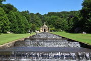
The sturdy gray stone villages around Chatsworth, surrounded by green rolling meadows enclosed in high stone walls, were more scenic than the estate itself. Chatsworth is famous for its water feature, a series of little waterfalls formed by big stone steps descending a hillside. The boys and Rose and I hiked up the waterfalls and up the hill into the woods where we found some big beech trees, a shallow pond and a broad sheep pasture up on top. We made our way back down just in time to meet the others at the car.
In Manchester we missed another turn and this time managed to lose Sarah. We had no way to contact her but fortunately we both decided to stop at the next highway rest area for coffee. It was an older place with a covered walkway extending all the way across the freeway so traffic in both directions could share the same facilities. We ate a bit of supper upstairs in a big glass-walled cafeteria from which we could see the distant hills of the Lake District.
It was a long drive up to Keswick and we arrived right about dusk. Silas had called the B&B to tell them that we would be late and they'd told him to look for "Lancaster" street on the left as we came into town. There was no Lancaster street. They were a bit put out when we called them again, close to 10PM this time, but were gracious enough when we showed up at their place, called Pitcairn house, built of gray slate in 1872 and located on Blencathra street.
06/17/2010 Keswick - Hike up Blencathra Hiking route Keswick Bird list
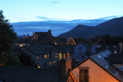
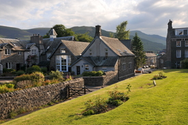
I walked around our part of town a bit this morning, south a few blocks to a church, then down to Borrowdale road and across it to a small public garden. Our neighborhood seems to be mostly B&B's in three story buildings made of flat greenish-gray stone with white wood trim around the windows and doors. The buildings form a continuous front along the street though some are set back enough for a little flower garden, or even a courtyard big enough for a card table or two. Down every street is a view of the mountains which seem to surround the town in all directions. They're more like steep-sided hills but the lack of trees makes them seem higher.
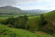
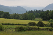
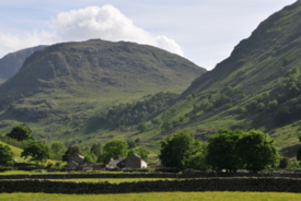
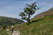
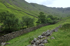
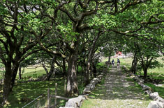
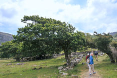
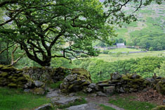
The mountains are mostly open, carpeted with grass cropped short by sheep, or by bracken (on the lower slopes) or gorse (higher elevations in some areas). The valley bottoms are mostly pastures or hay fields sectioned off into 2-20 acre parcels by stone walls and/or hedgerows. Forests for the most part are restricted to the edges of valleys and the lowest slopes of the mountains and frequently consist of mature mixed deciduous trees, stout and heavy-limbed - oak, ash, chestnut, maple, gray birch, cherry, beech, basswood?, cottonwood?, willow (low areas) and others, with larch and a red-barked pine in some places. There are also a few monoculture plantations of Douglas Fir scattered over the landscape, planted I think on formerly open land. I suspect the mixed hardwood forest once was much more widespread on the mountain slopes and would still be except for grazing of seedlings by sheep, because forest hardwoods grow wherever sheep can't reach, such as in stream gorges and on scattered plots of fenced land. Gnarled old hawthornes also grow scattered among the boulders on steep mountain slopes and gray birch and larch for pure stands in places on the lower hills, where I assume they were protected long enough to become established.
We didn't see many flowers in the mountain pastures, perhaps again due to sheep grazing. Nor did I spend enough time in the forests and glades to learn much about the understory plants. We saw no mammals other than sheep anywhere and no non-insectivorous birds, perhaps because the grasses rarely mature to form seeds. By and large though, the hillsides didn't seem overgrazed. Eroded or washed-out areas were generally restricted to the oversteepened backslopes of old roads and trails.
The landscape of the Lakes District has been subject to human alteration for a long time. According to Wikipedia Keswick was granted a charter for a market in 1276; the name refers to a place where cheese was made, sheep's milk cheese probably, based on historical information from the town's website. The area was a center of mining for graphite, slate, copper and lead at various times from the 16th century through the 20th. The bulk of the forests were probably cut in the 18th century to fuel smelters for copper and lead. Tourism began in the 1800's and has grown ever since, but thanks to its inclusion in the Lake District National Park, Keswick has apparently retained much of its 19th century character. That together with its location surrounded by lakes and fells makes it a popular destination for walkers.
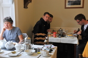
Anyhow, the family was down in the dining room when I got back to Pitcairn House. Breakfast consisted of scrambled eggs of perfectly uniform consistency, bacon, sausage, fried potatoes, sauteed (or perhaps boiled) mushrooms, baked beans in tomato sauce, broiled tomato halves, toast, apples and kiwis, coffee, tea and orange juice, in whatever combination and quantity we desired, plain but filling fare. Afterwards David and I walked downtown in search of an ATM. We eventually found one, though not before walking past thirteen different stores selling outdoor gear. I don't think there are that many outdoor stores in all of Seattle.
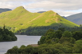
After breakfast we consulted the owners of the Pitcairn house regarding where to hike. They had some good suggestions, along with maps and directions for some of the more popular ones. The boys and I selected Blencathra, attracted by its renowned sharp-edged ridge, while the rest of the family decided to do Cat Bells, an enticing ridgewalk on the other side of the lake.
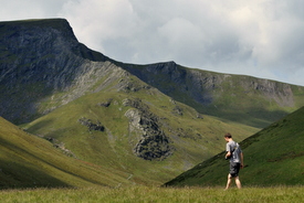
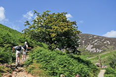
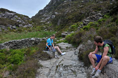
We parked at a pulloff on the A66 a couple hundred yards down the hill from the White Horse pub and hiked up to the northeast. Silas and Daniel went directly up the ridge while David and I dropped over the shoulder of the ridge into a bowl, then followed a trail diagonally up and over the headwall onto a flat saddle. Not a tree or bush anywhere, just short-cropped grass and some low bracken fern. On the far side of the saddle the valley of Scales Beck (brook) leads north past the east face of Blencathra, below the sharp-edge ridge. I was hot and sweaty from the hike up so I dropped into the valley and cooled off in the stream before following a trail up the east side of the valley while the boys traversed the west side. Silas, David and I reunited at Scales Tarn below Blencathra while Daniel across the slope above us. After a brief swim in the lake we hiked up to the sharp-edge, a steep rib of gray slate descending from the summit. I intended to walk up but used my hands in a couple of places. Daniel's route up the headwall above Scales Tarn was probably more difficult. He lingered on the summit to build a big Goldsworthy-style cairn while we wandered southwest across the fell on meadows so smooth and close-cropped that I took off my shoes and hiked barefoot for two miles. We hung out on the ridge above the A66 until Daniel made his way over to us, with occasional diversions to dash after sheep. Clouds of gnats along the ridge attracted a flock of swifts which sliced up the air around us. The gnats were not deterred. Descending towards Keswick Daniel practiced his front flips.
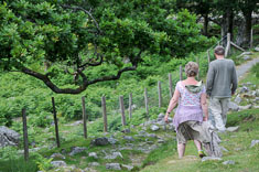
The boys continued on towards town while I followed a trail along the stone walls marking the upper boundary of the valley farms, back up to the White Horse Pub to pick up the car. We all reached the Pitcairn house just as the family was headed out to the George Hotel for dinner. I managed to get ready in time but the boys were late, so we all got a scolding by the master of the pub because our party wasn't all present at the appointed time of our reservation. The food was delicious though, so we arranged to return the following evening despite the prickly reception. I had butternut squash and goat cheese lasagna with an appetizer of grilled sardines, both very good.
06/18/2010 Keswick - Hike up Great Gable Hiking route Keswick Bird list
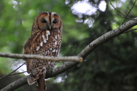
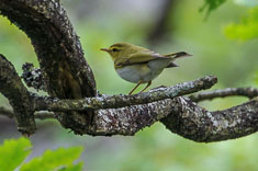
I set out early with my camera for some birding down towards Walla Crag but didn't make it quite to the trailhead. I started up Ambleside Road but when that veered off to the left I turned right on a lane across a meadow then found a trail which climbed through a patch of woods over the shoulder of a little hill, then dropped down to Borrowdale Road. About a half mile south of there in a strip of stout chestnut trees along the road I found the hightlight of my morning walk, a Tawny Owl. Though I didn't see it until I flushed it, the owl didn't go far and I was able to get close enough for some photos. I continued down to a low area of birch woods along the lake side of the road where I found a singing Willow Warbler, then it was time to head back home for breakfast.
Daniel had a bug bite of some kind on his foot which made walking in shoes a little uncomfortable so he and Silas decided to go boating on the lake. Sarah wanted to do a hike so she came along with David and me on a walk up to Styhead Pass above Seathwaite farm at the head of the Borrowdale valley south of Derwent Water, the lake by Keswick. Susan joined Mom and John on a hike up Latrigg, a low fell right above town. I'd have liked to climb that one too, along with Walla Crag south of town, but there just wasn't time.
We drove down the west side of the lake along the base of Cat Bells on a road better suited for walking than for driving. I would have stopped for a photo at every turn but we were short of time and there weren't many turnouts anyhow. It's probably typical of Lake District hikes, that the drive to the trailhead would make nearly as nice a hike as the trail itself. Seathwaite is an old farm in a narrow flat-floored valley surrounded by a green patchwork of pastures stitched together with stone walls. We passed a couple campgrounds with limited facilities, potential lodging options for a future trip. Approaching the farm the road is lined with cars; apparently Seathwaite is also the trailhead for Scafell Pike, the highest peak in England and therefore the object of many a quest.
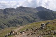
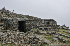
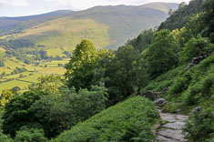
About a half mile above the farm, just past an old stone bridge over a bouldery stream, the trail forks. The right hand trail ascends a steep slope past a waterfall with larches growing along it. The other trail continues up the valley with steep boulder-studded meadows on the left and a rough ridge dotted with low crags on the right. David thought the ridge looked interesting so headed straight up it while Sarah and I continued up the valley, she on the trail while I walked up the meadows along the stream. Other than an occasional gnarled hawthorne on the open slopes and a ribbon of trees in a small gorge where the sheep couldn't easily reach, there was no vegetation taller than a bracken fern anywhere in the valley. No other hikers either, a bit surprising given the number of cars at the trailhead. We did see a few up at the height of land, where the trail continues up towards Scafell Pike. I followed the stream up into a shallow gorge, a gill in local terminology, shady and green with birch and hawthorne, clear water splashing over slabs and ribs of gray slate with occasional veins of white calcite. Near the top of the gorge an old mine adit formed a dark hole in the wall above me. I scrambled up to it, startling a solitary young sheep (old lamb?) resting nearby. I was sorry to see that sheep can get into the gorge but glad that at least a few trees are surviving. Lacking a light, I didn't explore the mine. Once out of the gorge I hiked up a narrow rib of moraine gravel carpeted with soft grass then traversed up towards the height of land across rough ledges and damp peat meadows. David reached the saddle at the same time I did so we hiked together down to a triangular tarn where Sarah was settling down to lunch.
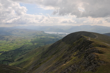
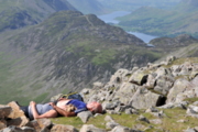
We had about an hour and a half before Sarah wanted to be back to the car, just enough time, I thought, to detour up over Great Gable, the prominent rounded peak above Styhead Pass. Sarah disagreed, so I told her we'd hurry and we did. I made it up the 1350' to the summit from Styhead Pass in 28 minutes of strenuous hiking, with David about 5 minutes behind me. From the summit gray-green fells extended in all directions, their rounded summits rough and exposed with crags and talus aprons dropping into green valleys, all fading blue towards the horizon. Radiating out to the north, west and south the larger valleys sheltered pale blue lakes bordered by the tell-tale geometry of distant human occupation, green pastures, dark hedgerows and rectangular conifer plantations flattened by perspective.
We lingered on top long enough to talk with a couple of women who were on their 200'th of some list of 211 (I think) peaks, perhaps the Marilyns (as opposed to the Munroes, which are peaks in Scotland). One of the women had also been to North Conway and done a little hiking in the White Mountains. Late leaving, we ran most of the way down with a brief detour to the rounded summit of Green Gable, Great's smaller sibling, reaching the car only ten minutes behind Sarah. She'd been delayed by taking a scenic route down along the waterfall which reminded her of hiking down Tuckerman's Ravine.
06/19/2010 Keswick to Harlech
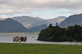
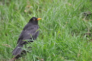
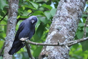
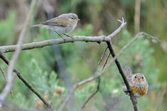
Our two day stay in Keswick was too short. Our last morning I made it out once more, walking with Sarah down to the shore of the lake on the far side of a sheep pasture from the little public garden below Borrowdale Road. Sarah turned back there and I continued along the shore up to a shallow bay lined with reeds and willows. The water is a foot or two lower than normal so I ventured out onto peat flats for a closer shot of a pair of nesting Great Crested Grebes but managed to keep my feet dry. On the way back I managed to get fairly close-up shots of the most common local birds - Jackdaw, Woodpigeon, Blackbird, Robin and Song Thrush along with a family of juvenile Great Tits, though I missed several others that I saw in the garden - a Chiffchaff, Dunnock, Blue Tit and Goldcrest.
After we packed up we had an hour or so before we had to leave so we all went downtown to buy some lunch. It was market day and there were all kinds of vendors in the pedestrian square above and below the historic Moot Hall in the center of town. I bought a jar of Mr Vikki's Hot Coriander Sauce, a dark chili sauce. I intended to spice up my bread and cheese with it but ended up carrying it home to the US and didn't open it for months. For lunch I picked up some sardines and a package of fresh snow peas from the little store around the corner, a plastic tub of roasted vegetables from a meat market/deli and and a loaf of ciabatta bread from a bakery near the market.
Rose wanted to see the Castlerigg stone circle so we stopped on the way out of town. It been sitting on a prominent flat hilltop a mile or two east of Keswick for 4,000 years but not much is known about it other than that it's been a popular tourist attraction for the last 150 years. I'd love to know how the landscape, and even just the immediate vicinity of the circle, has changed over the centuries since it was erected. Even now, little is known about who built it, for what purpose, and why they chose that particular site.
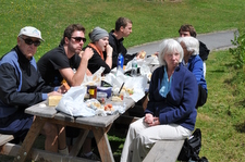
Returning to the A591, and narrowly avoiding a collision at the intersection, we headed south to Ambleside where we stopped for a bathroom break and brief shopping expedition. I photographed a brown trout finning in the shallow stream that runs through town. Ambleside has nearly as many outdoor shops as Keswick. A mile or two south of town we stopped again, this time for a picnic lunch at (one of?) the headquarters of the Lake District National Park. We found a table at the edge of a meadow below some gardens associated with a big house on the hill and pooled our various lunch selections for a nice potluck. A couple of Carrion Crows and a Black-headed Gull joined us for leftovers. It was a very nice day, bright and sunny but cool enough for a light fleeece.
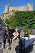
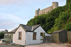
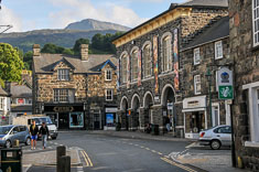
The rest of the drive down to Wales was tiring. The roads were narrow with lots of hills and turns and frequently bordered by a stone wall so close that we seemed in continual danger of scraping paint off the passenger side of the car. We never did though; the only damage we incurred was a dent Daniel pressed into the tailgate with his butt while trying to close it with all our gear in the back. We stopped in Llandudno to go grocery shopping since we'd be on our own for food in the apartment in Harlech. Prices seemed high and the selection somewhat limited. From Llandudno we drove south on the A470 through Betws-y-Coed, a town whose name we never did figure out how to pronounce, and up over a high pass from which we descended through a series of slate-mining towns in a steep-sided valley with gray tailings piles and drifts of pink-flowered heather. The B4573 into Harlech was particularly narrow, apparently a one lane road with stone walls pressing in on both sides converted to two lanes without any widening work. Fortunately there wasn't much traffic. We found our house, Tan-y-Graig, with no difficulty; there are only three or four houses situated with it at the foot of the castle. For dinner we tried the Castle Hotel across the parking lot from the entrance to the castle. Though we had some difficulty communicating with the waitress, who looked to be about 14, dinner was quite good and reasonably priced. I had ricotta canelloni.
06/20/2010 Harlech Bird list
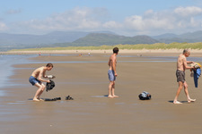
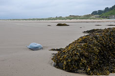
We all hiked out to the beach after a late breakfast. Harlech has quite a beach. It's flat and sandy and about two miles long backed by a band of low sand dunes covered with dune grass and low shrubs. The water was surprisingly comfortable considering Harlech is at approximately the same latitude as southern Labrador. John and the boys went in; I didn't feel like getting wet, so I didn't. I was more interested in the birds I heard calling back in the dunes, so while the boys dug tunnels in the sand I went birding. Willow warblers were singing from willows in hollows between the dunes and Common Whitethroats were common in the lower brush. Though I'd seen them in Oxford, I got closer views here.
Behind our house at the foot of the cliff below the castle is a small private yard with a picnic table and a resident robin. We all ate our lunch around the picnic table in the sun, relaxing after our strenuous travel day yesterday. As soon as we left the table the robin moved in to clean up behind us, and even offered to tackle the kitchen as well when we left the back door open. The sun was a little warm so we mostly settled down inside after lunch to peruse maps and screens. I was just about to take a nap when the power went out. I found the circuit box in a closet off the kitchen. and it looked as though the main breaker was tripped. I gingerly reset it and it immediately snapped off again. It stayed on if I turned off all the other circuits, but as soon as I turned on the kitchen circuit, the breaker tripped again. By unplugging various appliances I narrowed the problem down to the dishwasher. Then I realized what the hand- written notice over the dishwasher meant. It warned against washing and drying the dishes at the same time, which hadn't made sense until I discovered that the dishwasher had an option to dry the dishes at the end of its cycle, and we had not de-selected that option when we'd tried to do the lunch dishes.
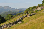
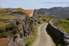
After my nap I went out again, this time up into the hills above town. Harlech and its castle+ sit on a steep bluff at the south end of a triangular coastal plain south of the estuary of Afon (river) Dwyryd and several other rivers. East of Harlech pastured hills rise up to 800-1000' before dropping into the semi-wooded valley of Afon Artro and Llyn lake) Cwm Bychan. The Rhinog mountains beyond the lake reach twice that height, their worn ridges rough and dark. About a quarter mile north of Tan-Y-Graig I found a trail up through the woods to the road. Though it wasn't marked, it continued diagonally up a driveway and through a gate before turning back towards the south again and emerging into stone-walled pastures and bracken meadows. Now I could see where I'd been, the slate roofs of town and the stone turrets of the castle behind a fringe of trees, and beyond them the green and tan plain and the blue ocean. I couldn't see where I wanted to go though; the Rhinogs were blocked by the bulk of the hill curving away above me with no peak in sight from which I might get a view, so I followed a faint track over to a narrow walled road which dropped back into town. The road was so narrow that when I saw a minivan descending above me I took refuge in a break in the wall to allow it to pass.
Back at Tan-Y-Graig I found Susan and the boys but no-one knew where the rest of the family had gone for supper. The options were limited so we walked back up the hill, checking places as we went, and found them at the Lion Pub just above the main street on the road I'd just walked down. My battered cod and chips were greasier than I expected, so I cracked off the coating and ate just the white fish inside.
Nice sunset as we walked back down the hill to Tan-Y-Graig.
06/21/2010 Harlech - Hike to Llyn Cwm Bychan Our route
In the morning I walked up the hill to the pharmacy to inquire about getting treatment for Daniel's foot. His bug bite was red and swollen and didn't seem to be getting better. The pharmacist decided from my description that his condition was more than she could handle so she referred me to the clinic down on the road to the beach, just a quarter mile or so from our place. Susan and I drove Daniel over and though they couldn't see him just then, they did have an opening after lunch. I wanted to try to hike over to the Rhinogs so Susan agreed to take him while David and I headed off into the hills.
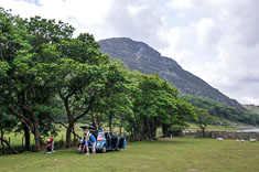
Most of the family started out with us, hiking up the road above town, but they headed south on a grassy lane while we continued up the hill. I snapped a photo of their map before we separated; though the narrow field of view on my camera LCD made navigation difficult, it was adequate. Following roads and trails we worked our way over the hills and down into the valley of the Afon Artro. A very scenic little road followed the stream up the valley to the lake. Though tempted to stop several times, we put off eating until we reached the head of the lake. The pastures at the head of the lake are private property, part of a working sheep farm, but since we had no vehicle we didn't pay the £5 parking fee. We settled down in some marshy grass out by the water and ate our lunch. There wasn't much of it since neither of us had carried a pack.
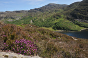
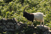
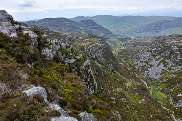
The Rhinogs were right above us, rough dark hills of gray limestone blanketed with brown heather. Unfortunately it was already 2PM and it would take us another three hours to get home leaving an hour at best to explore the mountains, so we turned back. There was time for a scenic route home though, and David was up for it, so we hiked up over the shoulder of the hill on the north side of the lake, up a talus slope and into the heather. I was glad to get a closer look at it. There seemed to be two species of heather - Bell heather (Erica cineria) and Cross-leafed Heath (E. tetralix) along with a type of blueberry, aka whinberry or wimberry or bilberry or whortleberry. The berries look and taste like huckleberries, tart and flavorful. Footing is treacherous in the heather; I'd hate to have to hike very far in the stuff, and fortunately we don't have to. We soon find a faint trail down through bracken and boggy grass, traversing along a gentle valley to a ruined stone house, and a new stone house beyond it by a stream. A Gray Wagtail that we flushed from the ledges by the stream was too wary for photos. A black and white goat with very long, curved horns steps along a stone wall then drops back into the bracken. He seems to feel about us the same way we do about him - curious, but content to keep his distance.
We're in sheep pastures the rest of the way back overland to the road but the sheep stay well clear of us. Not much wildlife either - a man walking on a distant road, a couple of hares in a patch of tall marsh grass, stonechats on a brushy hillside and a meadow pipit on a stone wall and buzzards, the local redtail equivalent, soaring overhead now and then. We also had a Red Kite over the hills back near the lake. It was a long walk back to Tan-Y-Graig and we made it just in time to join everyone at Y Branwen for dinner. I had salmon which was delicious.
Though it was her first time behind the wheel so far this trip, Susan had no problems driving Daniel to the doctor. The doctor gave Daniel a few pills of some antibiotic to take if his bug bite got worse but she didn't seem too concerned about it. She told us there were no poisonous insects in Wales, and that the bite would probably clear up on its own in a few days. Daniel decided he was OK without the antibiotics for the time being.
06/22/2010 Harlech - AM beach walk (Bird list), PM hike Cadair Idris
A quiet overcast morning, temperature around 60F. From Tan-y-Graig, our self-catering cottage below the Harlech Castle near the Y Branwen restaurant, I walked across the railroad tracks and along the edge of the of the Royal St David golf course to a trail which lead across the dunes out to the beach. I continued south along the water to the end of the beach, then returned via the trail, across the tracks and back up the lane to our place again. I counted birds, recognizing most of what I heard or saw, and took a few photos with the 70-300 lens as well.
In the afternoon we all drove from Harlech down to Dogellau, only about 10 miles to the southwest on
the map M+ but twice that by the road. From Dolgellau we continued
east and south a few miles on the A-487 to the carpark at Dol Idris, the trailhead for the Minffordd
Path up Cadair Idris. As we sat down at a picnic table for a bit of lunch two fighter jets raced low
overhead, the roar of their engines echoing off the ridges above us before fading into quiet of the
Welsh countryside.
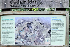
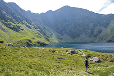
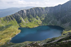
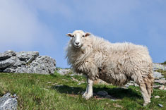
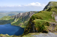
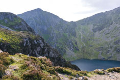
The blue lake Llyn Cau lies cradled in a cirque immediately below the summit of Cadair Idris +, aka Penygader or Penygadair, which at 2,930 feet is not the highest peak in Wales but may be, due to its relative isolation, the most spectacular. The mountain is devoid of trees, carpeted instead with green grass mowed short by sheep and with scattered patches of heather mostly constrained to cliffs and rocky ridges. As in the Lake District the trees are down in the valleys.
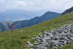
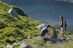
We all hiked together up to the lake then Silas and I continued up to the ridge, over the summit and on around the rim of the cirque before descending back to the lake.
We encountered a handful of hikers on the summit but otherwise had the mountain to ourselves. Except for the sheep of course, but there weren't many of them and they kept to themselves.
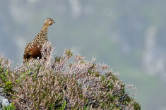
I did not see many birds either, but was delighted to run into a Red Grouse along the ridge east of Craig Cwm Amarch, and even more delighted to get a photo. It is conspecific with the Willow Ptarmigan of North America but unlike its Canadian cousin, does not turn white in winter.
We ate dinner in Dogellau; I don't remember what or where or whether it was any good but our afternoon on Cadair Idris was a highlight of our time in Wales.
A quiet overcast morning, temperature around 60F. From Tan-y-Graig, our self-catering cottage below the Harlech Castle near the Y Branwen restaurant, I walked across the railroad tracks and along the edge of the of the Royal St David golf course to a trail which lead across the dunes out to the beach. I continued south along the water to the end of the beach, then returned via the trail, across the tracks and back up the lane to our place again. I counted birds, recognizing most of what I heard or saw, and took a few photos with the 70-300 lens as well.
The blue lake Llyn Cau lies cradled in a cirque immediately below the summit of Cadair Idris +, aka Penygader or Penygadair, which at 2,930 feet is not the highest peak in Wales but may be, due to its relative isolation, the most spectacular. The mountain is devoid of trees, carpeted instead with green grass mowed short by sheep and with scattered patches of heather mostly constrained to cliffs and rocky ridges. As in the Lake District the trees are down in the valleys.
We all hiked together up to the lake then Silas and I continued up to the ridge, over the summit and on around the rim of the cirque before descending back to the lake.
We encountered a handful of hikers on the summit but otherwise had the mountain to ourselves. Except for the sheep of course, but there weren't many of them and they kept to themselves.
I did not see many birds either, but was delighted to run into a Red Grouse along the ridge east of Craig Cwm Amarch, and even more delighted to get a photo. It is conspecific with the Willow Ptarmigan of North America but unlike its Canadian cousin, does not turn white in winter.
We ate dinner in Dogellau; I don't remember what or where or whether it was any good but our afternoon on Cadair Idris was a highlight of our time in Wales.
06/23/2010 Harlech - Hike Roman Steps above Llyn Cwm Bychan
Bird list
We drove over from Harlech to Llyn Cwm Bychan, a lake on the west side of the Rhinog mountains about 3 miles east of Harlech. It was a challenging drive on steep narrow lanes with stone walls on either side but fortunately we encountered no traffic.
After paying £5 to park in a sheep pasture at the head of the lake we hiked up the trail to the Roman Steps, a series of ancient (medieval but probably not Roman) steps leading up to Bwlch Tyddiad, a narrow pass through the mountains.
I lingered behind to identify birds in a beautiful open oak-birch woods along the trail, then ran to catch up to the boys at the pass.
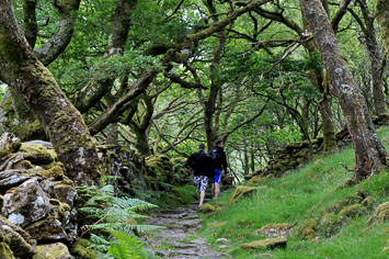
The trail continues beyond the pass, connecting to a climber's track which leads to a small lake and offers access to the peak of Rhinog Fawr. Years later I would come across this account + of a hike up Rhinog Fawr from the Roman Steps but today, short on time and unaware of what lay beyond, we scrambled up onto the ridge to the right of the pass, admired the view down the valley up which we had come then followed a faint track back down a few hundred yards to the trail.
Top
Brianpen Home | Journal Home | Previous | Next (1)
