Brian's Journal - Summer 2011
Brianpen Home | Journal Home | Previous | Next (1) Jade Lake | La Bohn Lakes | Mt Hinman | Dutch Miller Gap | Third Beach | Toleak Point | Ilwaco salmon fishing | Skagit Flats Marathon | End of page
07/06/2011 New Hampshire Photo Gallery
We arrived in Boston yesterday morning and drove up to New Hampshire. Don't recall much other than the dramatic sunset.
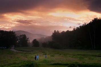
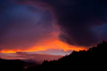
We arrived in Boston yesterday morning and drove up to New Hampshire. Don't recall much other than the dramatic sunset.
07/09/2011 SE Baldface hike 7.5 miles, 3000'
 We almost didn't go. Daniel had to be at work, busing dishes at the Red Fox, at 5PM and I figured
the drive over there would take 45 minutes each way and, leaving us five hours at most for the hike.
My estimates were pretty close; we hiked up to the summit of South Baldface and back in 4 hours,
including a 15 minute stop for lunch and another 15 minutes at the summit.
We almost didn't go. Daniel had to be at work, busing dishes at the Red Fox, at 5PM and I figured
the drive over there would take 45 minutes each way and, leaving us five hours at most for the hike.
My estimates were pretty close; we hiked up to the summit of South Baldface and back in 4 hours,
including a 15 minute stop for lunch and another 15 minutes at the summit.
We didn't notice any wind when we started up the trail. It was a beautiful clear day, the first morning we've had no black flies during breakfast on the front porch with Mom and John. I considered counting birds but when I couldn't recognize several of the songs I decided not to because I didn't have enough time to try to identify them. I did recognize a singing Scarlet Tanager, Hermit Thrush, Solitary Vireo, Ovenbird and several Blackburnian Warblers soon after we started Birds aren't singing much anymore; we heard perhaps two or three individuals every five minutes.
 We hiked steadily up through the woods. Daniel, carrying our one pack, was a little slower so David
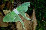
and I stopped periodically to let him catch up. At one stop David looked down and noticed a Luna
Moth sitting on dried leaves at the side of the trail, nearly worn out. We took photos. At the
shelter we all stopped, drank some water and perused the graffiti to find the oldest entry. We
found several dated '77 and '78 and one possible entry from Aug 73. The most recent entry which had
been painted over was 2009.
We hiked steadily up through the woods. Daniel, carrying our one pack, was a little slower so David
and I stopped periodically to let him catch up. At one stop David looked down and noticed a Luna
Moth sitting on dried leaves at the side of the trail, nearly worn out. We took photos. At the
shelter we all stopped, drank some water and perused the graffiti to find the oldest entry. We
found several dated '77 and '78 and one possible entry from Aug 73. The most recent entry which had
been painted over was 2009.
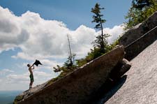
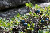
Reaching the ledges, we stepped into the breeze which had been stirring the treetops overhead on the way up. It felt good. Serviceberry bushes along the trail were laden with soft sweet fruits. We found a few ripe blueberries as well but most were still small and green. The wind picked up as we scrambled higher. Up on the shoulder of the ridge I traversed around to the east across the sloping slabs of granite. As the summit of North Baldface came into view across the basin, the wind became so strong over the exposed ledges that it was easier to scuttle across them on all fours than to try to walk. The boys would love this, I thought, so I waddled across the ridge to find them, bracing myself against the wind as if wading across a swift river.
 They had already discovered the wind and were reveling in it. We played in the wind until we our
ears hurt and we started shivering, then we found a sheltered crevice and ate some lunch while the
wind ripped overhead. We tossed sticks up in the air and watched the wind tear them away over the
shoulder of the ridge. After lunch the wind seemed to abate somewhat. We continued up to the
summit and admired the view for a few minutes. The wind there was only 15-20mph. I hiked up and
down the summit barefoot and found the granite rougher than it looked. On the way home, according
to tradition, we stopped in Stowe for ice cream. We delivered Daniel back to Jackson with 10 minutes
to dress and drive to work.
They had already discovered the wind and were reveling in it. We played in the wind until we our
ears hurt and we started shivering, then we found a sheltered crevice and ate some lunch while the
wind ripped overhead. We tossed sticks up in the air and watched the wind tear them away over the
shoulder of the ridge. After lunch the wind seemed to abate somewhat. We continued up to the
summit and admired the view for a few minutes. The wind there was only 15-20mph. I hiked up and
down the summit barefoot and found the granite rougher than it looked. On the way home, according
to tradition, we stopped in Stowe for ice cream. We delivered Daniel back to Jackson with 10 minutes
to dress and drive to work.
We didn't notice any wind when we started up the trail. It was a beautiful clear day, the first morning we've had no black flies during breakfast on the front porch with Mom and John. I considered counting birds but when I couldn't recognize several of the songs I decided not to because I didn't have enough time to try to identify them. I did recognize a singing Scarlet Tanager, Hermit Thrush, Solitary Vireo, Ovenbird and several Blackburnian Warblers soon after we started Birds aren't singing much anymore; we heard perhaps two or three individuals every five minutes.
Blueberriess
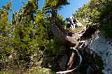
Luna Moth
Reaching the ledges, we stepped into the breeze which had been stirring the treetops overhead on the way up. It felt good. Serviceberry bushes along the trail were laden with soft sweet fruits. We found a few ripe blueberries as well but most were still small and green. The wind picked up as we scrambled higher. Up on the shoulder of the ridge I traversed around to the east across the sloping slabs of granite. As the summit of North Baldface came into view across the basin, the wind became so strong over the exposed ledges that it was easier to scuttle across them on all fours than to try to walk. The boys would love this, I thought, so I waddled across the ridge to find them, bracing myself against the wind as if wading across a swift river.
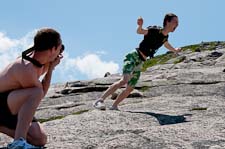
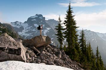
Daniel photographing leaning David
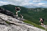
Racing the wind
07/15/2011 Home - a dream
In a dream last night;
In a dream last night;
I was in the bedroom with the sliding door open and heard a Winter Wren singing very close outside
on the deck. I went to the door and opened it to see if the wren would come inside, but instead
Puss trotted up to the door carrying a rather large animal, perhaps a woodchuck, in its mouth along
with the wren which had been singing. Lifeless, it looked more like a House Wren. I was going to
shoe the cat away, not wanting her to bring her prey inside, but she dropped the woodchuck and wren
outside the door. While Puss walked in through the door, the woodchuck struggled away but I think
the wren lay still.
As I considered the dream foggily last night, trying to remember it before I fell asleep again, it
seemed that Puss represented Susan and the woodchuck and wren, the farm in New Hampshire. During
our visit a House Wren was feeding young in a brown jug-shaped nest box on the corner of the barn
and its joyful bubbling song rang out frequently from the gardens below the house. Woodchucks
denning under the barn have long been the bane of the flower and vegetable gardens on that side of
the house, and in fact David saw one in the garden a few days ago.
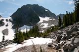
08/11/2011 Necklace Valley Trail to Jade Lake 8.5 miles, 3300'
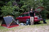 Packing took us much longer than anticipated, of course, so we left after supper and camped last
night at the trailhead. Up at 7AM we packed and ate breakfast and started hiking an hour and a half
later. Overcast sky, still air, a few mosquitos. After a couple of photo stops and about 2 1/2
hours of hiking we stopped for lunch at the base of a big rock slide below a bigger cliff. The
Packing took us much longer than anticipated, of course, so we left after supper and camped last
night at the trailhead. Up at 7AM we packed and ate breakfast and started hiking an hour and a half
later. Overcast sky, still air, a few mosquitos. After a couple of photo stops and about 2 1/2
hours of hiking we stopped for lunch at the base of a big rock slide below a bigger cliff. The
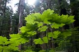
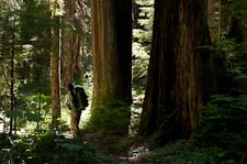
 valley floor is flat and sandy in that area with big firs and cedar trees. Olive-sided flycatchers
scolded us with crossbill-like "chip chip chip" calls all through lunch, or maybe they were just
conversing among themselves. There were four or five of them, apparently a family since outside of
migration they seem to be solitary birds. A few black (yellow?) flies and mosquitos joined us for
lunch too.
valley floor is flat and sandy in that area with big firs and cedar trees. Olive-sided flycatchers
scolded us with crossbill-like "chip chip chip" calls all through lunch, or maybe they were just
conversing among themselves. There were four or five of them, apparently a family since outside of
migration they seem to be solitary birds. A few black (yellow?) flies and mosquitos joined us for
lunch too.
 EarthCorp volunteers on the way out as we were hiking in had reported a bear habituated to humans
around 5-mile camp, where the trail crosses the river. That was about half mile above where we ate
lunch. Reports were that the bear had found a slab of bacon in a camper's tent so had begun
breaking into other campers' tents, looking for more bacon we supposed. Hard to blame the bear when
the alternative was unripe huckleberries and ant larvae in rotting logs. For a bear finding a slab
of bacon must be like winning the lottery. We wondered what sort of campers brought slabs of bacon
with them backpacking, and on top of that, left them in their tent while out hiking for the day.
The EarthCorp volunteers looked to be about David's age and all the young women were good-looking.
We didn't see the bear.
EarthCorp volunteers on the way out as we were hiking in had reported a bear habituated to humans
around 5-mile camp, where the trail crosses the river. That was about half mile above where we ate
lunch. Reports were that the bear had found a slab of bacon in a camper's tent so had begun
breaking into other campers' tents, looking for more bacon we supposed. Hard to blame the bear when
the alternative was unripe huckleberries and ant larvae in rotting logs. For a bear finding a slab
of bacon must be like winning the lottery. We wondered what sort of campers brought slabs of bacon
with them backpacking, and on top of that, left them in their tent while out hiking for the day.
The EarthCorp volunteers looked to be about David's age and all the young women were good-looking.
We didn't see the bear.
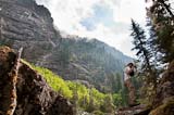
 The climb to Jade Lake, 2500' in three miles, was slow and hot. At 6 1/2 mile camp, elevation about
3300', we stopped to cool off at the stream crossing which I'd been promising David for 30 minutes
that we'd reach "any minute now". While we rested I misread the map and placed us at 3800', eight
hundred feet or so below the lake. That false hope turned out to be good for morale since by the
time I realized my error we were almost at the lake anyhow. I also found the EarthCorp volunteers'
food cache at the camp when I bushwhacked away from the trail to poop. Like a good bear I left it
alone.
The climb to Jade Lake, 2500' in three miles, was slow and hot. At 6 1/2 mile camp, elevation about
3300', we stopped to cool off at the stream crossing which I'd been promising David for 30 minutes
that we'd reach "any minute now". While we rested I misread the map and placed us at 3800', eight
hundred feet or so below the lake. That false hope turned out to be good for morale since by the
time I realized my error we were almost at the lake anyhow. I also found the EarthCorp volunteers'
food cache at the camp when I bushwhacked away from the trail to poop. Like a good bear I left it
alone.
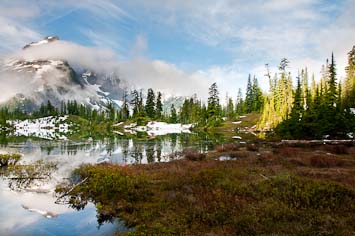
 Jade Lake is sunny and rocky on one side, shady and forested on the other. Which side is which
depends on what time of day it is. Three boys, fishing the clear green water with spinners and
bobbers, were camped at the upper end at the only site near the lake. They reported that they'd
caught one trout. We saw several small trout but nothing of any size as we walked along the shore.
Tired and hungry, we continued on up the trail. The terrain was rougher than I'd anticipated from
Jade Lake is sunny and rocky on one side, shady and forested on the other. Which side is which
depends on what time of day it is. Three boys, fishing the clear green water with spinners and
bobbers, were camped at the upper end at the only site near the lake. They reported that they'd
caught one trout. We saw several small trout but nothing of any size as we walked along the shore.
Tired and hungry, we continued on up the trail. The terrain was rougher than I'd anticipated from
 the map, little knolls and valleys in open forest of Mountain Hemlock and Alaska Cedar interspersed
with small clearings of low huckleberry brush and snow-beaten young trees. The snow was not long
melted; patches still lingered in shady gullies and boggy meadow edges. Above the outlet to Emerald
Lake on top of a little hill we found a tent site and parked our packs. David parked too while I
explored a little, over towards Al Lake then back again when I didn't find anything better.
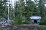
Returning to our knoll I noticed an old log cabin just beyond our camp. The split cedar roof and
log walls were intact. Inside the floor was mud and the lower level of bunks had collapsed along
the walls. Carved in the logs were inscriptions dating back to the 60's though I questioned the
reliability of some of the older ones until I noticed a placque by the door stating that the
Necklace Cabin had been built in 1950.
the map, little knolls and valleys in open forest of Mountain Hemlock and Alaska Cedar interspersed
with small clearings of low huckleberry brush and snow-beaten young trees. The snow was not long
melted; patches still lingered in shady gullies and boggy meadow edges. Above the outlet to Emerald
Lake on top of a little hill we found a tent site and parked our packs. David parked too while I
explored a little, over towards Al Lake then back again when I didn't find anything better.
Returning to our knoll I noticed an old log cabin just beyond our camp. The split cedar roof and
log walls were intact. Inside the floor was mud and the lower level of bunks had collapsed along
the walls. Carved in the logs were inscriptions dating back to the 60's though I questioned the
reliability of some of the older ones until I noticed a placque by the door stating that the
Necklace Cabin had been built in 1950.
We ate salted nuts and a sunshine bar each for energy to fix supper down by the lake. Our freeze-dried Pasta Parmesan was dated 2002 and hadn't aged well but we finished it anyhow along with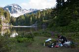 some dried split pea soup. I heated up some lake water and we each had a sponge bath. I used my
underwear, David his shirt. I don't like crawling into my sleeping bag all sticky with the day's
sweat. The bugs hadn't been too bad when we arrived but grew more numerous and hungrier as the
evening approached. Mosquitos in my face made brushing my teeth and hanging the food stuffsack a
bit of a challenge. We had bear canisters too but in my experience, they don't really hold six days
worth of food, more like three or four. I dove into the tent at 8PM, just before the No-see-ums
really got thick. A cloud of them hovered over the mosquito netting of our tent until dusk. I'm
hoping I don't have to get up during the night.
some dried split pea soup. I heated up some lake water and we each had a sponge bath. I used my
underwear, David his shirt. I don't like crawling into my sleeping bag all sticky with the day's
sweat. The bugs hadn't been too bad when we arrived but grew more numerous and hungrier as the
evening approached. Mosquitos in my face made brushing my teeth and hanging the food stuffsack a
bit of a challenge. We had bear canisters too but in my experience, they don't really hold six days
worth of food, more like three or four. I dove into the tent at 8PM, just before the No-see-ums
really got thick. A cloud of them hovered over the mosquito netting of our tent until dusk. I'm
hoping I don't have to get up during the night.
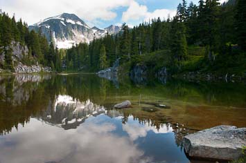
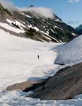
Emerald Lake, below our first night's camp
Morning at the trailhead
Photo stop
Devil's Club
Valley floor forest
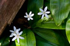
Clintonia lily
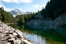
Jade Lake
Necklace Cabin
We ate salted nuts and a sunshine bar each for energy to fix supper down by the lake. Our freeze-dried Pasta Parmesan was dated 2002 and hadn't aged well but we finished it anyhow along with
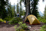
Supper by Emerald Lake
08/12/2011 Necklace Valley, La Bohn Lakes 5 miles, 2300'
 I did have to get up once but the bugs went to bed as soon as it got dark. David, having fallen
asleep immediately after supper, woke up and went outside to brush his teeth as the moon was rising.
An owl was hooting in the distance, "hoooo hoo hoo" was all I could make out. Nearby another bird,
probably a Sawwhet Owl, made several nasal "rreeeht" calls. We both slept better than our first
night at the trailhead. David was less congested and I was more accustomed to the hard ground. The
moon, though nearly full, stayed near the horizon over the headwall to our south and set around 2AM.
I prayed some for Susan. I don't
feel close to Jesus but I think He heard my prayers anyhow, if only for her sake.
I did have to get up once but the bugs went to bed as soon as it got dark. David, having fallen
asleep immediately after supper, woke up and went outside to brush his teeth as the moon was rising.
An owl was hooting in the distance, "hoooo hoo hoo" was all I could make out. Nearby another bird,
probably a Sawwhet Owl, made several nasal "rreeeht" calls. We both slept better than our first
night at the trailhead. David was less congested and I was more accustomed to the hard ground. The
moon, though nearly full, stayed near the horizon over the headwall to our south and set around 2AM.
I prayed some for Susan. I don't
feel close to Jesus but I think He heard my prayers anyhow, if only for her sake.
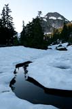
The sun, blocked by the wall on the east side of the valley, didn't reach our camp until 8:30. I woke up before that and went exploring down past shallow Al Lake to Locket Lake. Cliffs line one side, talus the other, a and the water is clear with the bluish cast characteristic of formerly glacial lakes from which the sediment has settled out. I didn't see ny trout near shore or at the inlet but saw a couple of rises farther out. A small snow-berg, perhaps four feet long and a foot tall, was drifting out in the middle of the lake.
 From Lockett I wandered up the west side of the valley to about 5100' above Opal Lake. I wanted to
inspect the route up to La Bohn Lakes along the right side of the outlet stream/waterfall. It looks
do-able, like the guidebook says. Down at Opal Lake I photographed reflections of the mountain at
the head of the valley. Accumulated sediment has reduced the lake to a set of shallow channels
between marshy islands. Returning by the cabin I saw that nobody slept there last night. Anymore
it's tough to compete with modern backpacking tents.
From Lockett I wandered up the west side of the valley to about 5100' above Opal Lake. I wanted to
inspect the route up to La Bohn Lakes along the right side of the outlet stream/waterfall. It looks
do-able, like the guidebook says. Down at Opal Lake I photographed reflections of the mountain at
the head of the valley. Accumulated sediment has reduced the lake to a set of shallow channels
between marshy islands. Returning by the cabin I saw that nobody slept there last night. Anymore
it's tough to compete with modern backpacking tents.
For breakfast we ate granola and blueberries. I'm glad I checked the blueberries; they were starting to mold and wouldn't have kept until tomorrow. Still hungry, I ate a can of sardines with a slice of bread. Bugs arrived just before sunrise, apparently deterred earlier by the cold. Down by the lake the sedges were frosted but in camp I don't think it dropped below 40F. Mostly black flies, the bugs were fairly thick for an hour or so then began to dissipate. I brought a big spray bottle of 26% Off so am having no problem with the bugs.
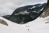
Knowing we had a short hike ahead of us we took our time breaking camp. Both of us napped after breakfast. I woke up around 11:15 and started packing. Around 12:30 we set out up the valley. The campers across the lake, who'd arrived while we were cooking supper down by the water, had packed up and headed back down the valley a couple of hours earlier. Seems like a shame to hike all the way up here only to turn around and go home - maybe they forgot their bug spray. The tent which had been on a promontory of rock overlooking Emerald Lake when I'd passed by earlier was also gone. We followed bootprints up the trail to the head of the valley but didn't see any other hikers all day.
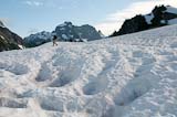
 Snow patches increased in size and frequency both in the woods and out in the open as we progressed
up the valley even though we gained essentially no elevation. The right (west) side of the valley
opens up into a fairly gentle slope providing easy access into the high country around Tank Lakes
but the wall on the east side continues right up to the head of the valley. The guidebook mentions
a route up the wall, by ascending along the waterfall which descends from the La Bohn Lakes, but I
wouldn't have guessed it. Talus leads up to cliff bands alternating with stunted hemlock and cedar
and though the tree cover is nearly continuous, the slope is still very steep. On the other hand
the snow chute directly up the valley head is also quite steep and a fall there could be dangerous.
The guidebook warns that hikers have died on that snowfield. It appeared possible to scramble up a
Snow patches increased in size and frequency both in the woods and out in the open as we progressed
up the valley even though we gained essentially no elevation. The right (west) side of the valley
opens up into a fairly gentle slope providing easy access into the high country around Tank Lakes
but the wall on the east side continues right up to the head of the valley. The guidebook mentions
a route up the wall, by ascending along the waterfall which descends from the La Bohn Lakes, but I
wouldn't have guessed it. Talus leads up to cliff bands alternating with stunted hemlock and cedar
and though the tree cover is nearly continuous, the slope is still very steep. On the other hand
the snow chute directly up the valley head is also quite steep and a fall there could be dangerous.
The guidebook warns that hikers have died on that snowfield. It appeared possible to scramble up a
 rocky outcrop in the center of the snow pitch and thereby avoid the steepest part of the chute but
we decided to follow the guidebook's suggestion to avoid it.
rocky outcrop in the center of the snow pitch and thereby avoid the steepest part of the chute but
we decided to follow the guidebook's suggestion to avoid it.
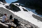
The route up the wall began with a bright crossing of the avalanche apron below the snow chute. David hadn't packed sunglasses and I'd left my extra pair at home. We hadn't needed them in the Wind Rivers, the packing list I used to prepare for this trip. For the crossing, I wore the sunglasses and David squinted. We didn't make it far up the talus before stopping for lunch - bread, feta cheese and one small tomato each. I find myself daydreaming about food already; I wonder if that means I'm losing weight.
 There was a trail up along the right side of the waterfall starting at the top of the talus, as
promised, but I can't imagine alot of backpackers using it. A couple steep snow patches added to
the difficulty but fortunately they were short with cedar thickets below to stop an accidental
slide. We carried ice axes for self-arrest and used them for balance. Off the snow we scrambled up
steep mountain heath and ladders of tree trunks curving horizontally out of the steep slope. Low
but impassable walls of granite appeared to block our route in several places but each time the
trail found a way around them and eventually we scrambled up the last little cliff band. In front
of us a broad
There was a trail up along the right side of the waterfall starting at the top of the talus, as
promised, but I can't imagine alot of backpackers using it. A couple steep snow patches added to
the difficulty but fortunately they were short with cedar thickets below to stop an accidental
slide. We carried ice axes for self-arrest and used them for balance. Off the snow we scrambled up
steep mountain heath and ladders of tree trunks curving horizontally out of the steep slope. Low
but impassable walls of granite appeared to block our route in several places but each time the
trail found a way around them and eventually we scrambled up the last little cliff band. In front
of us a broad
 smooth shelf of rock and mossy mountain heath sloped gently east a hundred yards or so to the lowest
of the La Bohn Lakes. Across the lake a wall of cliffs and steep talus barred the way but to our
right the smooth ledge rose to a gentle ridge of heather, rock and snow, easy walking up to the
other La Bohn Lakes and the saddle above the upper Middle Fork. We parked our packs and set out to
search for a campsite.
smooth shelf of rock and mossy mountain heath sloped gently east a hundred yards or so to the lowest
of the La Bohn Lakes. Across the lake a wall of cliffs and steep talus barred the way but to our
right the smooth ledge rose to a gentle ridge of heather, rock and snow, easy walking up to the
other La Bohn Lakes and the saddle above the upper Middle Fork. We parked our packs and set out to
search for a campsite.
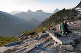
 We found several. The first two were flat spots on the ledges - great views but otherwise not very
inviting. We continued mostly on snow up to the saddle above the third lake where a stunning
panorama of craggy snowbound peaks opened up before us - Bears Breast, Summit Chief, Overcoat - the
rugged heart of the Alpine Lakes Wilderness. We followed the saddle east to a small crag which sits
right above the third lake where a break in the cliffs fronting the northwest shoulder of Mount
We found several. The first two were flat spots on the ledges - great views but otherwise not very
inviting. We continued mostly on snow up to the saddle above the third lake where a stunning
panorama of craggy snowbound peaks opened up before us - Bears Breast, Summit Chief, Overcoat - the
rugged heart of the Alpine Lakes Wilderness. We followed the saddle east to a small crag which sits
right above the third lake where a break in the cliffs fronting the northwest shoulder of Mount
 Hinman offers hiker access to the upper slopes of the mountain. On the south side of the small crag
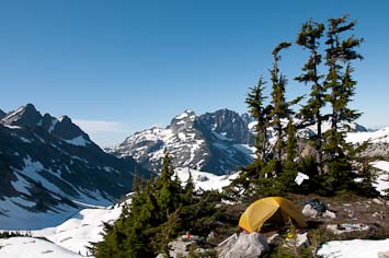
we found a flat patch of mountain heath framed by gnarled Mountain Hemlock trees, a dramatic
campsite with spectacular views, a sunny exposure and convenient snowbanks to keep our food cool.
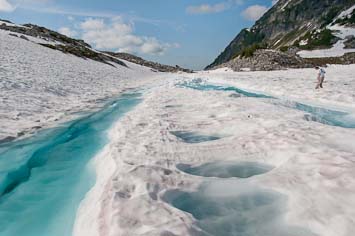
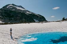
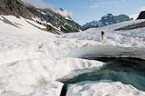
We scrambled to the top of the crag and admired the view then slid down a big snowbank to the
snow-covered lake. Near the shore two leads of aquamarine-colored water had filled parallel furrows
in the snowpack and between them, the snow was dotted with blue potholes, each with a little pile of
what appeared to be mouse or ptarmigan droppings (I thought I identified both) at its bottom. David
ventured out on the snow beyond the water leads and when he didn't fall in, I followed suit. The
snowpack was solid if a little mushy on the surface in places but we kept well clear of the open
water at the lake's outlet.
Hinman offers hiker access to the upper slopes of the mountain. On the south side of the small crag
we found a flat patch of mountain heath framed by gnarled Mountain Hemlock trees, a dramatic
campsite with spectacular views, a sunny exposure and convenient snowbanks to keep our food cool.
We scrambled to the top of the crag and admired the view then slid down a big snowbank to the
snow-covered lake. Near the shore two leads of aquamarine-colored water had filled parallel furrows
in the snowpack and between them, the snow was dotted with blue potholes, each with a little pile of
what appeared to be mouse or ptarmigan droppings (I thought I identified both) at its bottom. David
ventured out on the snow beyond the water leads and when he didn't fall in, I followed suit. The
snowpack was solid if a little mushy on the surface in places but we kept well clear of the open
water at the lake's outlet.
 Back at our packs we cooked and ate dinner, sitting on the smooth ledge looking out beyond a fringe
of krummholz to the hazy Necklace Valley below. Mosquitos were bad there, breeding perhaps in the
several bands of wet mountain heath, moss and sedges which extended across the ledge. Towards
sunset we packed up and started hiking up to our campsite but shed our packs to race up to vantage
points from which we could photograph the developing
Back at our packs we cooked and ate dinner, sitting on the smooth ledge looking out beyond a fringe
of krummholz to the hazy Necklace Valley below. Mosquitos were bad there, breeding perhaps in the
several bands of wet mountain heath, moss and sedges which extended across the ledge. Towards
sunset we packed up and started hiking up to our campsite but shed our packs to race up to vantage
points from which we could photograph the developing
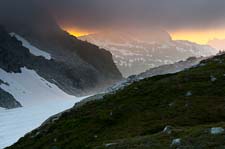 sunset - orange light streaming under a
lowering overcast and illuminating the fog which had begun to coalesce around the peaks.
Reaching camp we set up the tent then took more photos as dusk fell and the nearly full moon began
to rise behind the ridge above us. At David's suggestion I used thirty second exposures with white
balance set as yellow as possible to counteract the blue cast of the evening and ISO set low to
minimize noise in the low light.
sunset - orange light streaming under a
lowering overcast and illuminating the fog which had begun to coalesce around the peaks.
Reaching camp we set up the tent then took more photos as dusk fell and the nearly full moon began
to rise behind the ridge above us. At David's suggestion I used thirty second exposures with white
balance set as yellow as possible to counteract the blue cast of the evening and ISO set low to
minimize noise in the low light.
Third La Bohn Lake
Stream above Al Lake
The sun, blocked by the wall on the east side of the valley, didn't reach our camp until 8:30. I woke up before that and went exploring down past shallow Al Lake to Locket Lake. Cliffs line one side, talus the other, a and the water is clear with the bluish cast characteristic of formerly glacial lakes from which the sediment has settled out. I didn't see ny trout near shore or at the inlet but saw a couple of rises farther out. A small snow-berg, perhaps four feet long and a foot tall, was drifting out in the middle of the lake.
Sun finally reached camp
For breakfast we ate granola and blueberries. I'm glad I checked the blueberries; they were starting to mold and wouldn't have kept until tomorrow. Still hungry, I ate a can of sardines with a slice of bread. Bugs arrived just before sunrise, apparently deterred earlier by the cold. Down by the lake the sedges were frosted but in camp I don't think it dropped below 40F. Mostly black flies, the bugs were fairly thick for an hour or so then began to dissipate. I brought a big spray bottle of 26% Off so am having no problem with the bugs.
Knowing we had a short hike ahead of us we took our time breaking camp. Both of us napped after breakfast. I woke up around 11:15 and started packing. Around 12:30 we set out up the valley. The campers across the lake, who'd arrived while we were cooking supper down by the water, had packed up and headed back down the valley a couple of hours earlier. Seems like a shame to hike all the way up here only to turn around and go home - maybe they forgot their bug spray. The tent which had been on a promontory of rock overlooking Emerald Lake when I'd passed by earlier was also gone. We followed bootprints up the trail to the head of the valley but didn't see any other hikers all day.
Heading up the valley
Headwall ahead (on the left)
Lunch on the talus
The route up the wall began with a bright crossing of the avalanche apron below the snow chute. David hadn't packed sunglasses and I'd left my extra pair at home. We hadn't needed them in the Wind Rivers, the packing list I used to prepare for this trip. For the crossing, I wore the sunglasses and David squinted. We didn't make it far up the talus before stopping for lunch - bread, feta cheese and one small tomato each. I find myself daydreaming about food already; I wonder if that means I'm losing weight.
Final tree band
Tarn and La Bohn Peak
Alpine Lakes peaks
Supper ledge above Necklace Valley
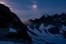
Moondog over La Bohn Gap
Sunset
08/13/2011 Mount Hinman, Williams Lake 4 miles, 1700'

 I was up several times during the night so didn't sleep well. David got up soon after sunrise to
photograph the mountains then came back to bed. I slept in. We couldn't go anywhere anyhow. We
didn't bring crampons and our crag is surrounded on all sides by snow which freezes into ice
overnight, trapping us until the morning sun softens the snow again.
I was up several times during the night so didn't sleep well. David got up soon after sunrise to
photograph the mountains then came back to bed. I slept in. We couldn't go anywhere anyhow. We
didn't bring crampons and our crag is surrounded on all sides by snow which freezes into ice
overnight, trapping us until the morning sun softens the snow again.
The morning was sunny, calm and bug-free; the first mosquito didn't show up until 10:30AM. There were none in camp yesterday evening either, perhaps because we're surrounded by snow. The only nearby water is an epehmeral melt pool at the foot of the snowbank by our tent. The pool was several inches deep yesterday evening, submerging mountain heath and budding alpine huckleberry, but this morning only a few blades of ice remained.
We spent another lazy morning in camp. Our plan was to dayhike up Hinman once the snow softened up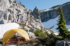 then backpack down to Williams Lake in the afternoon with a possible side trip up to the high point
on the ridge south of La Bohn Gap. Tomorrow we might check out Dutch Miller Gap before bushwhacking
up to the Tank Lakes to camp high again. From there we'll either hike back out the way we came or
try to find the alpine route to Chetwoot Lake over the shoulder of Iron Cap, then down to Big Heart
Lake and the West Fork of Foss Creek. I think we have enough food for the extra couple of days that
would take. It would be nice to complete that route. Thirteen years ago September David and I
hiked from Big Snow Mountain over to Chetwoot Lake but bailed via Crawford Lake rather than
continuing up to Tank Lakes.
then backpack down to Williams Lake in the afternoon with a possible side trip up to the high point
on the ridge south of La Bohn Gap. Tomorrow we might check out Dutch Miller Gap before bushwhacking
up to the Tank Lakes to camp high again. From there we'll either hike back out the way we came or
try to find the alpine route to Chetwoot Lake over the shoulder of Iron Cap, then down to Big Heart
Lake and the West Fork of Foss Creek. I think we have enough food for the extra couple of days that
would take. It would be nice to complete that route. Thirteen years ago September David and I
hiked from Big Snow Mountain over to Chetwoot Lake but bailed via Crawford Lake rather than
continuing up to Tank Lakes.
After breakfast an Evening Grosbeak paid us a visit. One had perched earlier on the tuft of Mountain Hemlock above us on the crag but flew away while I was thinking about putting on the 300mm lens to photograph it. A few minutes later it, or another male like it, suddenly perched in a low hemlock next to where David was sitting on the other side of the tent from me. I scuttled over to my pack to get the 300. As I was mounting it, the bird flew directly at me, as if to perch on my knee, but veered at the last moment and landed on the rock next to me. I was too startled to get a photo. It was a handsome male and so close that I could have picked him up without even having to reach. He inspected me for a second or two, then flew back towards David, but shied away and flew off when David stretched out his arm to provide a perch.
 We heard Grosbeaks yesterday, along with Red Crossbills and Pine Siskins. During dinner two shorebirds
circled the lake making med-high pitched "brreet" calls. They seemed largish, Dunlin perhaps. I also
heard a raven call this morning and saw a small bird, perhaps a nuthatch, fly over our camp. Otherwise
we haven't seen or heard many birds up here in the high country.
We heard Grosbeaks yesterday, along with Red Crossbills and Pine Siskins. During dinner two shorebirds
circled the lake making med-high pitched "brreet" calls. They seemed largish, Dunlin perhaps. I also
heard a raven call this morning and saw a small bird, perhaps a nuthatch, fly over our camp. Otherwise
we haven't seen or heard many birds up here in the high country.
For the hike up Hinman I packed a couple of almond-butter and honey sandwiches along with a few of our Sunrise energy bars. I didn't expect to be up there long, maybe three hours. David didn't bring his coat because it was sunny and warm. I didn't notice until we were already too far up to go back but he was OK, just a little chilly in the breeze on the ridges. It remined me of when I climbed Glacier years ago in shorts and spent our time on top huddled in the sunny lee of a snowbank. We also had only one pair of sunglasses between us. I wore them on the ascent and David wore them down and neither of us had trouble afterwards though it was bright.
 We followed the ridge most of the way up. Our first stop was a short detour out onto the ridge
which extends south towards La Bohn Gap, a knife-edge scary-steep on both sides. Williams Lake,
below us to the west, was more forested than I'd expected, clear, blue-green and still, with snow in
the woods all around but mostly bare on a few low knolls and along the water's edge. I hoped we'd
be able to find a snow-free camp. Closer below us the Chain Lakes were still almost completely
snowbound with one small break showing open water and an oval of blue water on top of the snow
marking the location of another larger lake. It appeared that we'd be on snow all the way down to
Williams Lake.
We followed the ridge most of the way up. Our first stop was a short detour out onto the ridge
which extends south towards La Bohn Gap, a knife-edge scary-steep on both sides. Williams Lake,
below us to the west, was more forested than I'd expected, clear, blue-green and still, with snow in
the woods all around but mostly bare on a few low knolls and along the water's edge. I hoped we'd
be able to find a snow-free camp. Closer below us the Chain Lakes were still almost completely
snowbound with one small break showing open water and an oval of blue water on top of the snow
marking the location of another larger lake. It appeared that we'd be on snow all the way down to
Williams Lake.
On the other side of the ridge Lake Rowena sparkled in the sunlight 1500' below us. An avalanche fan spread out into the water on one side and from it, a long narrow snowberg had broken off, drifted towards the outlet and lodged where the lake narrows, spanning from one shore to the other. David wondered what it would be like to ride a slab of snow across the lake. A Bald Eagle soared over the lake and behind a spur of the ridge. Anticipating that it might reappear nearby, I switched to the 300mm lens but instead of the eagle, a raven drifted up past us instead.
 We ate our sandwiches on a false summit at 7200', looking across at the steep granite slab south
face of the summit ridge. The crest of the ridge is thoroughly fractured into slivers and slabs.
The north side of the mountain is a broad snowfield which undulates down the mountainin in gentle
rolls except right at the ridge. We tried to stay on the rock but it was too unstable so we moved
onto the snow and traversed a short steep pitch before gaining the gentle crest of the snowfield.
The last couple hundred yards to the summit were easy walking on gentle snow. Looking back we
spotted another hiker behind us. He joined us on the summit, a muscular man with short-cropped dark
hair and quadriceps bulging on either side of his knees. He'd hiked all the way up from the
trailhead this morning, taking 8 hours to hike the 12 miles and 6000' vertical. He only stayed a
few minutes on the summit before starting down again.
We ate our sandwiches on a false summit at 7200', looking across at the steep granite slab south
face of the summit ridge. The crest of the ridge is thoroughly fractured into slivers and slabs.
The north side of the mountain is a broad snowfield which undulates down the mountainin in gentle
rolls except right at the ridge. We tried to stay on the rock but it was too unstable so we moved
onto the snow and traversed a short steep pitch before gaining the gentle crest of the snowfield.
The last couple hundred yards to the summit were easy walking on gentle snow. Looking back we
spotted another hiker behind us. He joined us on the summit, a muscular man with short-cropped dark
hair and quadriceps bulging on either side of his knees. He'd hiked all the way up from the
trailhead this morning, taking 8 hours to hike the 12 miles and 6000' vertical. He only stayed a
few minutes on the summit before starting down again.
David tried my phone and got a signal, so checked his email and marveled that he could get on the internet from the summit of Mount Hinman, with nothing but mountains visible in all directions. I got Susan on my second try. She was surprised to hear that we'd be back on Monday, having not been expecting us until Friday, so she asked if we could stay out another five days. Then she wanted to talk with David so I gave him the phone. He was fine, getting enough to eat, not too tired, having a good time.
 Our descent was mostly on snow, sunny, warm and bright. At camp we ate another lunch of bread and
Fontina cheese, which is like Muenster and not much to David's liking but improved somewhat by
mayonnaise. Our one tomato each tasted better today than yesterday. After packing up and before
starting down to Williams Lake we trekked across the saddle to investigate a prospect hole visible a
hundred feet or so up the shoulder of La Bohn Peak. It was not worth the hike but I found another a
little higher up with some massive gnarly black mineral, not as interesting as the pocket of
hornblende David found on the way up Hinman. The granite was laced with thin seams of black
amphibole, probably hornblende, which usually appears as a veneer on blocks and cliff faces since
the granite tends to fracture along the hornblende seams. David came across a spot where the hornblende
had filled a wider crack with a mass of larger grains, some with discernible crystal structure in
addition to the usual fibrous-looking cleavage. I broke off a couple chunks to bring home along
with the 18" pencil of granite David found near the summit but didn't want to pack out.
Our descent was mostly on snow, sunny, warm and bright. At camp we ate another lunch of bread and
Fontina cheese, which is like Muenster and not much to David's liking but improved somewhat by
mayonnaise. Our one tomato each tasted better today than yesterday. After packing up and before
starting down to Williams Lake we trekked across the saddle to investigate a prospect hole visible a
hundred feet or so up the shoulder of La Bohn Peak. It was not worth the hike but I found another a
little higher up with some massive gnarly black mineral, not as interesting as the pocket of
hornblende David found on the way up Hinman. The granite was laced with thin seams of black
amphibole, probably hornblende, which usually appears as a veneer on blocks and cliff faces since
the granite tends to fracture along the hornblende seams. David came across a spot where the hornblende
had filled a wider crack with a mass of larger grains, some with discernible crystal structure in
addition to the usual fibrous-looking cleavage. I broke off a couple chunks to bring home along
with the 18" pencil of granite David found near the summit but didn't want to pack out.
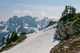
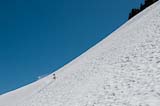
 Our boots were soaked from the long descent to Williams Lake in slushy snow. I broke through to
rocks once shortly after we started down but fortunately didn't sink more than a foot and wasn't
hurt. Around Chain Lakes suncups allmost waist deep were melted into the snowpack and deep hollows
marked pools in the stream not yet open. We took care to avoid them. Below Chain Lakes we crossed
a series of avalanche fans, some whith basketball-sized chunks of snow around which the matrix had
melted out, others where the surface was littered with pieces of mountain Hemlock trees up to twenty
feet tall. Though talus was showing in a few places we didn't reach bare ground until down by the
shore of the lake. The stream crossing at the outlet was a little tricky, our options being either
a submerged log or slippery stepping stones. I chose the ankle-deep water over the log; David did
the rocks. We cooked at the first site north of the outlet and camped at the second. The afternoon
haze condensed into stratus overhead which obscured the peaks around us. We had a few mosquitos
around dinner time but once dusk fell they thinned out and I was able to take a sponge bath without
getting bitten.
Our boots were soaked from the long descent to Williams Lake in slushy snow. I broke through to
rocks once shortly after we started down but fortunately didn't sink more than a foot and wasn't
hurt. Around Chain Lakes suncups allmost waist deep were melted into the snowpack and deep hollows
marked pools in the stream not yet open. We took care to avoid them. Below Chain Lakes we crossed
a series of avalanche fans, some whith basketball-sized chunks of snow around which the matrix had
melted out, others where the surface was littered with pieces of mountain Hemlock trees up to twenty
feet tall. Though talus was showing in a few places we didn't reach bare ground until down by the
shore of the lake. The stream crossing at the outlet was a little tricky, our options being either
a submerged log or slippery stepping stones. I chose the ankle-deep water over the log; David did
the rocks. We cooked at the first site north of the outlet and camped at the second. The afternoon
haze condensed into stratus overhead which obscured the peaks around us. We had a few mosquitos
around dinner time but once dusk fell they thinned out and I was able to take a sponge bath without
getting bitten.
Camp at La Bohn Gap
The morning was sunny, calm and bug-free; the first mosquito didn't show up until 10:30AM. There were none in camp yesterday evening either, perhaps because we're surrounded by snow. The only nearby water is an epehmeral melt pool at the foot of the snowbank by our tent. The pool was several inches deep yesterday evening, submerging mountain heath and budding alpine huckleberry, but this morning only a few blades of ice remained.
We spent another lazy morning in camp. Our plan was to dayhike up Hinman once the snow softened up
David on crag above camp
After breakfast an Evening Grosbeak paid us a visit. One had perched earlier on the tuft of Mountain Hemlock above us on the crag but flew away while I was thinking about putting on the 300mm lens to photograph it. A few minutes later it, or another male like it, suddenly perched in a low hemlock next to where David was sitting on the other side of the tent from me. I scuttled over to my pack to get the 300. As I was mounting it, the bird flew directly at me, as if to perch on my knee, but veered at the last moment and landed on the rock next to me. I was too startled to get a photo. It was a handsome male and so close that I could have picked him up without even having to reach. He inspected me for a second or two, then flew back towards David, but shied away and flew off when David stretched out his arm to provide a perch.
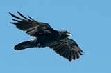
Raven
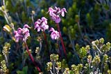
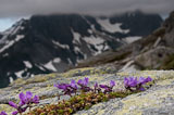
Bird's beak Lousewort
For the hike up Hinman I packed a couple of almond-butter and honey sandwiches along with a few of our Sunrise energy bars. I didn't expect to be up there long, maybe three hours. David didn't bring his coat because it was sunny and warm. I didn't notice until we were already too far up to go back but he was OK, just a little chilly in the breeze on the ridges. It remined me of when I climbed Glacier years ago in shorts and spent our time on top huddled in the sunny lee of a snowbank. We also had only one pair of sunglasses between us. I wore them on the ascent and David wore them down and neither of us had trouble afterwards though it was bright.
La Bohn Peak from shoulder of Hinman
Camp is at lower right center.
Camp is at lower right center.
On the other side of the ridge Lake Rowena sparkled in the sunlight 1500' below us. An avalanche fan spread out into the water on one side and from it, a long narrow snowberg had broken off, drifted towards the outlet and lodged where the lake narrows, spanning from one shore to the other. David wondered what it would be like to ride a slab of snow across the lake. A Bald Eagle soared over the lake and behind a spur of the ridge. Anticipating that it might reappear nearby, I switched to the 300mm lens but instead of the eagle, a raven drifted up past us instead.
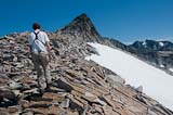
David ascending
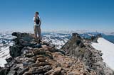
David on top of Hinman
David descending
David tried my phone and got a signal, so checked his email and marveled that he could get on the internet from the summit of Mount Hinman, with nothing but mountains visible in all directions. I got Susan on my second try. She was surprised to hear that we'd be back on Monday, having not been expecting us until Friday, so she asked if we could stay out another five days. Then she wanted to talk with David so I gave him the phone. He was fine, getting enough to eat, not too tired, having a good time.
David at Chain Lakes
Suncups below Chain Lakes
Summit Chief
David below Chain Lakes
08/14/2011 Dutch Miller Gap, Tank Lakes 7 miles, 2700'
 Stratus remained in place above us all night long - it would have been a sea of moonlit cloud at our
feet had we remained at yesterday's camp. Too bad. I only had to get up once during the night
which was nice. In the
morning I awoke as the stratus layer was breaking up. I grabbed my camera and raced out barefoot to
photograph clouds clinging to the peaks in the sunshine, reflected in the still lake. I chased
photos nearly halfway around the lake and it was a long uncomfortable walk back barefoot on
huckleberry twigs and snowbanks.
Stratus remained in place above us all night long - it would have been a sea of moonlit cloud at our
feet had we remained at yesterday's camp. Too bad. I only had to get up once during the night
which was nice. In the
morning I awoke as the stratus layer was breaking up. I grabbed my camera and raced out barefoot to
photograph clouds clinging to the peaks in the sunshine, reflected in the still lake. I chased
photos nearly halfway around the lake and it was a long uncomfortable walk back barefoot on
huckleberry twigs and snowbanks.
 We split our last peach over granola for breakfast. No huckleberries around here; the bushes are
just emerging from under the snow. We packed the bear canisters but left the tent up before setting
off for a morning hike up to Dutch Miller Gap and the ledges on the north flank of Summit Chief
Mountain. On the map the slope looks gentle enough to walk up but from La Bohn lakes we weren't so
sure. The bugs weren't bad until we reached the stream below Dutch Miller Gap, where I stopped to
put tape on my heel and was besieged by a ferocious swarm of mosquitos, the worst I've seen on our
whole trip. I think they came out of the grass along the stream. I took a bug dope shower and was
able to finish putting on my boot. David, up ahead photographing a waterfall, had missed them.
We split our last peach over granola for breakfast. No huckleberries around here; the bushes are
just emerging from under the snow. We packed the bear canisters but left the tent up before setting
off for a morning hike up to Dutch Miller Gap and the ledges on the north flank of Summit Chief
Mountain. On the map the slope looks gentle enough to walk up but from La Bohn lakes we weren't so
sure. The bugs weren't bad until we reached the stream below Dutch Miller Gap, where I stopped to
put tape on my heel and was besieged by a ferocious swarm of mosquitos, the worst I've seen on our
whole trip. I think they came out of the grass along the stream. I took a bug dope shower and was
able to finish putting on my boot. David, up ahead photographing a waterfall, had missed them.
 We crossed the flat meadow just west of the actual Gap and followed a stream up to a snowfield which
led to the base of the ledges. The rock looked like something we called Hornfels in my high school
geology class, a fine-grained, massive dark rock weathering to a gritty surface almost as grippy as
limestone. On the map the angle of the slope is 30 degrees (3200' per mile) but the first couple
hundred feet were considerably steeper than that, a bit exposed but easy enough to ascend by
We crossed the flat meadow just west of the actual Gap and followed a stream up to a snowfield which
led to the base of the ledges. The rock looked like something we called Hornfels in my high school
geology class, a fine-grained, massive dark rock weathering to a gritty surface almost as grippy as
limestone. On the map the angle of the slope is 30 degrees (3200' per mile) but the first couple
hundred feet were considerably steeper than that, a bit exposed but easy enough to ascend by
 following cracks. Above that it was easy walking most of the way up ledges, grass and mt heath to a
break in the krummholz along the west edge of the slope at about 5850'. We ate lunch there at the
edge of a sheer 400' cliff looking west across the valley to Crawford Lake, where David and I spent
the last night of our big backpacking trip 12 years ago. To the right of Crawford Lake is Iron Cap
mountain, the crux of the high route from Big Snow Mountain to La Bohn Lakes, or from the East Fork
of Foss Creek, which we came up, to the West Fork, which I considered going down, but we're running
low on food and I'm not up for that challenge this trip. The bushwhack up to Tank Lakes, which we'll
do this afternoon carrying our backpacks, looks challenging enough.
following cracks. Above that it was easy walking most of the way up ledges, grass and mt heath to a
break in the krummholz along the west edge of the slope at about 5850'. We ate lunch there at the
edge of a sheer 400' cliff looking west across the valley to Crawford Lake, where David and I spent
the last night of our big backpacking trip 12 years ago. To the right of Crawford Lake is Iron Cap
mountain, the crux of the high route from Big Snow Mountain to La Bohn Lakes, or from the East Fork
of Foss Creek, which we came up, to the West Fork, which I considered going down, but we're running
low on food and I'm not up for that challenge this trip. The bushwhack up to Tank Lakes, which we'll
do this afternoon carrying our backpacks, looks challenging enough.
 As we were finishing up our lunch (bread, cheese, nuts, a small tomato each, a bar) the wind picked
up and we got cold. David found a rock to bask on during a brief sunbreak; most of the sunshine was
east of us. West of the crest the sky was 95% cloudy, CU and/or STCU, while just a mile or two east
the sky was 95% clear. Our descent was worse in anticipation than in action though we didn't quite
find the route I'd tried to remember on the way up. Down on the Middle Fork Snoqualmie trail we
found recent footprints in the snow headed up over Dutch Miller Gap, perhaps while we were up on the
mountain.
As we were finishing up our lunch (bread, cheese, nuts, a small tomato each, a bar) the wind picked
up and we got cold. David found a rock to bask on during a brief sunbreak; most of the sunshine was
east of us. West of the crest the sky was 95% cloudy, CU and/or STCU, while just a mile or two east
the sky was 95% clear. Our descent was worse in anticipation than in action though we didn't quite
find the route I'd tried to remember on the way up. Down on the Middle Fork Snoqualmie trail we
found recent footprints in the snow headed up over Dutch Miller Gap, perhaps while we were up on the
mountain.
The clouds seemed thicker and darker by the time we broke camp. We ended up ascending a little to the left of my intended route, less talus and more steep duff but not too bad. The breeze was cold and the sky dark with heavy clouds over the Tank Lakes. The upper lake was snowbound. A crack filled with water the color of aquamarine circled most of the lake. From it, furrows in the snow, also filled with sky-blue water, converged on the center of the lake like spokes from the rim of a
 wheel. I don't know where the blue color comes from; the water itself is clear and there certainly
wasn't any blue in the sky. Other than bare ledges and a few south-facing slopes, the entire area
around the lake was still blanketed with snow and we weren't tempted to stay. If we did, we'd have
to wait until it softened up before descending to the valley for our hike out, which would make for
a long day tomorrow. After taking a few photos we continued over the saddle and down furrowed
snowfields towards the head of Necklace Valley. We had snow all the way down except for a brief
traverse of a steep rocky moraine slope. Our boots were quite wet by the time we reached the bottom
of the snowfield. We stopped there and I hiked across to look for my water bottle and cup but they
were gone.
wheel. I don't know where the blue color comes from; the water itself is clear and there certainly
wasn't any blue in the sky. Other than bare ledges and a few south-facing slopes, the entire area
around the lake was still blanketed with snow and we weren't tempted to stay. If we did, we'd have
to wait until it softened up before descending to the valley for our hike out, which would make for
a long day tomorrow. After taking a few photos we continued over the saddle and down furrowed
snowfields towards the head of Necklace Valley. We had snow all the way down except for a brief
traverse of a steep rocky moraine slope. Our boots were quite wet by the time we reached the bottom
of the snowfield. We stopped there and I hiked across to look for my water bottle and cup but they
were gone.
We tried to follow the trail down the valley but lost it at the head of Opal Lake so-called on the map. It's actually a wet pasture with a couple of streams running through it, deep and clear in their undercut channels. The trout weren't in the deep pools where we expected them but in the shallow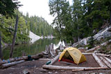
 gravel runout of another stream coming in from the left. We could have caught them with our hands but
I haven't felt like killing fish this trip. We picked up the trail and followed it down to Emerald
Lake but the boulder-top overlook where I'd envisioned camping wasn't flat enough and when we parked
our packs at our previous camping spot above the lake, it felt like we ought to move on, so we did.
We ended up a few minutes later at the log-framed site at the head of Jade Lake, shady and somewhat
dirty-feeling. The bears are still down in the lower valleys where the huckleberries are starting to
ripen, so we had no problems.
gravel runout of another stream coming in from the left. We could have caught them with our hands but
I haven't felt like killing fish this trip. We picked up the trail and followed it down to Emerald
Lake but the boulder-top overlook where I'd envisioned camping wasn't flat enough and when we parked
our packs at our previous camping spot above the lake, it felt like we ought to move on, so we did.
We ended up a few minutes later at the log-framed site at the head of Jade Lake, shady and somewhat
dirty-feeling. The bears are still down in the lower valleys where the huckleberries are starting to
ripen, so we had no problems.
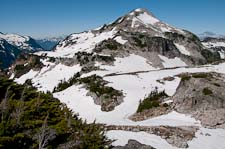
Summit Chief and Williams Lake
Camp at Williams Lake
Summit Chief from camp
David on ledges above Dutch Miller Gap
Summit Chief cliffs
Waiting for a sun break
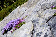
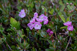
Kalmia
Penstemon
The clouds seemed thicker and darker by the time we broke camp. We ended up ascending a little to the left of my intended route, less talus and more steep duff but not too bad. The breeze was cold and the sky dark with heavy clouds over the Tank Lakes. The upper lake was snowbound. A crack filled with water the color of aquamarine circled most of the lake. From it, furrows in the snow, also filled with sky-blue water, converged on the center of the lake like spokes from the rim of a
David at a Tank Lake
Saddle above Tank Lakes
We tried to follow the trail down the valley but lost it at the head of Opal Lake so-called on the map. It's actually a wet pasture with a couple of streams running through it, deep and clear in their undercut channels. The trout weren't in the deep pools where we expected them but in the shallow
Camp at Jade Lake
Descending into Necklace Valley
08/15/2011 Hike out from Jade Lake 8 miles
 We both slept in an hour or more past sunrise, ate a leisurely but small breakfast, packed up and hit
the trail just as sunshine began to touch the far side of the lake. The overnight stratus had begun to
break up even before we got up. No regrets though about not camping higher in the mountains last
night. It would have been a cold night up at Tank Lakes, and I felt more relaxed knowing we had
only trail hiking on our agenda today. Perhaps it's a sign I'm getting old, but I've been a bit
more intimidated by the off-trail backpacking this trip than I remember from past trips.
We both slept in an hour or more past sunrise, ate a leisurely but small breakfast, packed up and hit
the trail just as sunshine began to touch the far side of the lake. The overnight stratus had begun to
break up even before we got up. No regrets though about not camping higher in the mountains last
night. It would have been a cold night up at Tank Lakes, and I felt more relaxed knowing we had
only trail hiking on our agenda today. Perhaps it's a sign I'm getting old, but I've been a bit
more intimidated by the off-trail backpacking this trip than I remember from past trips.
 The descent was tougher on David than on me because I'd had one extra training hike on Snoqualmie
Mt. It was still a long ways out. I estimated 4 hours of hiking and it was exactly that, excluding
a 40 minute lunch break along the clear rushing waters of Foss Creek. The upper part of the East
Fork valley has beautiful old forest growing on flat sandy soil, probably filled in when glaciers
came lower than they do now. The trail winds around old hemlocks and cedars with a mixed understory
of huckleberry and other shrubs. Avalanche paths break up the woods here and there with
impenetrable thickets of alder and forbs; we were glad for the trail. The lower half of the hike is
less interesting, mostly second-growth conifers with old stumps or snags where the mature forest was
The descent was tougher on David than on me because I'd had one extra training hike on Snoqualmie
Mt. It was still a long ways out. I estimated 4 hours of hiking and it was exactly that, excluding
a 40 minute lunch break along the clear rushing waters of Foss Creek. The upper part of the East
Fork valley has beautiful old forest growing on flat sandy soil, probably filled in when glaciers
came lower than they do now. The trail winds around old hemlocks and cedars with a mixed understory
of huckleberry and other shrubs. Avalanche paths break up the woods here and there with
impenetrable thickets of alder and forbs; we were glad for the trail. The lower half of the hike is
less interesting, mostly second-growth conifers with old stumps or snags where the mature forest was
 logged or burned respectively. Our packs were wearing on our shoulders and we were happy when the
parking lot appeared right on schedule.
logged or burned respectively. Our packs were wearing on our shoulders and we were happy when the
parking lot appeared right on schedule.
Driving home I called Susan to explain that we needed to stop by to pick up maps and food but that we would set out again this evening and we wouldn't spend the night. She was OK with that. She was fortunately going out to dinner with Kim for the evening so wouldn't even see us. At home we showered, washed clothes, ate lots of vegetables for supper and left around 10PM for David's house in Tacoma where we slept on the carpeted floor of his unfurnished room. Nice not having to prepare a scrape in the dirt for use in the middle of the night.
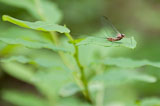
Mayfly
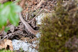
Alligator Lizard at 3300'
Butterfly
Driving home I called Susan to explain that we needed to stop by to pick up maps and food but that we would set out again this evening and we wouldn't spend the night. She was OK with that. She was fortunately going out to dinner with Kim for the evening so wouldn't even see us. At home we showered, washed clothes, ate lots of vegetables for supper and left around 10PM for David's house in Tacoma where we slept on the carpeted floor of his unfurnished room. Nice not having to prepare a scrape in the dirt for use in the middle of the night.
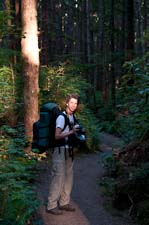
08/16/2011 Third Beach 1.8 miles
 We had a long drive followed by a short hike today. We left Tacoma on schedule around noon after a
satisfying visit to the Metropolitan Market, a delightful place to shop if you're hungry and not on
a budget. I picked up a little more cheese to augment what we'd brought from home and we each bought
a fresh Mozzarella and pesto Panino (so-labelled) sandwich and split a salad. I forgot to dig out the
leftover ears of corn that we'd brought from home when we stopped for lunch at a waterfront park near
Port Gamble, so I didn't realize until somewhere west of Port Angeles that I'd left our corn and cheese
in the fridge at David's house in Tacoma. Not a problem since Forks had a grocery store, but I was
looking forward to that corn. It will have to keep until we get back.
We had a long drive followed by a short hike today. We left Tacoma on schedule around noon after a
satisfying visit to the Metropolitan Market, a delightful place to shop if you're hungry and not on
a budget. I picked up a little more cheese to augment what we'd brought from home and we each bought
a fresh Mozzarella and pesto Panino (so-labelled) sandwich and split a salad. I forgot to dig out the
leftover ears of corn that we'd brought from home when we stopped for lunch at a waterfront park near
Port Gamble, so I didn't realize until somewhere west of Port Angeles that I'd left our corn and cheese
in the fridge at David's house in Tacoma. Not a problem since Forks had a grocery store, but I was
looking forward to that corn. It will have to keep until we get back.
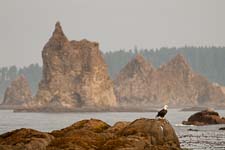
At Port Angeles we found the Olympic National Park ranger station and picked up our camping permit. The ranger was very helpful. It turns out that where we're planning to go, the tides won't be a problem - there are just a couple of tight spots, and in those, the water only needs to be somewhat lower than high tide, so we'll be fine. Much of our hike will be on the beach, and there will be lots of sea stacks. Sea stacks were why we chose to come here rather than return to the mountains - David wanted to photograph sea stacks. I wasn't real excited about beach hiking but didn't really feel like going back up into the mountains either.
 The sunlight filtering down through the trees had a definite golden cast by the time we got packed
up and on the trail. It was an easy walk on a comfortable path all the way to the beach. The woods
began to open up and offer glimpses of the water as we started to descend, then we followed a little
stream out to the edge of the forest, clambered over a pile of driftwood and onto fine golden-brown
sand stretching off to our left and right with the bright ocean in front of us, and yes, in the
distance to the south, where we are headed tomorrow, there are sea stacks.
The sunlight filtering down through the trees had a definite golden cast by the time we got packed
up and on the trail. It was an easy walk on a comfortable path all the way to the beach. The woods
began to open up and offer glimpses of the water as we started to descend, then we followed a little
stream out to the edge of the forest, clambered over a pile of driftwood and onto fine golden-brown
sand stretching off to our left and right with the bright ocean in front of us, and yes, in the
distance to the south, where we are headed tomorrow, there are sea stacks.
Even mid-week, most of the convenient camping sites on the beach are occupied. We started out to the north then decided instead to head down towards where we'll catch the trail tomorrow. The farther we walked, the more unoccupied sites we found. About a third of a mile down the beach from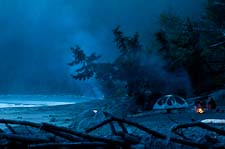 the trail, we picked out a spot sheltered by a small overhanging fir tree. The slope behind us was
steep but passable if we were motivated enough, as by a tsunami for instance, and two large logs in
front of us gave us a sense of privacy. The substrate wasn't exactly sand but it was fine enough to
be comfortable and soft enough to level with a piece of driftwood before setting up the tent. A
little stream nearby provided water and before dusk we were able to gather up enough small pieces of
driftwood to build a fire. That's one advantage of beach camping - you can have a campfire - and
most people do, judging by the spots of glowing orange and the thin plumes of blue smoke rising up
all along the beach as the sunset faded over the water.
the trail, we picked out a spot sheltered by a small overhanging fir tree. The slope behind us was
steep but passable if we were motivated enough, as by a tsunami for instance, and two large logs in
front of us gave us a sense of privacy. The substrate wasn't exactly sand but it was fine enough to
be comfortable and soft enough to level with a piece of driftwood before setting up the tent. A
little stream nearby provided water and before dusk we were able to gather up enough small pieces of
driftwood to build a fire. That's one advantage of beach camping - you can have a campfire - and
most people do, judging by the spots of glowing orange and the thin plumes of blue smoke rising up
all along the beach as the sunset faded over the water.
At Port Angeles we found the Olympic National Park ranger station and picked up our camping permit. The ranger was very helpful. It turns out that where we're planning to go, the tides won't be a problem - there are just a couple of tight spots, and in those, the water only needs to be somewhat lower than high tide, so we'll be fine. Much of our hike will be on the beach, and there will be lots of sea stacks. Sea stacks were why we chose to come here rather than return to the mountains - David wanted to photograph sea stacks. I wasn't real excited about beach hiking but didn't really feel like going back up into the mountains either.
Even mid-week, most of the convenient camping sites on the beach are occupied. We started out to the north then decided instead to head down towards where we'll catch the trail tomorrow. The farther we walked, the more unoccupied sites we found. About a third of a mile down the beach from
08/17/2011 Third Beach to Toleak Point 5.5 miles
 We were packed up and hiking down the beach by 8AM, a remarkably early start for us. Our goal was
to get around Scott's Bluff where we needed a 1 foot tide level, by 11AM or so. To get there we
hiked up and over Taylor point through pleasant forest which included one very large Western Red
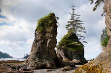
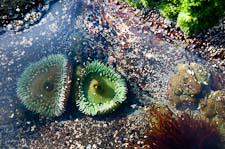
Cedar tree. We dropped back down to the beach at a cozy little camp with two sea stacks right on
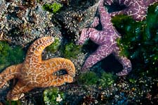
shore and our first nice display of intertidal life. We took lots of photos. A short beach curved
around to the eroded headland of Scott's Bluff. Rounding the bluff on slippery boulders was a bit
tricky with packs but once past that obstacle, the remaining three miles or so were all on the
beach. We passed a couple of interesting sea stacks accessible from shore and took lots of photos,
then came across a flock of Semipalmated Plovers and took more photos.
We were packed up and hiking down the beach by 8AM, a remarkably early start for us. Our goal was
to get around Scott's Bluff where we needed a 1 foot tide level, by 11AM or so. To get there we
hiked up and over Taylor point through pleasant forest which included one very large Western Red
Cedar tree. We dropped back down to the beach at a cozy little camp with two sea stacks right on
shore and our first nice display of intertidal life. We took lots of photos. A short beach curved
around to the eroded headland of Scott's Bluff. Rounding the bluff on slippery boulders was a bit
tricky with packs but once past that obstacle, the remaining three miles or so were all on the
beach. We passed a couple of interesting sea stacks accessible from shore and took lots of photos,
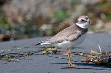
then came across a flock of Semipalmated Plovers and took more photos.
 At Toleak Point we investigated sites in the woods on the north side of the point and more sites on
the beach around and to the south of the point. Though some were occupied, we found a spot framed
by a mass of tree roots on one side and a couple of logs on the other, an overhanging spruce to
provide some shade, and smaller logs to sit on while cooking and eating. It was past lunch time so
we snacked on nuts then I retrieved water from behind a mass of driftwood a couple hundred yards to
the south and boiled some of it to fix a freeze-dried early dinner. After a nap or something like
it we moseyed down the beach to photograph a few of the hundreds of gulls sitting on the beach or
fishing just offshore. Later we tried to catch the green flash but were thwarted by a line of
previously invisible clouds right along the horizon. I gathered an armload of scraps of driftwood,
stuff too small for other parties to bother with, and we tended a little fire after dark until our
wood ran out. We tried toasting bread over the coals with mixed results - the driftwood imparted
an unappealing hint of burned plastic but some alder chips we found gave our bread and cheese a
pleasant smoky flavor.
At Toleak Point we investigated sites in the woods on the north side of the point and more sites on
the beach around and to the south of the point. Though some were occupied, we found a spot framed
by a mass of tree roots on one side and a couple of logs on the other, an overhanging spruce to
provide some shade, and smaller logs to sit on while cooking and eating. It was past lunch time so
we snacked on nuts then I retrieved water from behind a mass of driftwood a couple hundred yards to
the south and boiled some of it to fix a freeze-dried early dinner. After a nap or something like
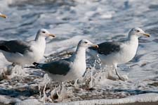
it we moseyed down the beach to photograph a few of the hundreds of gulls sitting on the beach or
fishing just offshore. Later we tried to catch the green flash but were thwarted by a line of
previously invisible clouds right along the horizon. I gathered an armload of scraps of driftwood,
stuff too small for other parties to bother with, and we tended a little fire after dark until our
wood ran out. We tried toasting bread over the coals with mixed results - the driftwood imparted
an unappealing hint of burned plastic but some alder chips we found gave our bread and cheese a
pleasant smoky flavor.
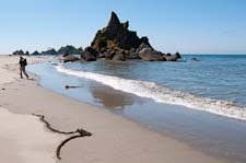
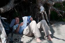
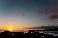 Backpacking on the beach is considerably more relaxing than in the mountains - a morning ambling
along the beach and an afternoon and evening lazing around camp. It's more scenic than I expected;
I'm probably shooting twice as many photos as last week and David seems pretty happy with our choice
too.
Backpacking on the beach is considerably more relaxing than in the mountains - a morning ambling
along the beach and an afternoon and evening lazing around camp. It's more scenic than I expected;
I'm probably shooting twice as many photos as last week and David seems pretty happy with our choice
too.
Scott's Beach
Anemones
Starfish
Bald Eagle
California Gulls
Semipalmated Plover
Beach Hiking
Siesta
Sunset
08/18/2011 Toleak Point and beyond 8 miles
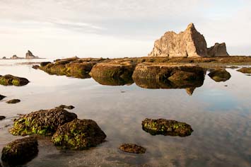
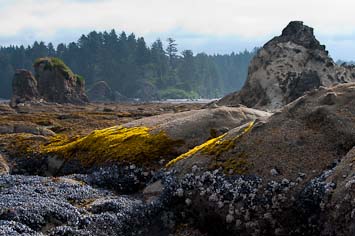 Slept really well last night thanks perhaps to the soft sand under our tent. I got up around sunrise.
The gulls were mostly on the beach or sitting quietly just offshore, even more of them than yesterday.
Overhead thin high clouds stretched across most of the sky and a thin mist hugged the water around
the offshore stacks and islands. The tide was falling but not yet low enough for us to get out to
the rocks off Toleak Point so we hung around and took some photos while we waited to cross. The sun
slipped under the clouds to light up the offshore stacks but had risen high enough to be obscured by
the time we picked our way out to the local sea stacks.
Slept really well last night thanks perhaps to the soft sand under our tent. I got up around sunrise.
The gulls were mostly on the beach or sitting quietly just offshore, even more of them than yesterday.
Overhead thin high clouds stretched across most of the sky and a thin mist hugged the water around
the offshore stacks and islands. The tide was falling but not yet low enough for us to get out to
the rocks off Toleak Point so we hung around and took some photos while we waited to cross. The sun
slipped under the clouds to light up the offshore stacks but had risen high enough to be obscured by
the time we picked our way out to the local sea stacks.
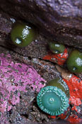
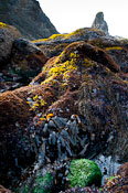
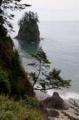
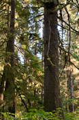
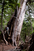
 Despite the flat light, we found lots of photo ops out in the intertidal areas around the stacks.
Masses of blue mussels and clumps of white barnacles contrast with bright yellow, green and brown
sea weeds. Green anemonies and orange and purple sea stars cluster in crevices. One deeper pocket
contained brilliant pink and scarlet sponges along with the anemonies. We spent a good hour out
there inspecting and photographing sea life and scrambling around on the pockmarked sandstone of the
stacks. On the way back in David found a small school of anchovies trapped in a tidepool. One of
the leaders of the scout troop camped next to us had mentioned to David that he'd cooked up an
anchovy yesterday so I decided to try them out. With David's somewhat ambivalent help, I managed
to catch one by hand and two more by splashing them out onto the rocks. I killed and cleaned them
and poached them over the stove during breakfast. They just took a minute or two and split neatly
into two small filets when I peeled out their spines. They were delicious, somewhat like trout but
without any hint of muddiness. As far as I can tell they're the same as the bait fish we use
salmon-fishing. Until today I never realized that the bait tastes better than the quarry.
Despite the flat light, we found lots of photo ops out in the intertidal areas around the stacks.
Masses of blue mussels and clumps of white barnacles contrast with bright yellow, green and brown
sea weeds. Green anemonies and orange and purple sea stars cluster in crevices. One deeper pocket
contained brilliant pink and scarlet sponges along with the anemonies. We spent a good hour out
there inspecting and photographing sea life and scrambling around on the pockmarked sandstone of the
stacks. On the way back in David found a small school of anchovies trapped in a tidepool. One of
the leaders of the scout troop camped next to us had mentioned to David that he'd cooked up an
anchovy yesterday so I decided to try them out. With David's somewhat ambivalent help, I managed
to catch one by hand and two more by splashing them out onto the rocks. I killed and cleaned them
and poached them over the stove during breakfast. They just took a minute or two and split neatly
into two small filets when I peeled out their spines. They were delicious, somewhat like trout but
without any hint of muddiness. As far as I can tell they're the same as the bait fish we use
salmon-fishing. Until today I never realized that the bait tastes better than the quarry.
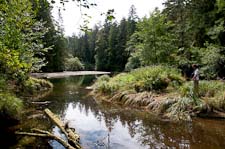
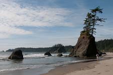 After a leisurely brunch we packed up a little food and set out for a hike down the coast. In a
walk-in crack at the south end of the beach I found my first Western Sea Roaches - basically marine
pillbugs. The trail over the headland was harder to find, hidden behind two big boulders, but
eventually we located it. We crossed a tidal stream in the woods, continued through groves of big
but probably not very old Sitka Spruce, descended to the beach again at a tall stack attached to the
shore. A long beach of smooth brown sand extended several miles down towards Hoh Head and we
wandered along it, stopping at a nearshore stack for lunch then continuing most of the way to
Mosquito Creek before turning around. A line of Japanese net floats made of hard plastic in shades
of orange and black, not nearly as beautiful as the old blown glass ones, adorned the beach south of
our lunch stack. We tossed them ineffectually back into the water. Where the trail climbed back up
After a leisurely brunch we packed up a little food and set out for a hike down the coast. In a
walk-in crack at the south end of the beach I found my first Western Sea Roaches - basically marine
pillbugs. The trail over the headland was harder to find, hidden behind two big boulders, but
eventually we located it. We crossed a tidal stream in the woods, continued through groves of big
but probably not very old Sitka Spruce, descended to the beach again at a tall stack attached to the
shore. A long beach of smooth brown sand extended several miles down towards Hoh Head and we
wandered along it, stopping at a nearshore stack for lunch then continuing most of the way to
Mosquito Creek before turning around. A line of Japanese net floats made of hard plastic in shades
of orange and black, not nearly as beautiful as the old blown glass ones, adorned the beach south of
our lunch stack. We tossed them ineffectually back into the water. Where the trail climbed back up
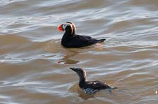
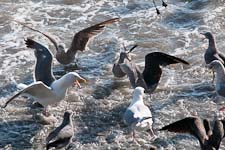
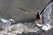 to bypass the headland a flock of birds, mostly gulls but including Pelagic Cormorants, a Common
Murre or two and at least four Tufted Puffins, was feeding on anchovies in the surf and offshore.
David and I sat on the saddle of the sea stack and photographed the birds for nearly an hour.
Having taken off my boots to walk on the beach after lunch I decided not to put them back on so
hiked all the way back to camp barefoot. The sun displayed a hint of a green flash as it set behind
a fog bank.
to bypass the headland a flock of birds, mostly gulls but including Pelagic Cormorants, a Common
Murre or two and at least four Tufted Puffins, was feeding on anchovies in the surf and offshore.
David and I sat on the saddle of the sea stack and photographed the birds for nearly an hour.
Having taken off my boots to walk on the beach after lunch I decided not to put them back on so
hiked all the way back to camp barefoot. The sun displayed a hint of a green flash as it set behind
a fog bank.
All day long I thought it was my birthday, and I thought it was a very nice one. Not until a few days later did I realize I had the wrong day.
David with Anchovy
Tidal creek
Our southernmost point
Tufted Puffin and Common Murre
Gulls arguing over anchovies
Gulls eating anchovies
All day long I thought it was my birthday, and I thought it was a very nice one. Not until a few days later did I realize I had the wrong day.
08/19/2011 back to Third Beach trailhead 6 miles
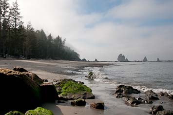
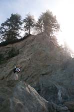 David wanted fog for photos and we got some today, filtering through the headland spruces and
obscuring the offshore seastacks for the first couple hours of our hike. We broke camp at a
comfortable time, hiked back at a comfortable pace and stopped for lunch in the sun-drenched
driftwood at Third Beach before returning to the car. We'd planned to hike down to Second Beach
because Susan suggested we see it, but it appeared to be blanketed in fog so we drove into La Push
instead. Fog blocked our view of the big stacks offshore but thinned enough to admit some sunshine in town.
Inland it was sunny and warm enough that we stopped along Lake Crescent for a brief swim on
the way home.
David wanted fog for photos and we got some today, filtering through the headland spruces and
obscuring the offshore seastacks for the first couple hours of our hike. We broke camp at a
comfortable time, hiked back at a comfortable pace and stopped for lunch in the sun-drenched
driftwood at Third Beach before returning to the car. We'd planned to hike down to Second Beach
because Susan suggested we see it, but it appeared to be blanketed in fog so we drove into La Push
instead. Fog blocked our view of the big stacks offshore but thinned enough to admit some sunshine in town.
Inland it was sunny and warm enough that we stopped along Lake Crescent for a brief swim on
the way home.

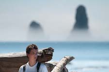
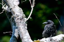
David on Scott's Bluff
Fog over the headlands
David at lunch on Third Beach
Crow waiting for leftovers
08/20/2011 Ilwaco
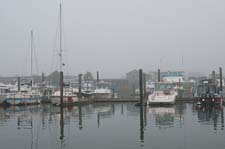
Ilwaco marina
08/21/2011 Ilwaco salmon fishing
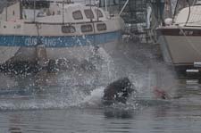
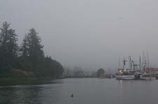
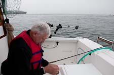 Foggy in the morning with little wind. I got up around sunrise, I think, and prepared the herring
(filet both sides, trim ragged belly edge, cut front end in broad wedge and pack in salt, preferably
overnight). Larry and Bill rigged our gear. We motored out a sinuous channel with woods on one
Foggy in the morning with little wind. I got up around sunrise, I think, and prepared the herring
(filet both sides, trim ragged belly edge, cut front end in broad wedge and pack in salt, preferably
overnight). Larry and Bill rigged our gear. We motored out a sinuous channel with woods on one
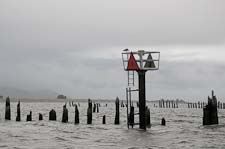
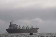 side, sandy flats and tall grass on the other with long rows of old pilings extending out from
shore. They made Larry nervous. We continued southeast across the shipping channel towards the
buoy 10 area, a well-known fishing spot. The tide was ebbing and a strong current made navigation
difficult. Because of the fog we had to use radar to spot incoming ships and the GPS to track our
position and I found it confusing; the GPS didn't seem to be oriented correctly. At trolling speed
running against the current we barely made any headway so we didn't cover much area. When the swells
began to pick up around us we picked up our gear and motored north back across the channel to calmer
side, sandy flats and tall grass on the other with long rows of old pilings extending out from
shore. They made Larry nervous. We continued southeast across the shipping channel towards the
buoy 10 area, a well-known fishing spot. The tide was ebbing and a strong current made navigation
difficult. Because of the fog we had to use radar to spot incoming ships and the GPS to track our
position and I found it confusing; the GPS didn't seem to be oriented correctly. At trolling speed
running against the current we barely made any headway so we didn't cover much area. When the swells
began to pick up around us we picked up our gear and motored north back across the channel to calmer
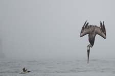
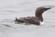 water and better visibility. We trolled along the north shore past the church spire, then southeast
towards Astoria and most of the other fishing boats. We didn't get any bites all day and most people
didn't do much better, though apparently the boats over near Astoria caught a few. I was groggy and
sleepy in the afternoon, probably from the anti-seasickness medicine. I only took one pill in the
morning and had no problem with motion sickness; maybe I'll try doing without tomorrow.
water and better visibility. We trolled along the north shore past the church spire, then southeast
towards Astoria and most of the other fishing boats. We didn't get any bites all day and most people
didn't do much better, though apparently the boats over near Astoria caught a few. I was groggy and
sleepy in the afternoon, probably from the anti-seasickness medicine. I only took one pill in the
morning and had no problem with motion sickness; maybe I'll try doing without tomorrow.
We ate at the Imperial Schooner this evening. Larry and Bill had fish and chips while I tried the calamari, which was pretty tasteless. I had a bottle of Dick's Lava Rock Porter and felt dizzy and
 weak afterwards, perhaps due to an interaction between the seasickness stuff, basically generic
Dramamine, and the alcohol. After a trip to Sid's grocery in town to get rock salt, we took turns
showering in the Port of Ilwaco restroom just east of the Pacific Salmon Charter office. I had no
soap but felt and smelled cleaner afterwards just the same. By bedtime, 9:15PM, it was foggy and
drizzly outside. I slept much better than last night despite having to get up once.
weak afterwards, perhaps due to an interaction between the seasickness stuff, basically generic
Dramamine, and the alcohol. After a trip to Sid's grocery in town to get rock salt, we took turns
showering in the Port of Ilwaco restroom just east of the Pacific Salmon Charter office. I had no
soap but felt and smelled cleaner afterwards just the same. By bedtime, 9:15PM, it was foggy and
drizzly outside. I slept much better than last night despite having to get up once.
Sea Lion eating breakfast
Leaving Ilwaco harbor
Bill rigging his gear
Piling fences along the way out
Fishing in the shipping channel
Common Murre and diving Brown Pelican
Common Murre
We ate at the Imperial Schooner this evening. Larry and Bill had fish and chips while I tried the calamari, which was pretty tasteless. I had a bottle of Dick's Lava Rock Porter and felt dizzy and
Charter boats done for the day
Larry done for the day
08/22/2011 Ilwaco salmon fishing
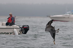
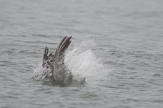 In the morning the fog had cleared though the sky was still mostly covered with a layer of
stratocumulus. A brisk breeze was blowing out of the west-southwest and the air was comfortably
warm. We started out trolling between buoys 10 and 12, and over towards 11. North of buoy 12
Larry, fishing about 20' down, hooked a salmon but lost it. As he was reeling in his line
a juvenile pelican spotted the herring and squid lure on the surface, dove on it and got hooked.
In the morning the fog had cleared though the sky was still mostly covered with a layer of
stratocumulus. A brisk breeze was blowing out of the west-southwest and the air was comfortably
warm. We started out trolling between buoys 10 and 12, and over towards 11. North of buoy 12
Larry, fishing about 20' down, hooked a salmon but lost it. As he was reeling in his line
a juvenile pelican spotted the herring and squid lure on the surface, dove on it and got hooked.
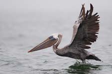 With its head and wings often partly submerged, the bird created too much drag to bring it in
so we had to turn the boat into the wind and drift back to it. It was hooked in the tip of the baggy
lower manible, all skin with a fine network of blood vessels. Up close the bird was big and floppy.
I unhooked it with a pair of needle nose pliers but as it was fleeing it caught my line with the
crook of its wing. It tried to fly a couple of times but the fishing line brought it down again.
I was afraid I would hook it if I tried to reel it in, so we tried to motor around it but the
bird kept swimming away from the boat with my line over its shoulder. It took probably 10 minutes
before we were able to loop far enough around it to pull my line free. In the same area we watched
a sea lion thrash and eat a salmon.
With its head and wings often partly submerged, the bird created too much drag to bring it in
so we had to turn the boat into the wind and drift back to it. It was hooked in the tip of the baggy
lower manible, all skin with a fine network of blood vessels. Up close the bird was big and floppy.
I unhooked it with a pair of needle nose pliers but as it was fleeing it caught my line with the
crook of its wing. It tried to fly a couple of times but the fishing line brought it down again.
I was afraid I would hook it if I tried to reel it in, so we tried to motor around it but the
bird kept swimming away from the boat with my line over its shoulder. It took probably 10 minutes
before we were able to loop far enough around it to pull my line free. In the same area we watched
a sea lion thrash and eat a salmon.
We trolled up the south shore to avoid the chop from the wind, which had picked up to 25 knots or more. Another boat cut too close behind us and cut off my flasher. I was using a 10oz banana weight but apparently that wasn't enough to sink the flasher. Our boat was difficult to control at trolling speed due to the wind. When at one point we turned too sharply we drifted back across our gear and got all three lines tangled together along with one of the downrigger balls. That was unfortunate since we were just approaching the area west of Astoria where the other boats were fishing. By the time we got everything untangled and cut free and re-assembled, we'd drifted north all the way across the river, so we trolled back downstream, rolling in fairly heavy chop, along the north shore. Larry hooked and landed a nice 10lb salmon but its gray gums and adipose fin identified it as a wild Coho so we had to release it.
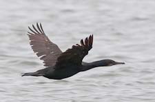
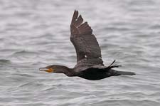 Docking was again difficult due to the wind. We backed off on our first try, then hit the dock on
our second try. Turning sideways, we also hit the other boat in the slip without ever getting close
enough for me to get off with the rope. We ended up mooring in the empty slip next door instead.
For supper we drove into Long Beach. I searched for restaurants on my phone and found the Lightship
had good ratings for seafood. Bill got directions on his phone while mine was still looking for a
map of Long Beach. It was a sparely decorated place on the fifth floor of the Adrift Motel on Sid
Snyder drive, overlooking dune grass and a long expanse of beach - a beautiful view though somewhat
desolate in the wind and drizzle. With binoculars I could pick out shearwaters streaming by beyond
the surf line. We all ordered the salmon, advertised as medium-rare but served overcooked though
the fish was fresh and the trimmings nice. The chocolate lava cake (chocolate sponge cake w/
Hershey's chocolate sauce and whipped cream) wasn't very sophisticated but tasted good anyhow. I
didn't take Dramamine today and wasn't groggy in the afternoon, nor did beer with dinner give me any
trouble. I also didn't have any queasiness despite the close work of untangling my fishing line on
the rocking boat. Too tired to shower before bed but I was up twice during the night, which
though chilly was dry.
Docking was again difficult due to the wind. We backed off on our first try, then hit the dock on
our second try. Turning sideways, we also hit the other boat in the slip without ever getting close
enough for me to get off with the rope. We ended up mooring in the empty slip next door instead.
For supper we drove into Long Beach. I searched for restaurants on my phone and found the Lightship
had good ratings for seafood. Bill got directions on his phone while mine was still looking for a
map of Long Beach. It was a sparely decorated place on the fifth floor of the Adrift Motel on Sid
Snyder drive, overlooking dune grass and a long expanse of beach - a beautiful view though somewhat
desolate in the wind and drizzle. With binoculars I could pick out shearwaters streaming by beyond
the surf line. We all ordered the salmon, advertised as medium-rare but served overcooked though
the fish was fresh and the trimmings nice. The chocolate lava cake (chocolate sponge cake w/
Hershey's chocolate sauce and whipped cream) wasn't very sophisticated but tasted good anyhow. I
didn't take Dramamine today and wasn't groggy in the afternoon, nor did beer with dinner give me any
trouble. I also didn't have any queasiness despite the close work of untangling my fishing line on
the rocking boat. Too tired to shower before bed but I was up twice during the night, which
though chilly was dry.
Brown Pelican taking off
We trolled up the south shore to avoid the chop from the wind, which had picked up to 25 knots or more. Another boat cut too close behind us and cut off my flasher. I was using a 10oz banana weight but apparently that wasn't enough to sink the flasher. Our boat was difficult to control at trolling speed due to the wind. When at one point we turned too sharply we drifted back across our gear and got all three lines tangled together along with one of the downrigger balls. That was unfortunate since we were just approaching the area west of Astoria where the other boats were fishing. By the time we got everything untangled and cut free and re-assembled, we'd drifted north all the way across the river, so we trolled back downstream, rolling in fairly heavy chop, along the north shore. Larry hooked and landed a nice 10lb salmon but its gray gums and adipose fin identified it as a wild Coho so we had to release it.
Brandt's Cormorant
Double-crested Cormorant
08/23/2011 Ilwaco salmon fishing
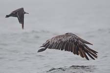
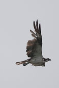
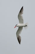
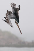 We got an early start and were out on the water by 7AM, along with lots of pelicans and Common
Murres, and a few Sooty Shearwaters. Most of the diving pelicans were attended by Heerman's Gulls,
one gull per pelican. I couldn't tell if the gulls each stuck with their own pelican or if they
switched around. The birds had more success than we did. Despite our optimism, we caught nothing,
had no bites and wrapped up around noon empty-handed for the trip. At least that made the
cleanup easier. We washed the boat and rinsed out the engine near the pullout using 'Al's' hoses, a
big time saver. Al was sitting in his car guarding his hoses when we pulled up; Larry chatted him
up and gave him $5 and Al happily let us use his fresh water and hoses. We were on the road for
home by 2:30 or so. It was a good trip despite the lack of fish - an adventure with good company,
a big change from my usual activites and relaxing in its intensity - keeping the boat on course, fiddling with the gear,
watching birds. The birds are more diverse at Westport but the fishing is
easier at Ilwaco; there's no bar to cross and a fairly short trip out to the fishing grounds. The main
drawback with Westport is that the seas tend to be rough; the main benefit is that we catch fish there.
We got an early start and were out on the water by 7AM, along with lots of pelicans and Common
Murres, and a few Sooty Shearwaters. Most of the diving pelicans were attended by Heerman's Gulls,
one gull per pelican. I couldn't tell if the gulls each stuck with their own pelican or if they
switched around. The birds had more success than we did. Despite our optimism, we caught nothing,
had no bites and wrapped up around noon empty-handed for the trip. At least that made the
cleanup easier. We washed the boat and rinsed out the engine near the pullout using 'Al's' hoses, a
big time saver. Al was sitting in his car guarding his hoses when we pulled up; Larry chatted him
up and gave him $5 and Al happily let us use his fresh water and hoses. We were on the road for
home by 2:30 or so. It was a good trip despite the lack of fish - an adventure with good company,
a big change from my usual activites and relaxing in its intensity - keeping the boat on course, fiddling with the gear,
watching birds. The birds are more diverse at Westport but the fishing is
easier at Ilwaco; there's no bar to cross and a fairly short trip out to the fishing grounds. The main
drawback with Westport is that the seas tend to be rough; the main benefit is that we catch fish there.
We watched sea lions eating fish three times - the salmon, a big flounder in the marina, and something else. We saw porpoises twice, harbor seals all the time and birds as listed below:
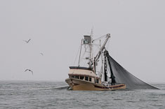
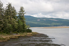
Brown Pelican escorted by Heerman's Gull
Osprey
Caspian Tern
Diving pelican
We watched sea lions eating fish three times - the salmon, a big flounder in the marina, and something else. We saw porpoises twice, harbor seals all the time and birds as listed below:
Sooty Shearwater
5
Individuals on the river. Hundreds more off the beach one evening.
Brown Pelican
100+
Feeding on river, roosting on pilings along north shore
Brandt's Cormorant
1000+
Feeding on river, roosting on pilings along north shore
Double-crested Cormorant
300+
Widespread, mostly w/ Brandt's
Pelagic Cormorant
A few
Solitary, out on the river
Great Blue Heron
A few
Osprey
1
Peregrine Falcon
1
Flying over town carrying large prey (a yellowlegs?)
Peeps
50
Several flocks
Greater Yellowlegs
10
Dowitcher sp.
1
Heerman's Gull
200
Around pelicans
California Gull
20
Western Gull
50
Glaucous-winged Gull
50
Caspian Tern
20
Mostly around/over the marina
Common Murre
200
Most on our last day out
Pigeon Guillemot
5
Occasional individuals
American Crow
5
Brewer's Blackbird
5
Around marina
Seine-netting baitfish
Baitfish float in the marina
Willapa Bay - heading home
08/30/2011 Commencement Bay
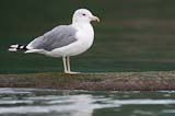
 Susan and I went canoeing around the log booms on the north side of Commencement Bay in Tacoma
today for the first time in a long time. We were inspired by our tour of the Port of Tacoma
a couple of days ago, when I saw that the California Gulls were back on the log booms and that
the city had built a new kayak launch at the pullout from which we scoped gulls a couple of years
ago when the Black-tailed Gull was in town. I brought my camera and took a few photos.
Susan and I went canoeing around the log booms on the north side of Commencement Bay in Tacoma
today for the first time in a long time. We were inspired by our tour of the Port of Tacoma
a couple of days ago, when I saw that the California Gulls were back on the log booms and that
the city had built a new kayak launch at the pullout from which we scoped gulls a couple of years
ago when the Black-tailed Gull was in town. I brought my camera and took a few photos.
California Gull
Harbor Seals
09/03/2011 Soaring Eagle trail marathon, Rattlesnake Ledge hike
I was relieved to find a half dozen Maniacs I recognized in the parking lot at the Soaring Eagle trailhead somewhere on the Sammamish plateau northeast of Issaquah, about an hour drive. As I suspected despite lack of any confirmation, I had signed up for the race. About 20 of us did the early start at 7:30 as the sun was beginning to filter down through the trees. I wore my lightweight jacket for the first mile or so while I warmed up. I followed three women, Barb Blumenthal, Luisa ??? and Lisa Switzer, with only one other runner out ahead of us. For 21 miles I ran behind the three women and talked mostly with Lisa, who has a boy and a girl 12 and 10 at home and a husband nicknamed Double (for double-wide) who mostly watches sports instead of doing them. She took up running a few years ago and it transformed her life, giving her self-confidence which extended to everything else she was doing. Thanks to Barb's steady comfortable pace, I felt strong enough to run several faster miles in the last five and didn't stiffen up much afterwards hanging around the finish for a couple hours visiting with Rob and Diana and other Maniacs.
Rather later than I'd planned I drove back to Issaquah then called Pastor McClarty. The church group hadn't been at Rattlesnake Lake long so I drove out to meet them after checking in with Susan, who was having a sleepy day at home and didn't mind my staying out a while longer. In North Bend I rinsed off briefly in the cold silty waters of the Middle Fork so I could show up all fresh and dressed at Rattlesnake Lake. I didn't know anyone at the picnic except John and Karin but overheard a guy, possibly named Randy, talking about Lightroom so joined their conversation for a few minutes. When John and Karin and a few others set out for Rattlesnake Ledge I followed them after a few minutes but managed to get ahead of them without realizing it, so walked up the trail by myself though not exactly alone given the horde of descending hikders. I did the whole ascent barefoot despite scattered loose gravel on much of the trail. Few people noticed. The handful of church members arrived a few minutes behind me. John and I speculated about the origins of the landscape in front of us, particularly the flat shelves extending across the mouths of the river valleys and south like a skirt along the front of the mountains. I wore my flip-flops down and drove Karin home since John stayed to await the return of another hiker who missed the ledge and continued several miles to the peak instead.
09/04/2011 Chinook Pass hike
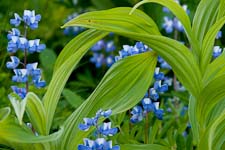
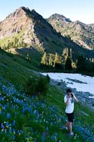 David and Monica stopped by to pick up some gear for David before heading out to Monica's research
site out near Mt Persis. I plied her with questions about her project, which is to determine if the
volcanics of Mt Persis are related to the Mt Index granite pluton. They apparently are not. After
they left, as I was beginning to consider a late morning nap, Daniel called to see if I wanted to go
for a hike. Not wanting to turn him down, I agreed and we settled on something in the Chinook Pass
area as being relatively short but sufficiently challenging to be of interest. We set out from the
parking lot around 3PM and took about an hour, including frequent stops to photograph flowers, to reach
the summit of the peak immediately west of the pass. The ascent, via the northwest ridge, involves a
little scrambling and smearing up slanted ledges. On top we at some lunch and fed some small but
persistent mosquitoes before descending the south face and picking up a well-trodden footpath around
to the east and down. Beautiful warm sunny day, beautiful flowers and still quite a few patches of snow
in shady woods.
David and Monica stopped by to pick up some gear for David before heading out to Monica's research
site out near Mt Persis. I plied her with questions about her project, which is to determine if the
volcanics of Mt Persis are related to the Mt Index granite pluton. They apparently are not. After
they left, as I was beginning to consider a late morning nap, Daniel called to see if I wanted to go
for a hike. Not wanting to turn him down, I agreed and we settled on something in the Chinook Pass
area as being relatively short but sufficiently challenging to be of interest. We set out from the
parking lot around 3PM and took about an hour, including frequent stops to photograph flowers, to reach
the summit of the peak immediately west of the pass. The ascent, via the northwest ridge, involves a
little scrambling and smearing up slanted ledges. On top we at some lunch and fed some small but
persistent mosquitoes before descending the south face and picking up a well-trodden footpath around
to the east and down. Beautiful warm sunny day, beautiful flowers and still quite a few patches of snow
in shady woods.
Daniel stayed for supper. David called around an hour after sunset to say that he and Monica were still in the woods but they had flashlights and would be OK. I went to bed soon after.
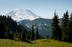
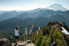
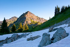
Lupine and Hellebore
Daniel below Yakima Peak
Daniel stayed for supper. David called around an hour after sunset to say that he and Monica were still in the woods but they had flashlights and would be OK. I went to bed soon after.
09/05/2011 Labor Day Marathon
Diana and Rob agreed to meet at 8AM in Elma for the Labor Day marathon, and they were there when I arrived on a quiet cool morning under a low stratus overcast. The race director and crew hadn't arrived yet but the course was marked so we followed the arrows out to the main road and south towards the river. I gave Rob and Diana a 5-minute head start because I wasn't ready yet but caught up to them within a couple miles because they were mostly walking. Other than a mile at 7:50 just before the half-way point (which felt wonderful, the best I've felt running in a long time), I walked with them until mile 21 when Claudia caught up to us. She ran her first marathon back in February at Cupid's, then qualified for Manaics at our February Yours Truly, then set a PR at the Tunnel. When she passed us she was on track for another PR so I decided to pace her in to the finish. Not that I did much, other than try to talk to pass the time for her and encourage her that she was going to make it, and she did, beating her Tunnel time by 6 minutes. The course, a double out- and-back on rural chip-sealed roads, is fairly boring, but the traffic was light and I was able to get a brief swim in the lake afterwards.
Diana and Rob agreed to meet at 8AM in Elma for the Labor Day marathon, and they were there when I arrived on a quiet cool morning under a low stratus overcast. The race director and crew hadn't arrived yet but the course was marked so we followed the arrows out to the main road and south towards the river. I gave Rob and Diana a 5-minute head start because I wasn't ready yet but caught up to them within a couple miles because they were mostly walking. Other than a mile at 7:50 just before the half-way point (which felt wonderful, the best I've felt running in a long time), I walked with them until mile 21 when Claudia caught up to us. She ran her first marathon back in February at Cupid's, then qualified for Manaics at our February Yours Truly, then set a PR at the Tunnel. When she passed us she was on track for another PR so I decided to pace her in to the finish. Not that I did much, other than try to talk to pass the time for her and encourage her that she was going to make it, and she did, beating her Tunnel time by 6 minutes. The course, a double out- and-back on rural chip-sealed roads, is fairly boring, but the traffic was light and I was able to get a brief swim in the lake afterwards.
09/7/2011
Replaced the kitchen faucet today. The old one was tough to get out because the plastic mounting nuts were stuck (or glued) in place, but once I got it out, the new one was easy to install. It works great, much smoother than the old one and doesn't drip. We were both pleased about it.
Replaced the kitchen faucet today. The old one was tough to get out because the plastic mounting nuts were stuck (or glued) in place, but once I got it out, the new one was easy to install. It works great, much smoother than the old one and doesn't drip. We were both pleased about it.
09/10/2011 Rosario Beach Sabbath
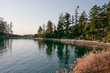
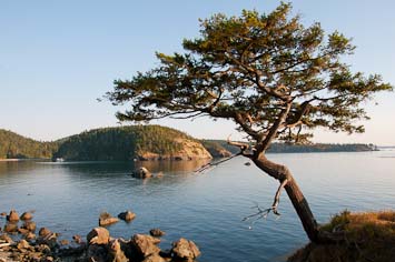 We joined the North Hill Church on their annual retreat at Rosario this Sabbath, sharing a cabin
with John and Karin McClarty after Wayne and Margie couldn't make it. The theme was dancing with
God, dance as a Scriptural metaphor for our individual relationship and personal experience with
Him. Think high-school prom, not dance as a performance. He invites me, I accept; He leads, I
follow; He holds me tight as we dance together. The metaphor does not accomodate my
paradigm for relationship with the Divine, which is I perform, or fail to, and He judges and finds
insufficient.
We joined the North Hill Church on their annual retreat at Rosario this Sabbath, sharing a cabin
with John and Karin McClarty after Wayne and Margie couldn't make it. The theme was dancing with
God, dance as a Scriptural metaphor for our individual relationship and personal experience with
Him. Think high-school prom, not dance as a performance. He invites me, I accept; He leads, I
follow; He holds me tight as we dance together. The metaphor does not accomodate my
paradigm for relationship with the Divine, which is I perform, or fail to, and He judges and finds
insufficient.
In the morning service John spoke briefly, reiterating his recent theme that God, viewing us through Jesus, regards us as good, as in "Am I doing OK?" You're good." (You're OK, sufficient, adequate, fine...). But more than that, He delights in us. He doesn't love us in spite of who we are; He
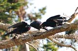
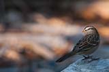 loves us because of who we are. The church seemed to agree. Several individuals shared testimonies
about how they were going, had gone, astray and God found them and the church welcomed them in.
They welcomed us too, but I didn't really want to be welcomed in the afternoon so I took a nap
after lunch instead of going for a hike. Jim Brothers drove up at Susan's request and they spent
a warm afternoon in each others' company. After a while I wandered out to take a few
photos of birds and scenery, returning after the evening meeting and snack supper was underway.
loves us because of who we are. The church seemed to agree. Several individuals shared testimonies
about how they were going, had gone, astray and God found them and the church welcomed them in.
They welcomed us too, but I didn't really want to be welcomed in the afternoon so I took a nap
after lunch instead of going for a hike. Jim Brothers drove up at Susan's request and they spent
a warm afternoon in each others' company. After a while I wandered out to take a few
photos of birds and scenery, returning after the evening meeting and snack supper was underway.
Pleasant enough day though I was tired, having not slept well the night before. I did have a good run in the morning, on trails over to Bowman Beach and up to the bridge, then out and back on the bridge 180 feet above Deception Pass, then back onto trails over to Pass Lake where I went for a brief swim in the morning sunshine before heading up Rosario Beach road and back to the Marine Lab. I tried to run barefoot on the road but it was recently chip-sealed with rather coarse gravel so I only made it a few tenths of a mile before putting shoes back on.
In the morning service John spoke briefly, reiterating his recent theme that God, viewing us through Jesus, regards us as good, as in "Am I doing OK?" You're good." (You're OK, sufficient, adequate, fine...). But more than that, He delights in us. He doesn't love us in spite of who we are; He
Northwestern Crows
White-crowned Sparrow
Pleasant enough day though I was tired, having not slept well the night before. I did have a good run in the morning, on trails over to Bowman Beach and up to the bridge, then out and back on the bridge 180 feet above Deception Pass, then back onto trails over to Pass Lake where I went for a brief swim in the morning sunshine before heading up Rosario Beach road and back to the Marine Lab. I tried to run barefoot on the road but it was recently chip-sealed with rather coarse gravel so I only made it a few tenths of a mile before putting shoes back on.
09/11/2011 Skagit Flats Marathon
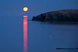 I ran 3:42:14 at Skagit Flats Marathon today and qualified for Boston for the first time in the past
year and a half. Unfortunately my time probably isn't fast enough to actually get me into the race.
Qualifying was definitely a stretch goal since I only resumed training a few weeks ago after minimal
running over the summer. My goal was simply to maintain my sub-4 streak at Skagit Flats and I
figured I could do that, but didn't think I had much chance of breaking 3:45, my 2012 qualifying
time.
I ran 3:42:14 at Skagit Flats Marathon today and qualified for Boston for the first time in the past
year and a half. Unfortunately my time probably isn't fast enough to actually get me into the race.
Qualifying was definitely a stretch goal since I only resumed training a few weeks ago after minimal
running over the summer. My goal was simply to maintain my sub-4 streak at Skagit Flats and I
figured I could do that, but didn't think I had much chance of breaking 3:45, my 2012 qualifying
time.
The weather was sunny and fairly warm, particularly in the last hour, but a bit of a breeze and lots of water helped keep me cool. In the last four miles I slowed down about a minute a mile, a clear indication of insufficient training though fueling had something to do with it too since I was able to pick up the pace again in the last mile. Perhaps during the second half of a hard race I need to step up my Gu consumption to one every 3 miles instead of every 4-5 miles. I ate Gu's after 4, 8, 12, 15, 18 and 22 and I probably should have tried for 15, 18, 21, 23 instead. A salt cap around mile 18 would have helped too; during the ten minutes after I finished I was very stiff and sore, even starting to cramp, but the soreness cleared up almost completely soon after I took a salt cap and drank most of a quart of water.
As often seems to happen before a hard race, I had some ephemeral soreness before the start. This time it was my left IT band and my left arch but neither those problems nor the soreness under my left 2nd toe which was bothering me yesterday caused any issues during the race. Nonetheless I didn't feel particularly strong in the first few miles. I started at about 8:20/mile, picked up with Jon Mahoney around mile 3 then left him for a young man with close-cropped hair and a bright red shirt who was going for a fast half-marathon. From the results I learned his name was Brian Johnson. We ran about 8:15 together until his turnaround and kept it up; my half split was within seconds of his finish time.
About two miles after leaving Brian I finally caught up to the next two runners ahead of me. Both like me were wearing Maniac yellow but I didn't recognize them. Stan, about my age but taller with dark hair in ringlets down the back of his neck, was trying to pace his daughter Bekah, in her twenties and very attractive with dark hair in a ponytail, to a Boston Qualifier. We didn't talk much. For the first couple of miles I drafted them, mostly Stan since he was running on the right, then I pulled ahead so they could draft me but they didn't. After the turnaround we were running with the wind and I picked up the pace a bit, dropping Stan soon after though Bekah stayed with me for another couple miles. She finished 10 minutes behind me and Stan another 14 minutes behind her, but for the second six miles of the race, their pacing really helped me out.
I usually get a boost at the halfway point but today my surge lasted only a mile or two. I had slowed to about 8:35 when I caught up to Monte and Diana somewhere after mile 19. Neal Saxe was walking with them and offered to pace me when I mentioned that I was on track for a BQ. We took off and ran together at about 8:40 a mile. At mile 21.8 we passed Susan volunteering at the intersection of Benson and Avon Allen roads and she trotted along with us for 50 yards or so. Shortly after that Neal dropped back and I think it was around that point that I ate my last Gu, a little too late to prevent me from hitting the wall somewhere around mile 24.5. I took a couple walk breaks in quick succession and struggled to keep running in between, feeling terribly stiff and sluggish for ten minutes or so until the Gu began to give me some energy again. I averaged 9:45/mile for miles 24 and 25, and about 9:10/mile for 23 and 26 but was back down to 8:35/mile by the time I finished. I figure those four miles added about three minutes to my finishing time. Still, it was an excellent run given my low mileage over the past six months. With better training over the next few months and cooler temperatures on race day, I'm thinking I can get under 3:35 and maybe even break 3:30 again.
Susan had lots of fun directing traffic with Bill Barmore and the race photographer and a couple of Sheriff's deputies. She arrived at the finish with Matt and Betsy about an hour after I did. Feeling pretty good once the salt cap took effect, I rested in the sunshine while I waited for them, talking with Rob Stretz and Tracy Brown and a few other Maniacs and nibbling on bread and pretzels. We met Matt and Betsy at Skagit River Brewery for lunch, then Robert and Kristen joined us there; the food was good and the company even better - a great way to wrap up a great race.
Moonset on marathon morning
The weather was sunny and fairly warm, particularly in the last hour, but a bit of a breeze and lots of water helped keep me cool. In the last four miles I slowed down about a minute a mile, a clear indication of insufficient training though fueling had something to do with it too since I was able to pick up the pace again in the last mile. Perhaps during the second half of a hard race I need to step up my Gu consumption to one every 3 miles instead of every 4-5 miles. I ate Gu's after 4, 8, 12, 15, 18 and 22 and I probably should have tried for 15, 18, 21, 23 instead. A salt cap around mile 18 would have helped too; during the ten minutes after I finished I was very stiff and sore, even starting to cramp, but the soreness cleared up almost completely soon after I took a salt cap and drank most of a quart of water.
As often seems to happen before a hard race, I had some ephemeral soreness before the start. This time it was my left IT band and my left arch but neither those problems nor the soreness under my left 2nd toe which was bothering me yesterday caused any issues during the race. Nonetheless I didn't feel particularly strong in the first few miles. I started at about 8:20/mile, picked up with Jon Mahoney around mile 3 then left him for a young man with close-cropped hair and a bright red shirt who was going for a fast half-marathon. From the results I learned his name was Brian Johnson. We ran about 8:15 together until his turnaround and kept it up; my half split was within seconds of his finish time.
About two miles after leaving Brian I finally caught up to the next two runners ahead of me. Both like me were wearing Maniac yellow but I didn't recognize them. Stan, about my age but taller with dark hair in ringlets down the back of his neck, was trying to pace his daughter Bekah, in her twenties and very attractive with dark hair in a ponytail, to a Boston Qualifier. We didn't talk much. For the first couple of miles I drafted them, mostly Stan since he was running on the right, then I pulled ahead so they could draft me but they didn't. After the turnaround we were running with the wind and I picked up the pace a bit, dropping Stan soon after though Bekah stayed with me for another couple miles. She finished 10 minutes behind me and Stan another 14 minutes behind her, but for the second six miles of the race, their pacing really helped me out.
I usually get a boost at the halfway point but today my surge lasted only a mile or two. I had slowed to about 8:35 when I caught up to Monte and Diana somewhere after mile 19. Neal Saxe was walking with them and offered to pace me when I mentioned that I was on track for a BQ. We took off and ran together at about 8:40 a mile. At mile 21.8 we passed Susan volunteering at the intersection of Benson and Avon Allen roads and she trotted along with us for 50 yards or so. Shortly after that Neal dropped back and I think it was around that point that I ate my last Gu, a little too late to prevent me from hitting the wall somewhere around mile 24.5. I took a couple walk breaks in quick succession and struggled to keep running in between, feeling terribly stiff and sluggish for ten minutes or so until the Gu began to give me some energy again. I averaged 9:45/mile for miles 24 and 25, and about 9:10/mile for 23 and 26 but was back down to 8:35/mile by the time I finished. I figure those four miles added about three minutes to my finishing time. Still, it was an excellent run given my low mileage over the past six months. With better training over the next few months and cooler temperatures on race day, I'm thinking I can get under 3:35 and maybe even break 3:30 again.
Susan had lots of fun directing traffic with Bill Barmore and the race photographer and a couple of Sheriff's deputies. She arrived at the finish with Matt and Betsy about an hour after I did. Feeling pretty good once the salt cap took effect, I rested in the sunshine while I waited for them, talking with Rob Stretz and Tracy Brown and a few other Maniacs and nibbling on bread and pretzels. We met Matt and Betsy at Skagit River Brewery for lunch, then Robert and Kristen joined us there; the food was good and the company even better - a great way to wrap up a great race.
Top | Jade Lake | La Bohn Lakes | Mt Hinman | Dutch Miller Gap | Third Beach | Toleak Point | Ilwaco salmon fishing | Skagit Flats Marathon
Brianpen Home | Journal Home | Previous | Next (1)