Photos from hike into Buckskin Gulch via the Middle Route, UT
Brianpen...Hiking | Journal | Gallery
Buckskin Gulch via Middle Route, March 20, 2008 1 / 29 (Start seq 0; Curr file p3020539.jpg)
The Middle Route is a sparsely-marked trail which follows an ancient Indian route down into (and actually across) Buckskin Gulch about 6 miles above its confluence with the Pariah River. To access the trailhead, follow the Long Canyon road SW from Hwy 89 just E of the Pariah River, then take two lefts and a right, following the main road. 4WD needed for a couple of wash crossings. The route involves scrambling on sandy ledges with some exposure, so it definitely isn't a casual hike. In addition the Gulch itself is prone to serious flash floods between June and October. When we hiked it in March, we were able to walk down the gulch about 3 miles from our access point without getting our feet wet, at which point we encountered waist-deep ice-cold water and turned around. We also explored a short distance upstream.
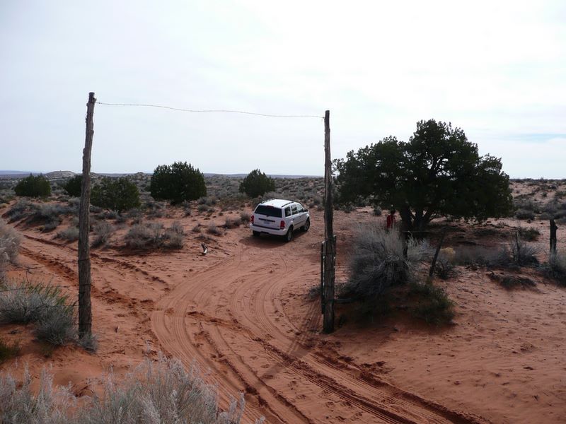
The trailhead is marked by two tall poles. From the parking area we walked south about a quarter mile along a barbed-wire fence to get to the rim of the bench, then another mile or so down a wash to get to Buckskin Gulch itself.
Photos from hike into Buckskin Gulch via the Middle Route, UT
Brianpen...Hiking | Journal | Gallery
Buckskin Gulch via Middle Route, March 20, 2008 2 / 29 (Start seq 0; Curr file p3020540.jpg)
The Middle Route is a sparsely-marked trail which follows an ancient Indian route down into (and actually across) Buckskin Gulch about 6 miles above its confluence with the Pariah River. To access the trailhead, follow the Long Canyon road SW from Hwy 89 just E of the Pariah River, then take two lefts and a right, following the main road. 4WD needed for a couple of wash crossings. The route involves scrambling on sandy ledges with some exposure, so it definitely isn't a casual hike. In addition the Gulch itself is prone to serious flash floods between June and October. When we hiked it in March, we were able to walk down the gulch about 3 miles from our access point without getting our feet wet, at which point we encountered waist-deep ice-cold water and turned around. We also explored a short distance upstream.
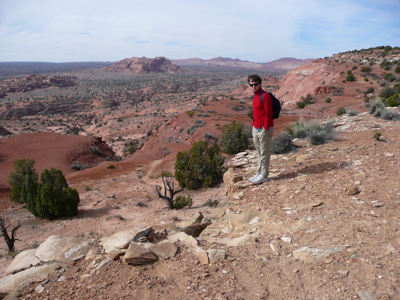
Daniel at the rim. Buckskin Gulch lies in the valley in the middle distance.
Photos from hike into Buckskin Gulch via the Middle Route, UT
Brianpen...Hiking | Journal | Gallery
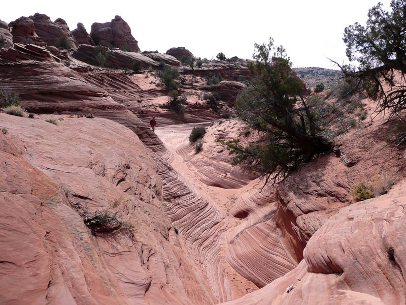
Buckskin Gulch via Middle Route, March 20, 2008 3 / 29 (Start seq 0; Curr file p3020541.jpg)
The Middle Route is a sparsely-marked trail which follows an ancient Indian route down into (and actually across) Buckskin Gulch about 6 miles above its confluence with the Pariah River. To access the trailhead, follow the Long Canyon road SW from Hwy 89 just E of the Pariah River, then take two lefts and a right, following the main road. 4WD needed for a couple of wash crossings. The route involves scrambling on sandy ledges with some exposure, so it definitely isn't a casual hike. In addition the Gulch itself is prone to serious flash floods between June and October. When we hiked it in March, we were able to walk down the gulch about 3 miles from our access point without getting our feet wet, at which point we encountered waist-deep ice-cold water and turned around. We also explored a short distance upstream.
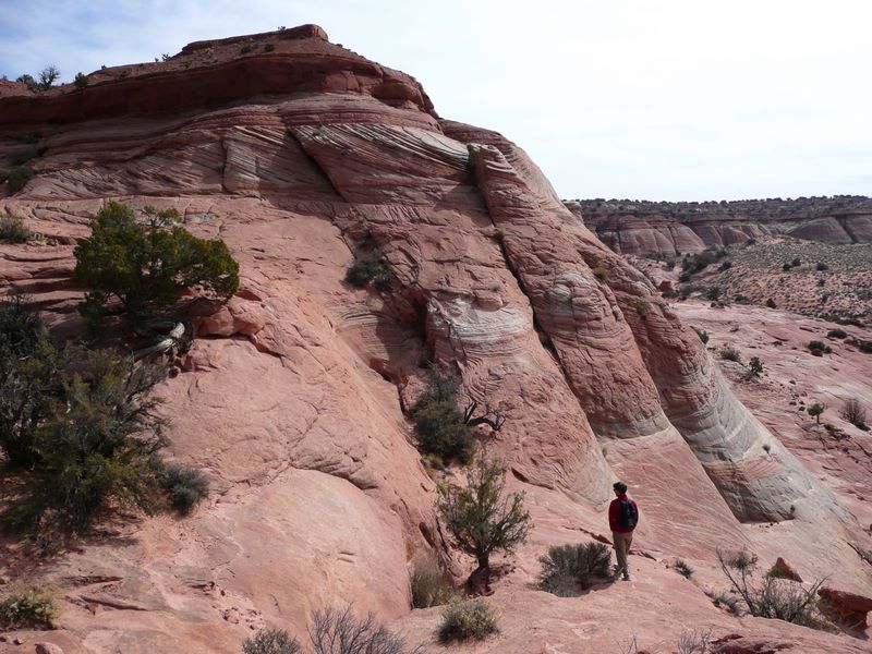
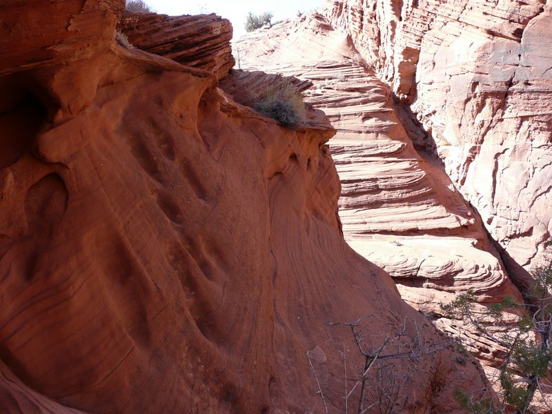
Colorful sandstone ledges alternate with orange sand, very scenic.
Photos from hike into Buckskin Gulch via the Middle Route, UT
Brianpen...Hiking | Journal | Gallery
Buckskin Gulch via Middle Route, March 20, 2008 4 / 29 (Start seq 0; Curr file p3020542.jpg)
The Middle Route is a sparsely-marked trail which follows an ancient Indian route down into (and actually across) Buckskin Gulch about 6 miles above its confluence with the Pariah River. To access the trailhead, follow the Long Canyon road SW from Hwy 89 just E of the Pariah River, then take two lefts and a right, following the main road. 4WD needed for a couple of wash crossings. The route involves scrambling on sandy ledges with some exposure, so it definitely isn't a casual hike. In addition the Gulch itself is prone to serious flash floods between June and October. When we hiked it in March, we were able to walk down the gulch about 3 miles from our access point without getting our feet wet, at which point we encountered waist-deep ice-cold water and turned around. We also explored a short distance upstream.
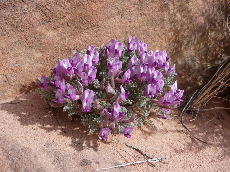
This pea was the only flower we noticed when we were there.
Photos from hike into Buckskin Gulch via the Middle Route, UT
Brianpen...Hiking | Journal | Gallery
Buckskin Gulch via Middle Route, March 20, 2008 5 / 29 (Start seq 0; Curr file p3020543.jpg)
The Middle Route is a sparsely-marked trail which follows an ancient Indian route down into (and actually across) Buckskin Gulch about 6 miles above its confluence with the Pariah River. To access the trailhead, follow the Long Canyon road SW from Hwy 89 just E of the Pariah River, then take two lefts and a right, following the main road. 4WD needed for a couple of wash crossings. The route involves scrambling on sandy ledges with some exposure, so it definitely isn't a casual hike. In addition the Gulch itself is prone to serious flash floods between June and October. When we hiked it in March, we were able to walk down the gulch about 3 miles from our access point without getting our feet wet, at which point we encountered waist-deep ice-cold water and turned around. We also explored a short distance upstream.
The patterns in the sandstone represent layers of sand laid down in dunes by the wind.
Photos from hike into Buckskin Gulch via the Middle Route, UT
Brianpen...Hiking | Journal | Gallery
Buckskin Gulch via Middle Route, March 20, 2008 6 / 29 (Start seq 0; Curr file p3020544.jpg)
The Middle Route is a sparsely-marked trail which follows an ancient Indian route down into (and actually across) Buckskin Gulch about 6 miles above its confluence with the Pariah River. To access the trailhead, follow the Long Canyon road SW from Hwy 89 just E of the Pariah River, then take two lefts and a right, following the main road. 4WD needed for a couple of wash crossings. The route involves scrambling on sandy ledges with some exposure, so it definitely isn't a casual hike. In addition the Gulch itself is prone to serious flash floods between June and October. When we hiked it in March, we were able to walk down the gulch about 3 miles from our access point without getting our feet wet, at which point we encountered waist-deep ice-cold water and turned around. We also explored a short distance upstream.
After following a wash down to the rim of the Gulch, we could see the bottom of the slot canyon 100' below us but getting down there looked utterly impossible.
Photos from hike into Buckskin Gulch via the Middle Route, UT
Brianpen...Hiking | Journal | Gallery
Buckskin Gulch via Middle Route, March 20, 2008 7 / 29 (Start seq 0; Curr file p3020545.jpg)
The Middle Route is a sparsely-marked trail which follows an ancient Indian route down into (and actually across) Buckskin Gulch about 6 miles above its confluence with the Pariah River. To access the trailhead, follow the Long Canyon road SW from Hwy 89 just E of the Pariah River, then take two lefts and a right, following the main road. 4WD needed for a couple of wash crossings. The route involves scrambling on sandy ledges with some exposure, so it definitely isn't a casual hike. In addition the Gulch itself is prone to serious flash floods between June and October. When we hiked it in March, we were able to walk down the gulch about 3 miles from our access point without getting our feet wet, at which point we encountered waist-deep ice-cold water and turned around. We also explored a short distance upstream.
We followed the edge of the Gulch downstream (east) and soon found the route, which led across two narrow and exposed traverses, intimidating but not difficult. The second traverse led to a series of sloping sandy ledges. By zig-zagging carefully down them we were able to reach the floor of the gulch. Focused on our footing, we completely missed the petroglyph of a man falling chiseled into the wall of the canyon centuries ago as a warning sign.
Photos from hike into Buckskin Gulch via the Middle Route, UT
Brianpen...Hiking | Journal | Gallery
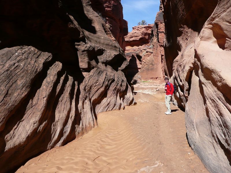
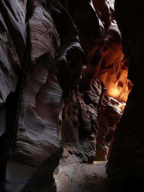
Buckskin Gulch via Middle Route, March 20, 2008 8 / 29 (Start seq 0; Curr file p3020546.jpg)
The Middle Route is a sparsely-marked trail which follows an ancient Indian route down into (and actually across) Buckskin Gulch about 6 miles above its confluence with the Pariah River. To access the trailhead, follow the Long Canyon road SW from Hwy 89 just E of the Pariah River, then take two lefts and a right, following the main road. 4WD needed for a couple of wash crossings. The route involves scrambling on sandy ledges with some exposure, so it definitely isn't a casual hike. In addition the Gulch itself is prone to serious flash floods between June and October. When we hiked it in March, we were able to walk down the gulch about 3 miles from our access point without getting our feet wet, at which point we encountered waist-deep ice-cold water and turned around. We also explored a short distance upstream.
In many areas the slot canyon is narrow and dark. The fluted and undulating walls nearly block out the sky.
Photos from hike into Buckskin Gulch via the Middle Route, UT
Brianpen...Hiking | Journal | Gallery
Buckskin Gulch via Middle Route, March 20, 2008 9 / 29 (Start seq 0; Curr file p3020548.jpg)
The Middle Route is a sparsely-marked trail which follows an ancient Indian route down into (and actually across) Buckskin Gulch about 6 miles above its confluence with the Pariah River. To access the trailhead, follow the Long Canyon road SW from Hwy 89 just E of the Pariah River, then take two lefts and a right, following the main road. 4WD needed for a couple of wash crossings. The route involves scrambling on sandy ledges with some exposure, so it definitely isn't a casual hike. In addition the Gulch itself is prone to serious flash floods between June and October. When we hiked it in March, we were able to walk down the gulch about 3 miles from our access point without getting our feet wet, at which point we encountered waist-deep ice-cold water and turned around. We also explored a short distance upstream.
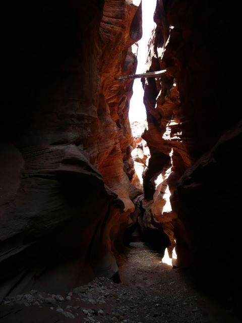
A log wedged between the walls 30' overhead testifies to the depth of some of the flash floods.
Photos from hike into Buckskin Gulch via the Middle Route, UT
Brianpen...Hiking | Journal | Gallery
Buckskin Gulch via Middle Route, March 20, 2008 10 / 29 (Start seq 0; Curr file p3020550.jpg)
The Middle Route is a sparsely-marked trail which follows an ancient Indian route down into (and actually across) Buckskin Gulch about 6 miles above its confluence with the Pariah River. To access the trailhead, follow the Long Canyon road SW from Hwy 89 just E of the Pariah River, then take two lefts and a right, following the main road. 4WD needed for a couple of wash crossings. The route involves scrambling on sandy ledges with some exposure, so it definitely isn't a casual hike. In addition the Gulch itself is prone to serious flash floods between June and October. When we hiked it in March, we were able to walk down the gulch about 3 miles from our access point without getting our feet wet, at which point we encountered waist-deep ice-cold water and turned around. We also explored a short distance upstream.
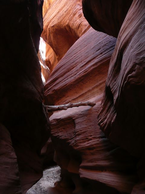
This log was left behind by a flood which, though smaller than some, was still plenty deep.
Photos from hike into Buckskin Gulch via the Middle Route, UT
Brianpen...Hiking | Journal | Gallery
Buckskin Gulch via Middle Route, March 20, 2008 11 / 29 (Start seq 0; Curr file p3020551.jpg)
The Middle Route is a sparsely-marked trail which follows an ancient Indian route down into (and actually across) Buckskin Gulch about 6 miles above its confluence with the Pariah River. To access the trailhead, follow the Long Canyon road SW from Hwy 89 just E of the Pariah River, then take two lefts and a right, following the main road. 4WD needed for a couple of wash crossings. The route involves scrambling on sandy ledges with some exposure, so it definitely isn't a casual hike. In addition the Gulch itself is prone to serious flash floods between June and October. When we hiked it in March, we were able to walk down the gulch about 3 miles from our access point without getting our feet wet, at which point we encountered waist-deep ice-cold water and turned around. We also explored a short distance upstream.
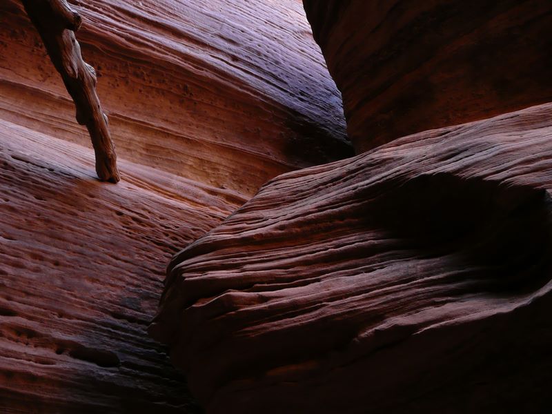
Sandstone walls carved by the gritty water.
Photos from hike into Buckskin Gulch via the Middle Route, UT
Brianpen...Hiking | Journal | Gallery
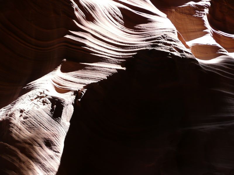
Buckskin Gulch via Middle Route, March 20, 2008 12 / 29 (Start seq 0; Curr file p3020552.jpg)
The Middle Route is a sparsely-marked trail which follows an ancient Indian route down into (and actually across) Buckskin Gulch about 6 miles above its confluence with the Pariah River. To access the trailhead, follow the Long Canyon road SW from Hwy 89 just E of the Pariah River, then take two lefts and a right, following the main road. 4WD needed for a couple of wash crossings. The route involves scrambling on sandy ledges with some exposure, so it definitely isn't a casual hike. In addition the Gulch itself is prone to serious flash floods between June and October. When we hiked it in March, we were able to walk down the gulch about 3 miles from our access point without getting our feet wet, at which point we encountered waist-deep ice-cold water and turned around. We also explored a short distance upstream.
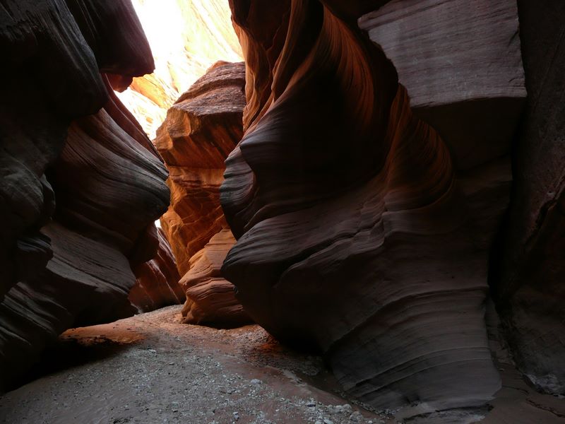
Eddies carve out alcoves in the walls.
Photos from hike into Buckskin Gulch via the Middle Route, UT
Brianpen...Hiking | Journal | Gallery
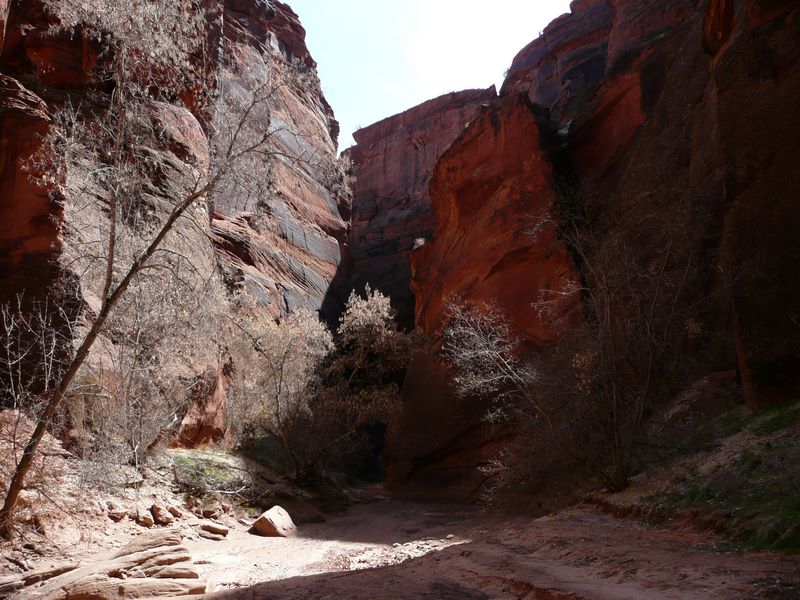
Buckskin Gulch via Middle Route, March 20, 2008 13 / 29 (Start seq 0; Curr file p3020553.jpg)
The Middle Route is a sparsely-marked trail which follows an ancient Indian route down into (and actually across) Buckskin Gulch about 6 miles above its confluence with the Pariah River. To access the trailhead, follow the Long Canyon road SW from Hwy 89 just E of the Pariah River, then take two lefts and a right, following the main road. 4WD needed for a couple of wash crossings. The route involves scrambling on sandy ledges with some exposure, so it definitely isn't a casual hike. In addition the Gulch itself is prone to serious flash floods between June and October. When we hiked it in March, we were able to walk down the gulch about 3 miles from our access point without getting our feet wet, at which point we encountered waist-deep ice-cold water and turned around. We also explored a short distance upstream.
Elsewhere the walls are lower and the canyon floor somewhat wider, allowing the sunshine in.
Photos from hike into Buckskin Gulch via the Middle Route, UT
Brianpen...Hiking | Journal | Gallery
Buckskin Gulch via Middle Route, March 20, 2008 14 / 29 (Start seq 0; Curr file p3020554.jpg)
The Middle Route is a sparsely-marked trail which follows an ancient Indian route down into (and actually across) Buckskin Gulch about 6 miles above its confluence with the Pariah River. To access the trailhead, follow the Long Canyon road SW from Hwy 89 just E of the Pariah River, then take two lefts and a right, following the main road. 4WD needed for a couple of wash crossings. The route involves scrambling on sandy ledges with some exposure, so it definitely isn't a casual hike. In addition the Gulch itself is prone to serious flash floods between June and October. When we hiked it in March, we were able to walk down the gulch about 3 miles from our access point without getting our feet wet, at which point we encountered waist-deep ice-cold water and turned around. We also explored a short distance upstream.
Boulders fallen from the walls eventually become themselves polished and fluted by the occasional floods.
Photos from hike into Buckskin Gulch via the Middle Route, UT
Brianpen...Hiking | Journal | Gallery
Buckskin Gulch via Middle Route, March 20, 2008 15 / 29 (Start seq 0; Curr file p3020555.jpg)
The Middle Route is a sparsely-marked trail which follows an ancient Indian route down into (and actually across) Buckskin Gulch about 6 miles above its confluence with the Pariah River. To access the trailhead, follow the Long Canyon road SW from Hwy 89 just E of the Pariah River, then take two lefts and a right, following the main road. 4WD needed for a couple of wash crossings. The route involves scrambling on sandy ledges with some exposure, so it definitely isn't a casual hike. In addition the Gulch itself is prone to serious flash floods between June and October. When we hiked it in March, we were able to walk down the gulch about 3 miles from our access point without getting our feet wet, at which point we encountered waist-deep ice-cold water and turned around. We also explored a short distance upstream.
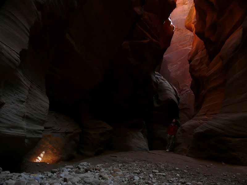
A spot of sunlight illuminates an alcove from between narrow walls high overhead.
Photos from hike into Buckskin Gulch via the Middle Route, UT
Brianpen...Hiking | Journal | Gallery
Buckskin Gulch via Middle Route, March 20, 2008 16 / 29 (Start seq 0; Curr file p3020557.jpg)
The Middle Route is a sparsely-marked trail which follows an ancient Indian route down into (and actually across) Buckskin Gulch about 6 miles above its confluence with the Pariah River. To access the trailhead, follow the Long Canyon road SW from Hwy 89 just E of the Pariah River, then take two lefts and a right, following the main road. 4WD needed for a couple of wash crossings. The route involves scrambling on sandy ledges with some exposure, so it definitely isn't a casual hike. In addition the Gulch itself is prone to serious flash floods between June and October. When we hiked it in March, we were able to walk down the gulch about 3 miles from our access point without getting our feet wet, at which point we encountered waist-deep ice-cold water and turned around. We also explored a short distance upstream.
Daniel looks pretty small by comparison with the walls towering above him.
Photos from hike into Buckskin Gulch via the Middle Route, UT
Brianpen...Hiking | Journal | Gallery
Buckskin Gulch via Middle Route, March 20, 2008 17 / 29 (Start seq 0; Curr file p3020558.jpg)
The Middle Route is a sparsely-marked trail which follows an ancient Indian route down into (and actually across) Buckskin Gulch about 6 miles above its confluence with the Pariah River. To access the trailhead, follow the Long Canyon road SW from Hwy 89 just E of the Pariah River, then take two lefts and a right, following the main road. 4WD needed for a couple of wash crossings. The route involves scrambling on sandy ledges with some exposure, so it definitely isn't a casual hike. In addition the Gulch itself is prone to serious flash floods between June and October. When we hiked it in March, we were able to walk down the gulch about 3 miles from our access point without getting our feet wet, at which point we encountered waist-deep ice-cold water and turned around. We also explored a short distance upstream.
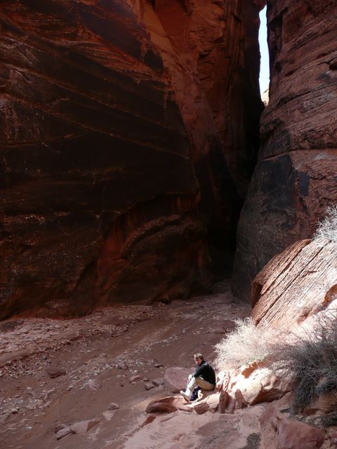
About an hour downstream from the Middle Route, we stopped in a wide spot for lunch. Daniel was still recovering from the flu so he sat in the sun and read a book while I explored another mile or so down the canyon.
Photos from hike into Buckskin Gulch via the Middle Route, UT
Brianpen...Hiking | Journal | Gallery
Buckskin Gulch via Middle Route, March 20, 2008 18 / 29 (Start seq 0; Curr file p3020559.jpg)
The Middle Route is a sparsely-marked trail which follows an ancient Indian route down into (and actually across) Buckskin Gulch about 6 miles above its confluence with the Pariah River. To access the trailhead, follow the Long Canyon road SW from Hwy 89 just E of the Pariah River, then take two lefts and a right, following the main road. 4WD needed for a couple of wash crossings. The route involves scrambling on sandy ledges with some exposure, so it definitely isn't a casual hike. In addition the Gulch itself is prone to serious flash floods between June and October. When we hiked it in March, we were able to walk down the gulch about 3 miles from our access point without getting our feet wet, at which point we encountered waist-deep ice-cold water and turned around. We also explored a short distance upstream.
Ribbed walls scoured by rushing water.
Photos from hike into Buckskin Gulch via the Middle Route, UT
Brianpen...Hiking | Journal | Gallery
Buckskin Gulch via Middle Route, March 20, 2008 19 / 29 (Start seq 0; Curr file p3020560.jpg)
The Middle Route is a sparsely-marked trail which follows an ancient Indian route down into (and actually across) Buckskin Gulch about 6 miles above its confluence with the Pariah River. To access the trailhead, follow the Long Canyon road SW from Hwy 89 just E of the Pariah River, then take two lefts and a right, following the main road. 4WD needed for a couple of wash crossings. The route involves scrambling on sandy ledges with some exposure, so it definitely isn't a casual hike. In addition the Gulch itself is prone to serious flash floods between June and October. When we hiked it in March, we were able to walk down the gulch about 3 miles from our access point without getting our feet wet, at which point we encountered waist-deep ice-cold water and turned around. We also explored a short distance upstream.
A wide spot, complete with a small grove of box-elder, before the canyon closed in again. As best I could tell, this is about in the center of section 3, R1W, T44S, just 1 mile north of the Arizona border, on the West Clark Bench topo map.
Photos from hike into Buckskin Gulch via the Middle Route, UT
Brianpen...Hiking | Journal | Gallery
Buckskin Gulch via Middle Route, March 20, 2008 20 / 29 (Start seq 0; Curr file p3020561.jpg)
The Middle Route is a sparsely-marked trail which follows an ancient Indian route down into (and actually across) Buckskin Gulch about 6 miles above its confluence with the Pariah River. To access the trailhead, follow the Long Canyon road SW from Hwy 89 just E of the Pariah River, then take two lefts and a right, following the main road. 4WD needed for a couple of wash crossings. The route involves scrambling on sandy ledges with some exposure, so it definitely isn't a casual hike. In addition the Gulch itself is prone to serious flash floods between June and October. When we hiked it in March, we were able to walk down the gulch about 3 miles from our access point without getting our feet wet, at which point we encountered waist-deep ice-cold water and turned around. We also explored a short distance upstream.
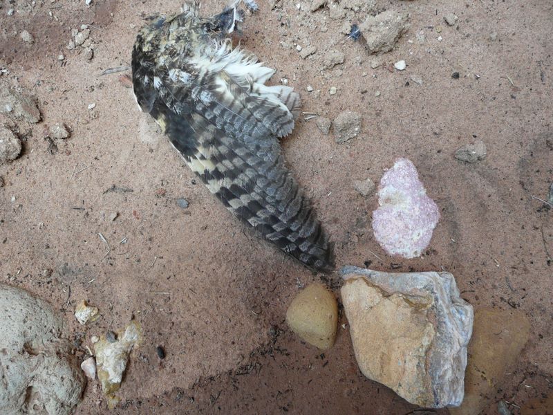
An owl, perhaps a long-eared, met its demise here. All that remained were two wings and scattered feathers.
Photos from hike into Buckskin Gulch via the Middle Route, UT
Brianpen...Hiking | Journal | Gallery
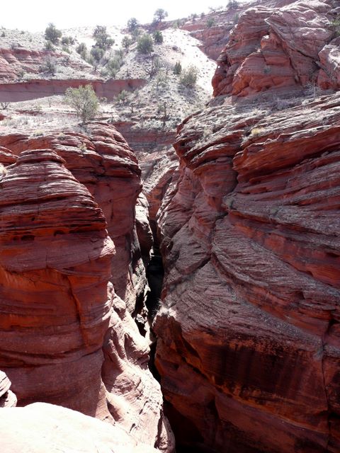
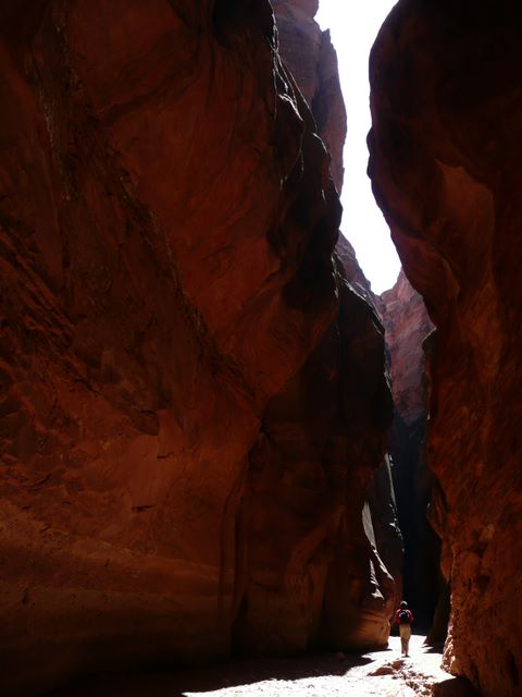
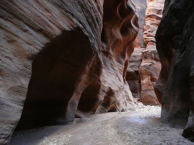
Buckskin Gulch via Middle Route, March 20, 2008 21 / 29 (Start seq 0; Curr file p3020562.jpg)
The Middle Route is a sparsely-marked trail which follows an ancient Indian route down into (and actually across) Buckskin Gulch about 6 miles above its confluence with the Pariah River. To access the trailhead, follow the Long Canyon road SW from Hwy 89 just E of the Pariah River, then take two lefts and a right, following the main road. 4WD needed for a couple of wash crossings. The route involves scrambling on sandy ledges with some exposure, so it definitely isn't a casual hike. In addition the Gulch itself is prone to serious flash floods between June and October. When we hiked it in March, we were able to walk down the gulch about 3 miles from our access point without getting our feet wet, at which point we encountered waist-deep ice-cold water and turned around. We also explored a short distance upstream.
Light ahead after a narrow section.
Photos from hike into Buckskin Gulch via the Middle Route, UT
Brianpen...Hiking | Journal | Gallery
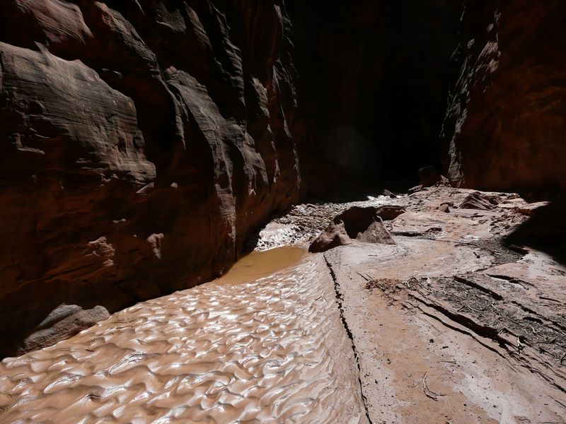
Buckskin Gulch via Middle Route, March 20, 2008 22 / 29 (Start seq 0; Curr file p3020563.jpg)
The Middle Route is a sparsely-marked trail which follows an ancient Indian route down into (and actually across) Buckskin Gulch about 6 miles above its confluence with the Pariah River. To access the trailhead, follow the Long Canyon road SW from Hwy 89 just E of the Pariah River, then take two lefts and a right, following the main road. 4WD needed for a couple of wash crossings. The route involves scrambling on sandy ledges with some exposure, so it definitely isn't a casual hike. In addition the Gulch itself is prone to serious flash floods between June and October. When we hiked it in March, we were able to walk down the gulch about 3 miles from our access point without getting our feet wet, at which point we encountered waist-deep ice-cold water and turned around. We also explored a short distance upstream.
About 3 miles below the Middle Route crossing, pools of water began to occur more frequently.
Photos from hike into Buckskin Gulch via the Middle Route, UT
Brianpen...Hiking | Journal | Gallery
Buckskin Gulch via Middle Route, March 20, 2008 23 / 29 (Start seq 0; Curr file p3020567.jpg)
The Middle Route is a sparsely-marked trail which follows an ancient Indian route down into (and actually across) Buckskin Gulch about 6 miles above its confluence with the Pariah River. To access the trailhead, follow the Long Canyon road SW from Hwy 89 just E of the Pariah River, then take two lefts and a right, following the main road. 4WD needed for a couple of wash crossings. The route involves scrambling on sandy ledges with some exposure, so it definitely isn't a casual hike. In addition the Gulch itself is prone to serious flash floods between June and October. When we hiked it in March, we were able to walk down the gulch about 3 miles from our access point without getting our feet wet, at which point we encountered waist-deep ice-cold water and turned around. We also explored a short distance upstream.
The canyon opened up for a quarter mile or so, allowing the sunlight in. Where exposed to the open sky (although not in this photo), the mud flats were sometimes criss-crossed by fine straight cracks where ice crystals had formed overnight then melted out.
Photos from hike into Buckskin Gulch via the Middle Route, UT
Brianpen...Hiking | Journal | Gallery
Buckskin Gulch via Middle Route, March 20, 2008 24 / 29 (Start seq 0; Curr file p3020564.jpg)
The Middle Route is a sparsely-marked trail which follows an ancient Indian route down into (and actually across) Buckskin Gulch about 6 miles above its confluence with the Pariah River. To access the trailhead, follow the Long Canyon road SW from Hwy 89 just E of the Pariah River, then take two lefts and a right, following the main road. 4WD needed for a couple of wash crossings. The route involves scrambling on sandy ledges with some exposure, so it definitely isn't a casual hike. In addition the Gulch itself is prone to serious flash floods between June and October. When we hiked it in March, we were able to walk down the gulch about 3 miles from our access point without getting our feet wet, at which point we encountered waist-deep ice-cold water and turned around. We also explored a short distance upstream.
Where the walls close in, the alcoves scoured out by eddies seem to grow larger and occur more frequently.
Photos from hike into Buckskin Gulch via the Middle Route, UT
Brianpen...Hiking | Journal | Gallery
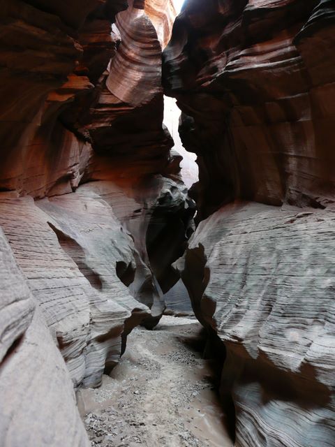
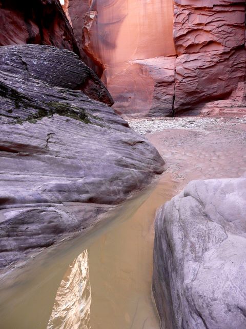
Buckskin Gulch via Middle Route, March 20, 2008 25 / 29 (Start seq 0; Curr file p3020566.jpg)
The Middle Route is a sparsely-marked trail which follows an ancient Indian route down into (and actually across) Buckskin Gulch about 6 miles above its confluence with the Pariah River. To access the trailhead, follow the Long Canyon road SW from Hwy 89 just E of the Pariah River, then take two lefts and a right, following the main road. 4WD needed for a couple of wash crossings. The route involves scrambling on sandy ledges with some exposure, so it definitely isn't a casual hike. In addition the Gulch itself is prone to serious flash floods between June and October. When we hiked it in March, we were able to walk down the gulch about 3 miles from our access point without getting our feet wet, at which point we encountered waist-deep ice-cold water and turned around. We also explored a short distance upstream.
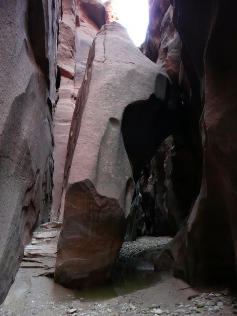
A large slab of the cliff wall nearly blocks the canyon.
Photos from hike into Buckskin Gulch via the Middle Route, UT
Brianpen...Hiking | Journal | Gallery
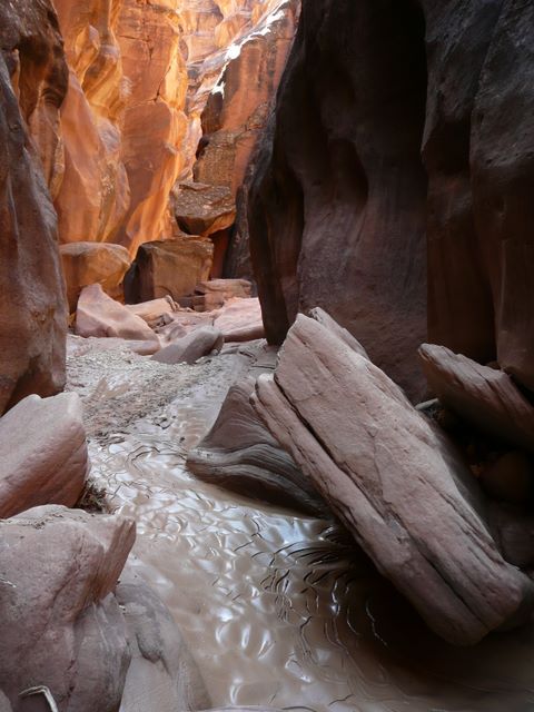
Buckskin Gulch via Middle Route, March 20, 2008 26 / 29 (Start seq 0; Curr file p3020565.jpg)
The Middle Route is a sparsely-marked trail which follows an ancient Indian route down into (and actually across) Buckskin Gulch about 6 miles above its confluence with the Pariah River. To access the trailhead, follow the Long Canyon road SW from Hwy 89 just E of the Pariah River, then take two lefts and a right, following the main road. 4WD needed for a couple of wash crossings. The route involves scrambling on sandy ledges with some exposure, so it definitely isn't a casual hike. In addition the Gulch itself is prone to serious flash floods between June and October. When we hiked it in March, we were able to walk down the gulch about 3 miles from our access point without getting our feet wet, at which point we encountered waist-deep ice-cold water and turned around. We also explored a short distance upstream.
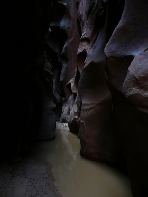
I turned around here, having already numbed my feet by wading though a 40' long pool of icy waist-deep water like this just 100 yards earlier. The walls were only about 4 feet apart and completely blocked out the sky. The uneven bottom of the pool underwater was coated with about 4" of slimy mud. I might have ventured futher had I not left my neoprene waders back with Daniel. Exploring the rest of the canyon will have to wait for another trip.
Photos from hike into Buckskin Gulch via the Middle Route, UT
Brianpen...Hiking | Journal | Gallery
Buckskin Gulch via Middle Route, March 20, 2008 27 / 29 (Start seq 0; Curr file p3020568.jpg)
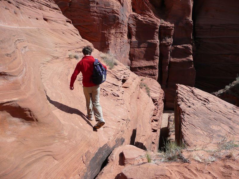
The Middle Route is a sparsely-marked trail which follows an ancient Indian route down into (and actually across) Buckskin Gulch about 6 miles above its confluence with the Pariah River. To access the trailhead, follow the Long Canyon road SW from Hwy 89 just E of the Pariah River, then take two lefts and a right, following the main road. 4WD needed for a couple of wash crossings. The route involves scrambling on sandy ledges with some exposure, so it definitely isn't a casual hike. In addition the Gulch itself is prone to serious flash floods between June and October. When we hiked it in March, we were able to walk down the gulch about 3 miles from our access point without getting our feet wet, at which point we encountered waist-deep ice-cold water and turned around. We also explored a short distance upstream.
Back at the Middle Route crossing. These footholds were carved in the sandstone centuries ago to make the climb up the south side of the Gulch a little easier. Our route climbs the ledges just to the left of the diagonal crack visible on the far side of the Gulch.
Photos from hike into Buckskin Gulch via the Middle Route, UT
Brianpen...Hiking | Journal | Gallery
Buckskin Gulch via Middle Route, March 20, 2008 28 / 29 (Start seq 0; Curr file p3020569.jpg)
The Middle Route is a sparsely-marked trail which follows an ancient Indian route down into (and actually across) Buckskin Gulch about 6 miles above its confluence with the Pariah River. To access the trailhead, follow the Long Canyon road SW from Hwy 89 just E of the Pariah River, then take two lefts and a right, following the main road. 4WD needed for a couple of wash crossings. The route involves scrambling on sandy ledges with some exposure, so it definitely isn't a casual hike. In addition the Gulch itself is prone to serious flash floods between June and October. When we hiked it in March, we were able to walk down the gulch about 3 miles from our access point without getting our feet wet, at which point we encountered waist-deep ice-cold water and turned around. We also explored a short distance upstream.
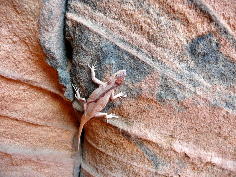
As we were climbing back out of the Gulch, we spotted this lizard which had been bleeding from a wound on its head. It seemed a little dazed. Just 25' above us under an overhanging shelf on the cliff face, we had also just noticed a killer bee nest - fortunately abandoned. Several wax combs were still hanging out in the open under the shelf, and a couple of others were lying on the gravel at the base of the cliff. As far as I know, the habit of hanging combs out in the open is characteristic of Africanized honey bees. We were glad the hive was no longer active.
Photos from hike into Buckskin Gulch via the Middle Route, UT
Brianpen...Hiking | Journal | Gallery
Buckskin Gulch via Middle Route, March 20, 2008 29 / 29 (Start seq 0; Curr file p3020570.jpg)
The Middle Route is a sparsely-marked trail which follows an ancient Indian route down into (and actually across) Buckskin Gulch about 6 miles above its confluence with the Pariah River. To access the trailhead, follow the Long Canyon road SW from Hwy 89 just E of the Pariah River, then take two lefts and a right, following the main road. 4WD needed for a couple of wash crossings. The route involves scrambling on sandy ledges with some exposure, so it definitely isn't a casual hike. In addition the Gulch itself is prone to serious flash floods between June and October. When we hiked it in March, we were able to walk down the gulch about 3 miles from our access point without getting our feet wet, at which point we encountered waist-deep ice-cold water and turned around. We also explored a short distance upstream.
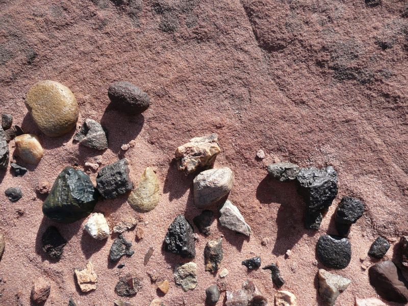
Pebbles, the harder ones polished to a satin finish by many years of exposure to blowing sand, lie in a sandy depression on a bedrock shelf above the Gulch. Among the pebbles were a few small chips of grey, white and yellow agate. We also found gray and white agate scattered among the cobbles and gravel down in the Gulch.