Photos from Clark Mt backpacking trip, October 28-30, 2008
Brianpen...Hiking | Journal | Gallery
Clark Mt Backpack, Oct 28-30 2008 1 / 53 (Start seq 0; Curr file dsc_5975_nif.jpg)
When a window of good weather unexpectedly materialized in late October I took the opportunity to return to an area which has always intrigued me - Clark Mountain and the Napeequa valley. I caught the tail-end of the good weather so couldn't stay as long as I would have liked, but I did make it up Clark. The next day I hiked up to Boulder Pass, then on up to a 7200' high point above Boulder Basin instead of dropping 2000' down into the Napeequa valley. That will have to wait for the next trip. Click here for my account of the trip.
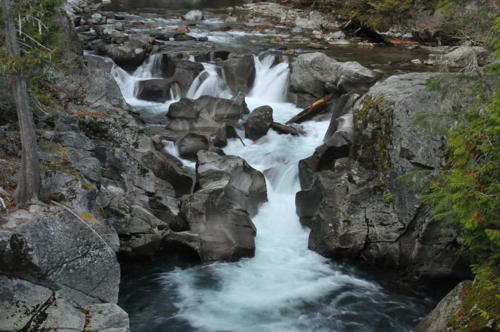
Falls in the White River at the trailhead
Photos from Clark Mt backpacking trip, October 28-30, 2008
Brianpen...Hiking | Journal | Gallery
Clark Mt Backpack, Oct 28-30 2008 2 / 53 (Start seq 0; Curr file dsc_5977.jpg)
When a window of good weather unexpectedly materialized in late October I took the opportunity to return to an area which has always intrigued me - Clark Mountain and the Napeequa valley. I caught the tail-end of the good weather so couldn't stay as long as I would have liked, but I did make it up Clark. The next day I hiked up to Boulder Pass, then on up to a 7200' high point above Boulder Basin instead of dropping 2000' down into the Napeequa valley. That will have to wait for the next trip. Click here for my account of the trip.
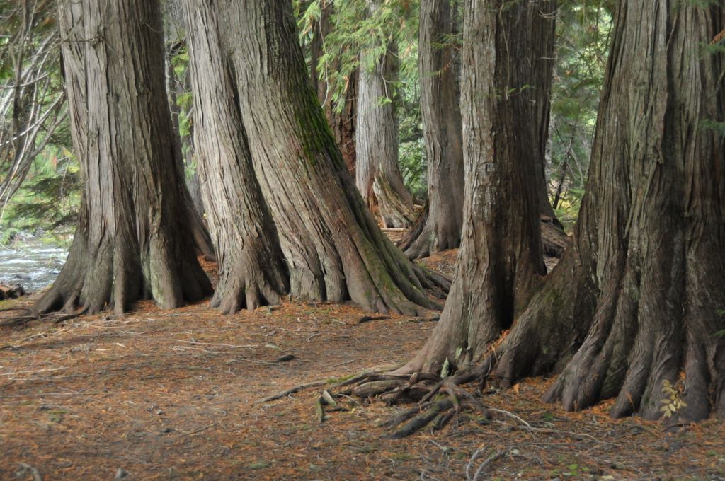
Cedar grove along the White River
Photos from Clark Mt backpacking trip, October 28-30, 2008
Brianpen...Hiking | Journal | Gallery
Clark Mt Backpack, Oct 28-30 2008 3 / 53 (Start seq 0; Curr file dsc_5980.jpg)
When a window of good weather unexpectedly materialized in late October I took the opportunity to return to an area which has always intrigued me - Clark Mountain and the Napeequa valley. I caught the tail-end of the good weather so couldn't stay as long as I would have liked, but I did make it up Clark. The next day I hiked up to Boulder Pass, then on up to a 7200' high point above Boulder Basin instead of dropping 2000' down into the Napeequa valley. That will have to wait for the next trip. Click here for my account of the trip.
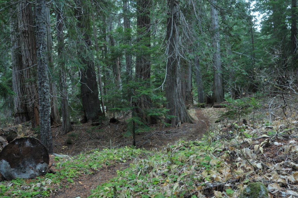
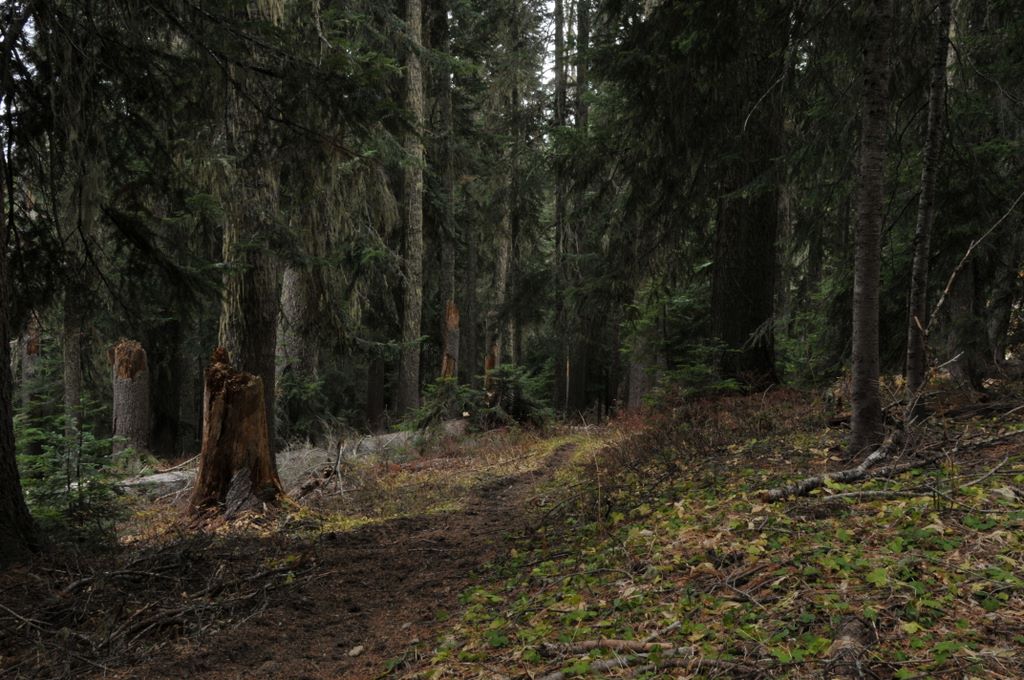
Forest along the White River trail
Photos from Clark Mt backpacking trip, October 28-30, 2008
Brianpen...Hiking | Journal | Gallery
Clark Mt Backpack, Oct 28-30 2008 4 / 53 (Start seq 0; Curr file dsc_5984.jpg)
When a window of good weather unexpectedly materialized in late October I took the opportunity to return to an area which has always intrigued me - Clark Mountain and the Napeequa valley. I caught the tail-end of the good weather so couldn't stay as long as I would have liked, but I did make it up Clark. The next day I hiked up to Boulder Pass, then on up to a 7200' high point above Boulder Basin instead of dropping 2000' down into the Napeequa valley. That will have to wait for the next trip. Click here for my account of the trip.
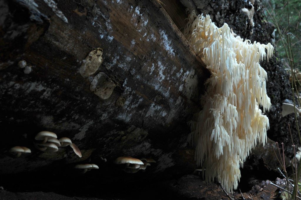
Icicle mushroom, one of many along the trail
Photos from Clark Mt backpacking trip, October 28-30, 2008
Brianpen...Hiking | Journal | Gallery
Clark Mt Backpack, Oct 28-30 2008 5 / 53 (Start seq 0; Curr file dsc_5994.jpg)
When a window of good weather unexpectedly materialized in late October I took the opportunity to return to an area which has always intrigued me - Clark Mountain and the Napeequa valley. I caught the tail-end of the good weather so couldn't stay as long as I would have liked, but I did make it up Clark. The next day I hiked up to Boulder Pass, then on up to a 7200' high point above Boulder Basin instead of dropping 2000' down into the Napeequa valley. That will have to wait for the next trip. Click here for my account of the trip.
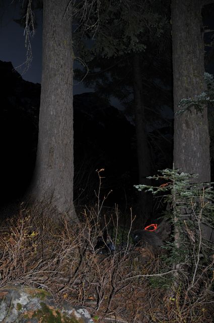
My first camp between two big firs along the Boulder Pass trail
Photos from Clark Mt backpacking trip, October 28-30, 2008
Brianpen...Hiking | Journal | Gallery
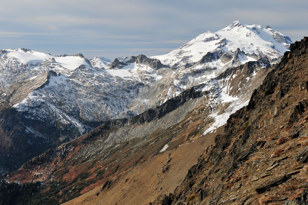
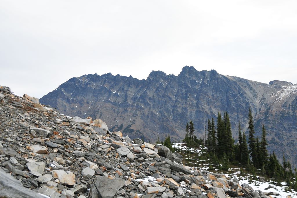
Clark Mt Backpack, Oct 28-30 2008 6 / 53 (Start seq 0; Curr file dsc_6006.jpg)
When a window of good weather unexpectedly materialized in late October I took the opportunity to return to an area which has always intrigued me - Clark Mountain and the Napeequa valley. I caught the tail-end of the good weather so couldn't stay as long as I would have liked, but I did make it up Clark. The next day I hiked up to Boulder Pass, then on up to a 7200' high point above Boulder Basin instead of dropping 2000' down into the Napeequa valley. That will have to wait for the next trip. Click here for my account of the trip.
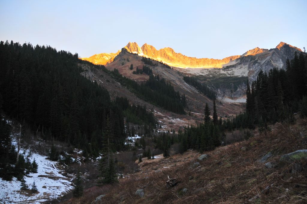
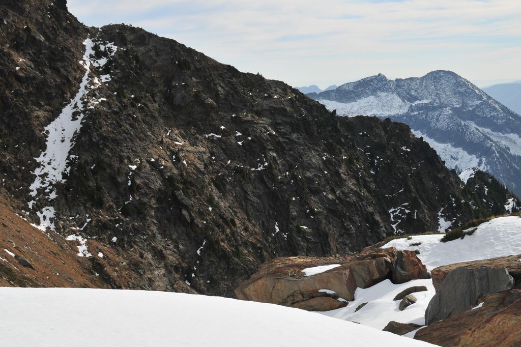
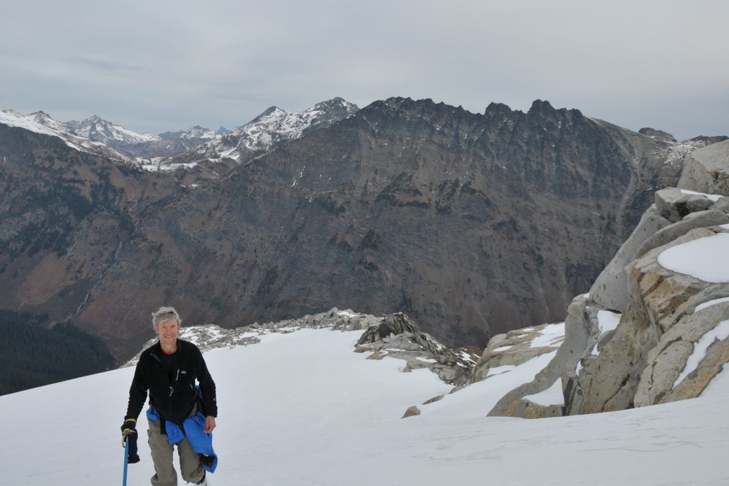
Sun on the east ridge of Clark Mt above Boulder Basin, at center-right in the photo
Photos from Clark Mt backpacking trip, October 28-30, 2008
Brianpen...Hiking | Journal | Gallery
Clark Mt Backpack, Oct 28-30 2008 7 / 53 (Start seq 0; Curr file dsc_6014.jpg)
When a window of good weather unexpectedly materialized in late October I took the opportunity to return to an area which has always intrigued me - Clark Mountain and the Napeequa valley. I caught the tail-end of the good weather so couldn't stay as long as I would have liked, but I did make it up Clark. The next day I hiked up to Boulder Pass, then on up to a 7200' high point above Boulder Basin instead of dropping 2000' down into the Napeequa valley. That will have to wait for the next trip. Click here for my account of the trip.
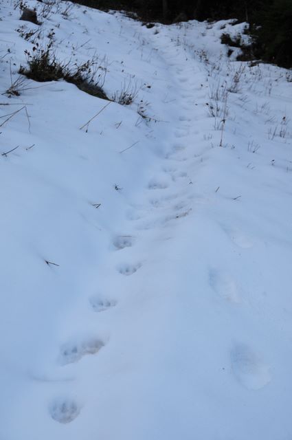
Bear tracks in the snow on the Boulder Pass trail
Photos from Clark Mt backpacking trip, October 28-30, 2008
Brianpen...Hiking | Journal | Gallery
Clark Mt Backpack, Oct 28-30 2008 8 / 53 (Start seq 0; Curr file dsc_6026.jpg)
When a window of good weather unexpectedly materialized in late October I took the opportunity to return to an area which has always intrigued me - Clark Mountain and the Napeequa valley. I caught the tail-end of the good weather so couldn't stay as long as I would have liked, but I did make it up Clark. The next day I hiked up to Boulder Pass, then on up to a 7200' high point above Boulder Basin instead of dropping 2000' down into the Napeequa valley. That will have to wait for the next trip. Click here for my account of the trip.
View back down the Boulder River valley from Boulder Basin
Photos from Clark Mt backpacking trip, October 28-30, 2008
Brianpen...Hiking | Journal | Gallery
Clark Mt Backpack, Oct 28-30 2008 9 / 53 (Start seq 0; Curr file dsc_6022.jpg)
When a window of good weather unexpectedly materialized in late October I took the opportunity to return to an area which has always intrigued me - Clark Mountain and the Napeequa valley. I caught the tail-end of the good weather so couldn't stay as long as I would have liked, but I did make it up Clark. The next day I hiked up to Boulder Pass, then on up to a 7200' high point above Boulder Basin instead of dropping 2000' down into the Napeequa valley. That will have to wait for the next trip. Click here for my account of the trip.
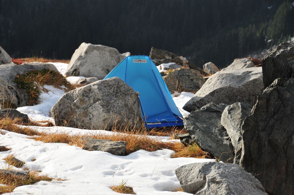
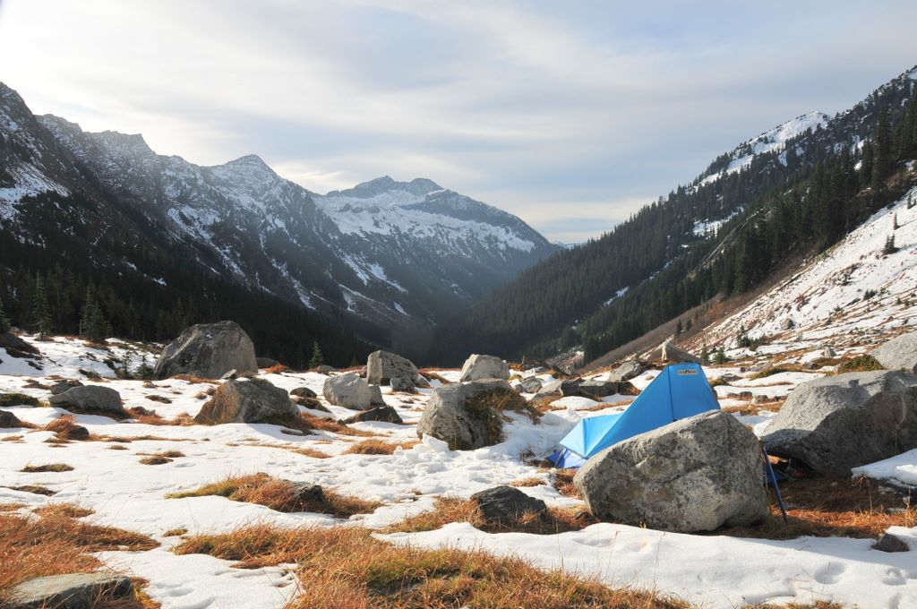
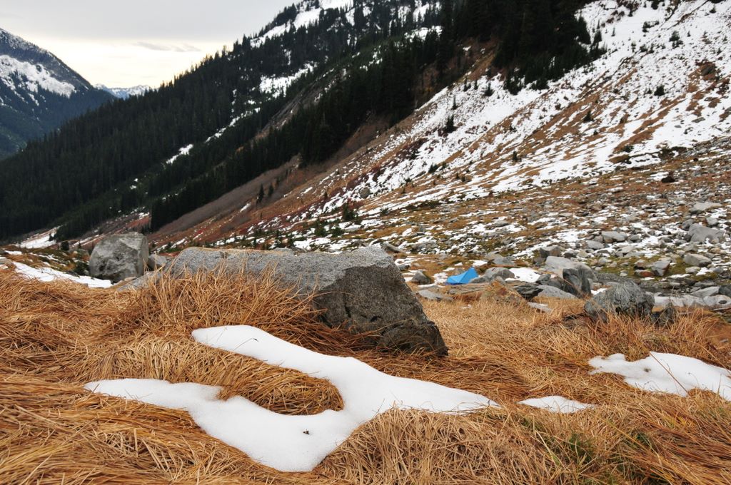
My camp among the boulders of Boulder Basin. I set up the tent in the morning before hiking up Clark.
Photos from Clark Mt backpacking trip, October 28-30, 2008
Brianpen...Hiking | Journal | Gallery
Clark Mt Backpack, Oct 28-30 2008 10 / 53 (Start seq 0; Curr file dsc_6030.jpg)
When a window of good weather unexpectedly materialized in late October I took the opportunity to return to an area which has always intrigued me - Clark Mountain and the Napeequa valley. I caught the tail-end of the good weather so couldn't stay as long as I would have liked, but I did make it up Clark. The next day I hiked up to Boulder Pass, then on up to a 7200' high point above Boulder Basin instead of dropping 2000' down into the Napeequa valley. That will have to wait for the next trip. Click here for my account of the trip.
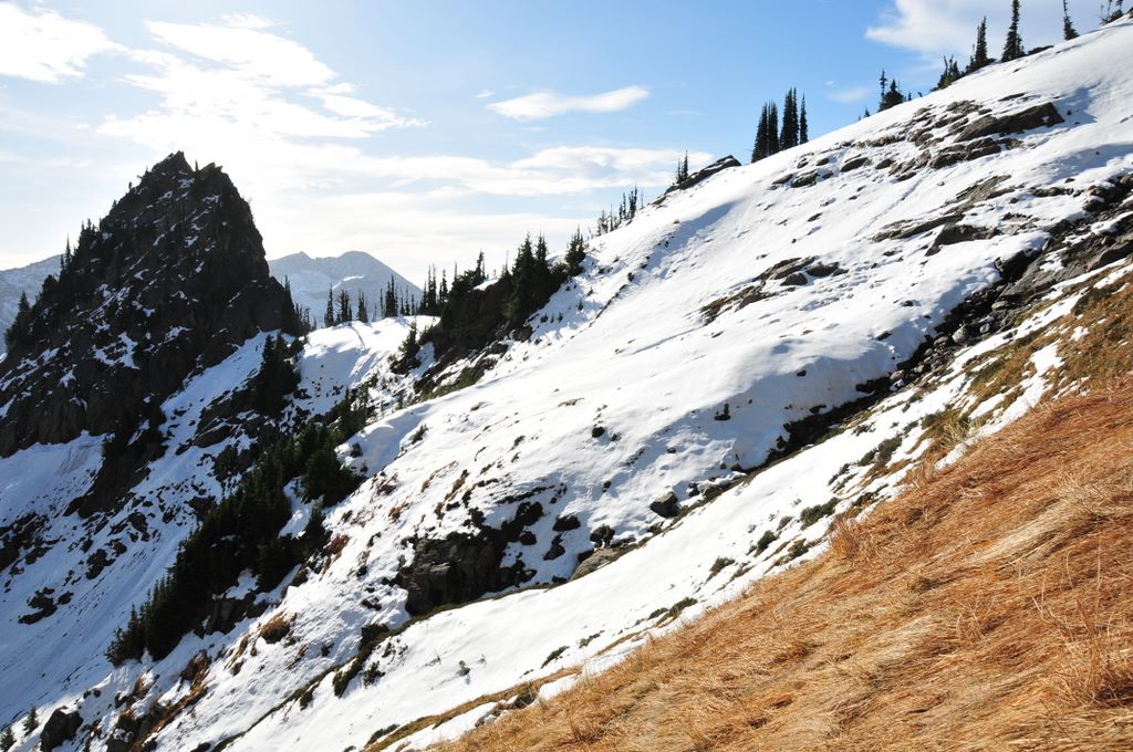
The west side of Boulder Basin. I ascended via the slippery slope of dried sedges on the right and descended via the slippery snow slope on the left.
Photos from Clark Mt backpacking trip, October 28-30, 2008
Brianpen...Hiking | Journal | Gallery
Clark Mt Backpack, Oct 28-30 2008 11 / 53 (Start seq 0; Curr file dsc_6036.jpg)
When a window of good weather unexpectedly materialized in late October I took the opportunity to return to an area which has always intrigued me - Clark Mountain and the Napeequa valley. I caught the tail-end of the good weather so couldn't stay as long as I would have liked, but I did make it up Clark. The next day I hiked up to Boulder Pass, then on up to a 7200' high point above Boulder Basin instead of dropping 2000' down into the Napeequa valley. That will have to wait for the next trip. Click here for my account of the trip.
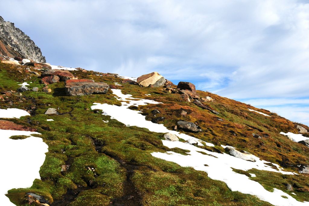
Mossy rivulet at about 7000' on the way over to Clark Mt
Photos from Clark Mt backpacking trip, October 28-30, 2008
Brianpen...Hiking | Journal | Gallery
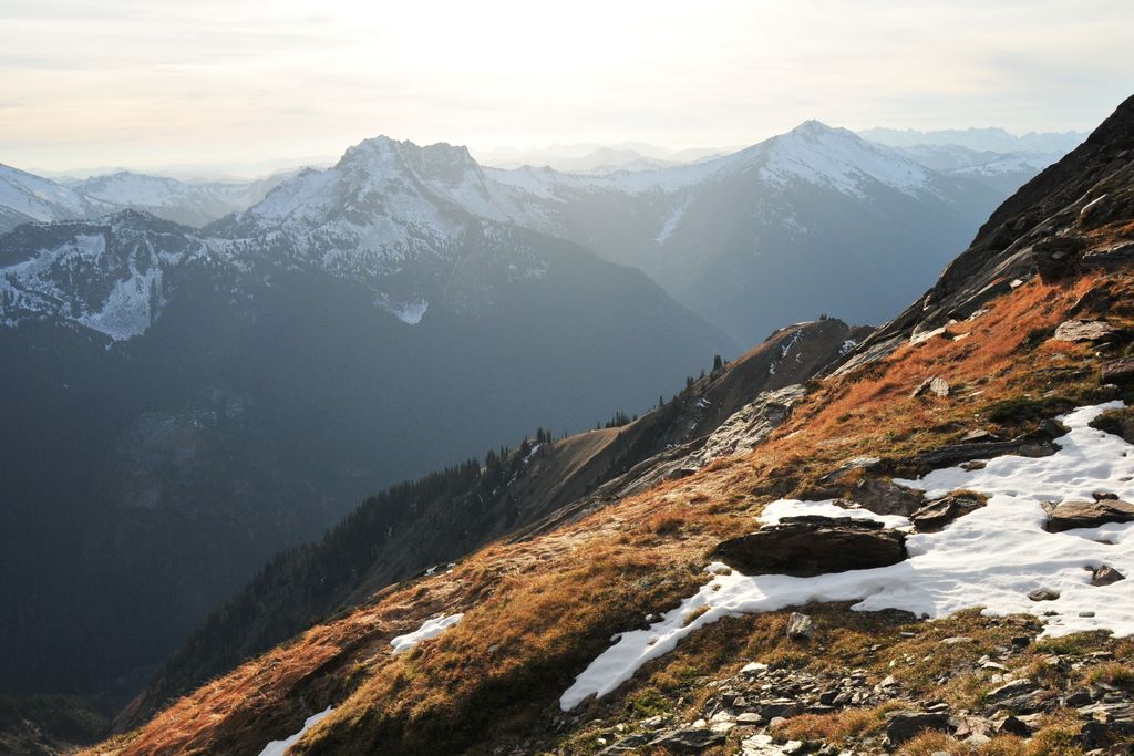
Clark Mt Backpack, Oct 28-30 2008 12 / 53 (Start seq 0; Curr file dsc_6045.jpg)
When a window of good weather unexpectedly materialized in late October I took the opportunity to return to an area which has always intrigued me - Clark Mountain and the Napeequa valley. I caught the tail-end of the good weather so couldn't stay as long as I would have liked, but I did make it up Clark. The next day I hiked up to Boulder Pass, then on up to a 7200' high point above Boulder Basin instead of dropping 2000' down into the Napeequa valley. That will have to wait for the next trip. Click here for my account of the trip.
View down the SE ridge of Clark from the notch at 7350'. White River valley runs diagonally from lower right to upper left. Prominent peak at center of horizon is Mt David.
Photos from Clark Mt backpacking trip, October 28-30, 2008
Brianpen...Hiking | Journal | Gallery
Clark Mt Backpack, Oct 28-30 2008 13 / 53 (Start seq 0; Curr file dsc_6048.jpg)
When a window of good weather unexpectedly materialized in late October I took the opportunity to return to an area which has always intrigued me - Clark Mountain and the Napeequa valley. I caught the tail-end of the good weather so couldn't stay as long as I would have liked, but I did make it up Clark. The next day I hiked up to Boulder Pass, then on up to a 7200' high point above Boulder Basin instead of dropping 2000' down into the Napeequa valley. That will have to wait for the next trip. Click here for my account of the trip.
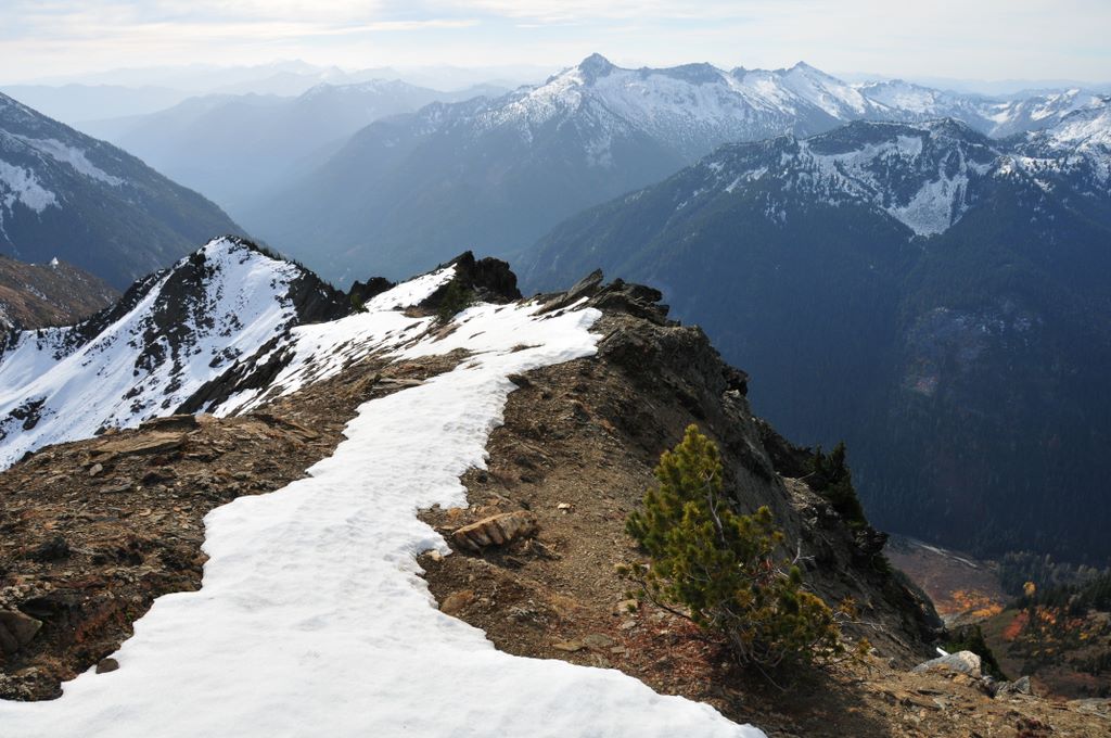
View back at the gully below the notch on the SE ridge. It is the only hikable route across the ridge.
Photos from Clark Mt backpacking trip, October 28-30, 2008
Brianpen...Hiking | Journal | Gallery
Clark Mt Backpack, Oct 28-30 2008 14 / 53 (Start seq 0; Curr file dsc_6049.jpg)
When a window of good weather unexpectedly materialized in late October I took the opportunity to return to an area which has always intrigued me - Clark Mountain and the Napeequa valley. I caught the tail-end of the good weather so couldn't stay as long as I would have liked, but I did make it up Clark. The next day I hiked up to Boulder Pass, then on up to a 7200' high point above Boulder Basin instead of dropping 2000' down into the Napeequa valley. That will have to wait for the next trip. Click here for my account of the trip.
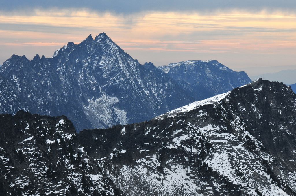
Mt David on the left, Mt Saul on the right from the south slope of Clark
Photos from Clark Mt backpacking trip, October 28-30, 2008
Brianpen...Hiking | Journal | Gallery
Clark Mt Backpack, Oct 28-30 2008 15 / 53 (Start seq 0; Curr file dsc_6050ci.jpg)
When a window of good weather unexpectedly materialized in late October I took the opportunity to return to an area which has always intrigued me - Clark Mountain and the Napeequa valley. I caught the tail-end of the good weather so couldn't stay as long as I would have liked, but I did make it up Clark. The next day I hiked up to Boulder Pass, then on up to a 7200' high point above Boulder Basin instead of dropping 2000' down into the Napeequa valley. That will have to wait for the next trip. Click here for my account of the trip.
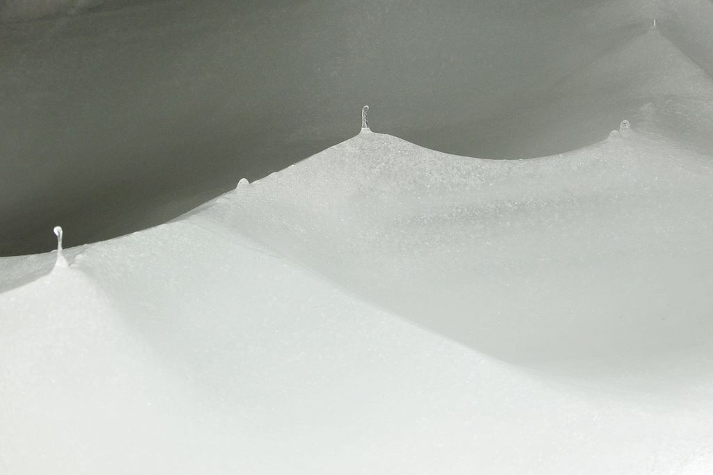
Scalloped snow
Photos from Clark Mt backpacking trip, October 28-30, 2008
Brianpen...Hiking | Journal | Gallery
Clark Mt Backpack, Oct 28-30 2008 16 / 53 (Start seq 0; Curr file dsc_6061.jpg)
When a window of good weather unexpectedly materialized in late October I took the opportunity to return to an area which has always intrigued me - Clark Mountain and the Napeequa valley. I caught the tail-end of the good weather so couldn't stay as long as I would have liked, but I did make it up Clark. The next day I hiked up to Boulder Pass, then on up to a 7200' high point above Boulder Basin instead of dropping 2000' down into the Napeequa valley. That will have to wait for the next trip. Click here for my account of the trip.
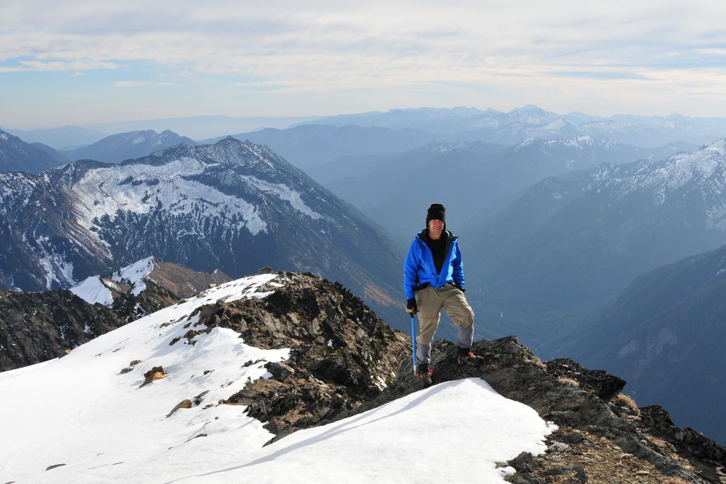
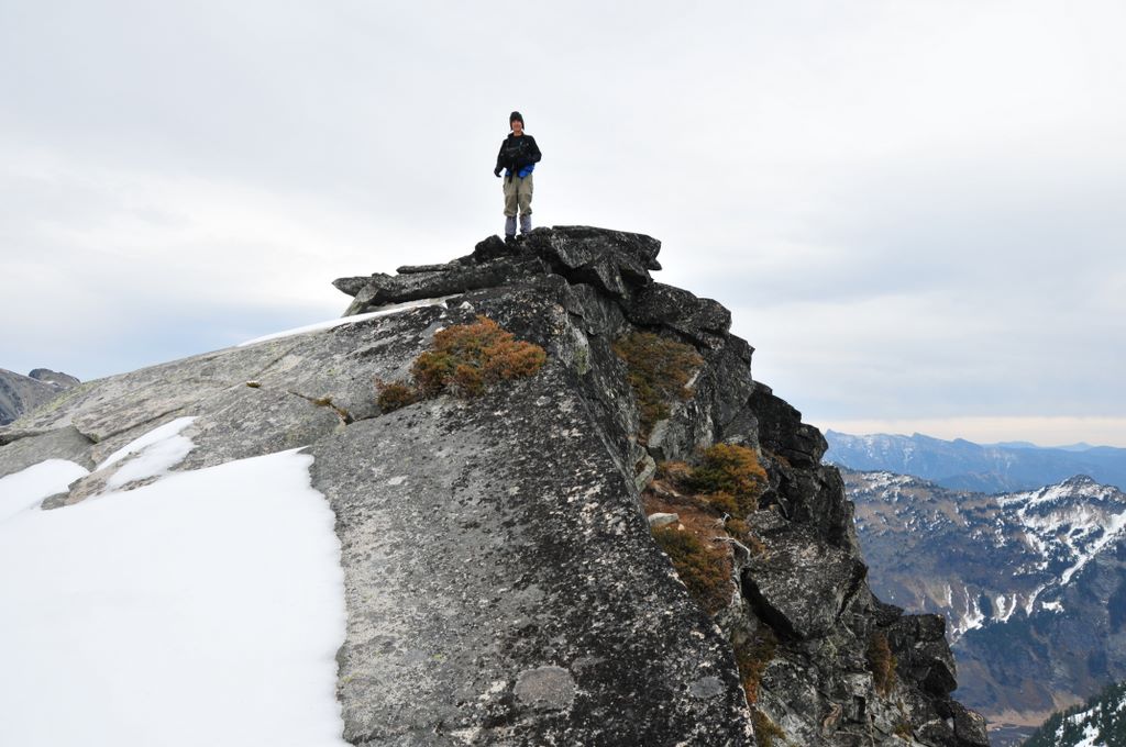
On the south ridge of Clark near the summit, with White River valley behind me
Photos from Clark Mt backpacking trip, October 28-30, 2008
Brianpen...Hiking | Journal | Gallery
Clark Mt Backpack, Oct 28-30 2008 17 / 53 (Start seq 0; Curr file dsc_6064.jpg)
When a window of good weather unexpectedly materialized in late October I took the opportunity to return to an area which has always intrigued me - Clark Mountain and the Napeequa valley. I caught the tail-end of the good weather so couldn't stay as long as I would have liked, but I did make it up Clark. The next day I hiked up to Boulder Pass, then on up to a 7200' high point above Boulder Basin instead of dropping 2000' down into the Napeequa valley. That will have to wait for the next trip. Click here for my account of the trip.
Glacier Peak from the south ridge of Clark Mt
Photos from Clark Mt backpacking trip, October 28-30, 2008
Brianpen...Hiking | Journal | Gallery
Clark Mt Backpack, Oct 28-30 2008 18 / 53 (Start seq 0; Curr file dsc_6092.jpg)
When a window of good weather unexpectedly materialized in late October I took the opportunity to return to an area which has always intrigued me - Clark Mountain and the Napeequa valley. I caught the tail-end of the good weather so couldn't stay as long as I would have liked, but I did make it up Clark. The next day I hiked up to Boulder Pass, then on up to a 7200' high point above Boulder Basin instead of dropping 2000' down into the Napeequa valley. That will have to wait for the next trip. Click here for my account of the trip.
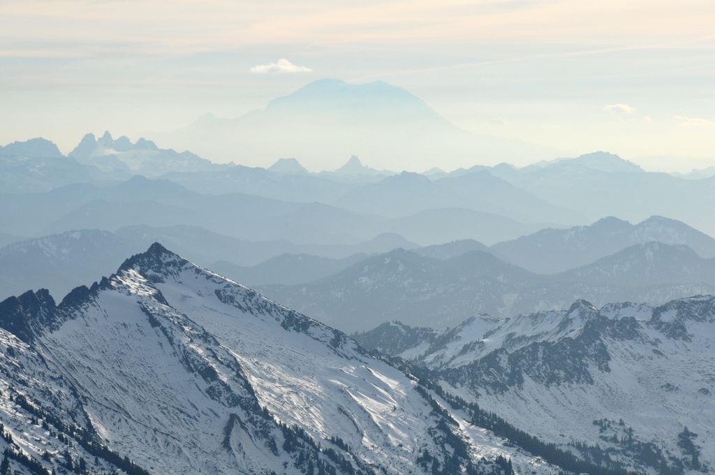
Peaks to the south, Rainier in the center. Whittier Pk in the left foreground.
Photos from Clark Mt backpacking trip, October 28-30, 2008
Brianpen...Hiking | Journal | Gallery
Clark Mt Backpack, Oct 28-30 2008 19 / 53 (Start seq 0; Curr file dsc_6103.jpg)
When a window of good weather unexpectedly materialized in late October I took the opportunity to return to an area which has always intrigued me - Clark Mountain and the Napeequa valley. I caught the tail-end of the good weather so couldn't stay as long as I would have liked, but I did make it up Clark. The next day I hiked up to Boulder Pass, then on up to a 7200' high point above Boulder Basin instead of dropping 2000' down into the Napeequa valley. That will have to wait for the next trip. Click here for my account of the trip.
View southwest from the south slope of Clark. Mt Saul on the left, Indian Head Peak on the right.
Photos from Clark Mt backpacking trip, October 28-30, 2008
Brianpen...Hiking | Journal | Gallery
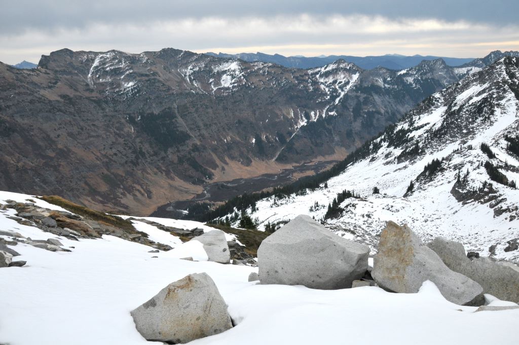
Clark Mt Backpack, Oct 28-30 2008 20 / 53 (Start seq 0; Curr file dsc_6124.jpg)
When a window of good weather unexpectedly materialized in late October I took the opportunity to return to an area which has always intrigued me - Clark Mountain and the Napeequa valley. I caught the tail-end of the good weather so couldn't stay as long as I would have liked, but I did make it up Clark. The next day I hiked up to Boulder Pass, then on up to a 7200' high point above Boulder Basin instead of dropping 2000' down into the Napeequa valley. That will have to wait for the next trip. Click here for my account of the trip.
View south from the southeast shoulder of Clark Mt, over SE ridge, Boulder River and White River valleys
Photos from Clark Mt backpacking trip, October 28-30, 2008
Brianpen...Hiking | Journal | Gallery
Clark Mt Backpack, Oct 28-30 2008 21 / 53 (Start seq 0; Curr file dsc_6291.jpg)
When a window of good weather unexpectedly materialized in late October I took the opportunity to return to an area which has always intrigued me - Clark Mountain and the Napeequa valley. I caught the tail-end of the good weather so couldn't stay as long as I would have liked, but I did make it up Clark. The next day I hiked up to Boulder Pass, then on up to a 7200' high point above Boulder Basin instead of dropping 2000' down into the Napeequa valley. That will have to wait for the next trip. Click here for my account of the trip.
Camp in Boulder Basin the second morning out
Photos from Clark Mt backpacking trip, October 28-30, 2008
Brianpen...Hiking | Journal | Gallery
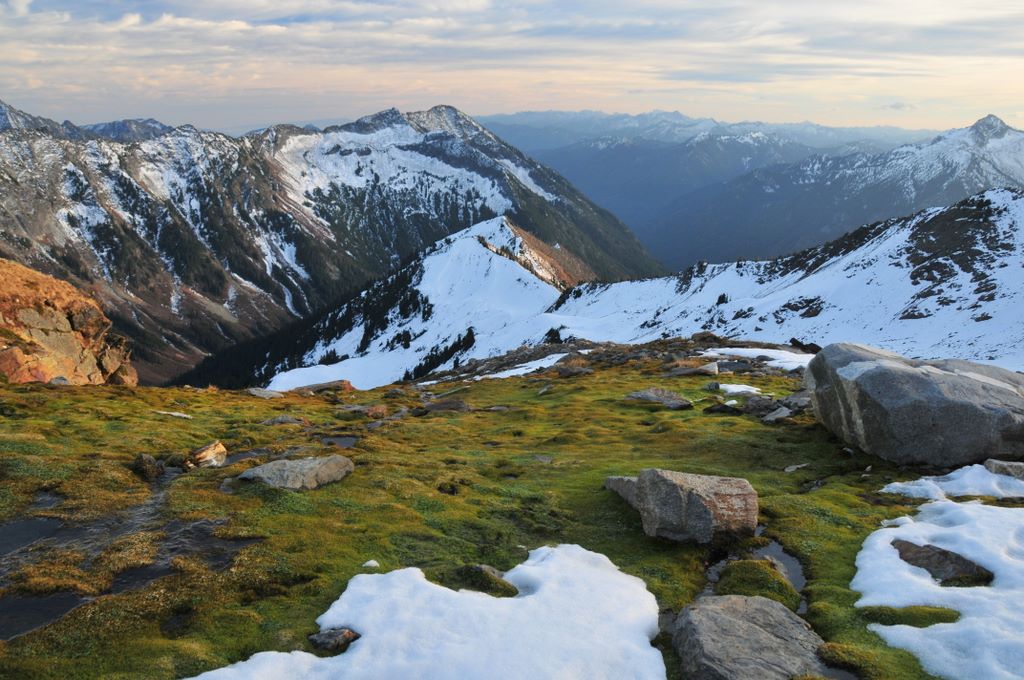
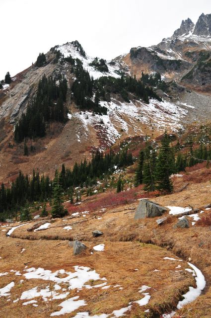
Clark Mt Backpack, Oct 28-30 2008 22 / 53 (Start seq 0; Curr file dsc_6297.jpg)
When a window of good weather unexpectedly materialized in late October I took the opportunity to return to an area which has always intrigued me - Clark Mountain and the Napeequa valley. I caught the tail-end of the good weather so couldn't stay as long as I would have liked, but I did make it up Clark. The next day I hiked up to Boulder Pass, then on up to a 7200' high point above Boulder Basin instead of dropping 2000' down into the Napeequa valley. That will have to wait for the next trip. Click here for my account of the trip.
7200' point (on left) above Boulder Basin
Photos from Clark Mt backpacking trip, October 28-30, 2008
Brianpen...Hiking | Journal | Gallery
Clark Mt Backpack, Oct 28-30 2008 23 / 53 (Start seq 0; Curr file dsc_6154.jpg)
When a window of good weather unexpectedly materialized in late October I took the opportunity to return to an area which has always intrigued me - Clark Mountain and the Napeequa valley. I caught the tail-end of the good weather so couldn't stay as long as I would have liked, but I did make it up Clark. The next day I hiked up to Boulder Pass, then on up to a 7200' high point above Boulder Basin instead of dropping 2000' down into the Napeequa valley. That will have to wait for the next trip. Click here for my account of the trip.
East ridge of Clark above Boulder Basin
Photos from Clark Mt backpacking trip, October 28-30, 2008
Brianpen...Hiking | Journal | Gallery
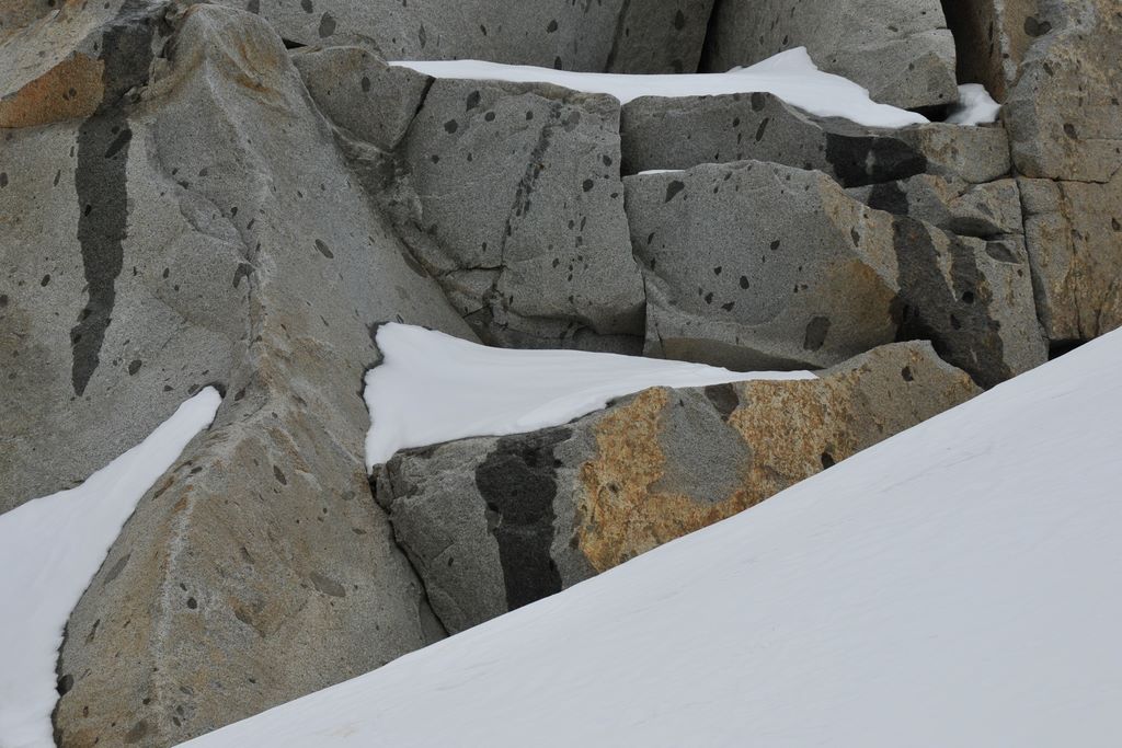
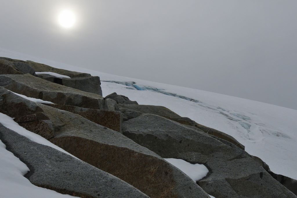
Clark Mt Backpack, Oct 28-30 2008 24 / 53 (Start seq 0; Curr file dsc_6165.jpg)
When a window of good weather unexpectedly materialized in late October I took the opportunity to return to an area which has always intrigued me - Clark Mountain and the Napeequa valley. I caught the tail-end of the good weather so couldn't stay as long as I would have liked, but I did make it up Clark. The next day I hiked up to Boulder Pass, then on up to a 7200' high point above Boulder Basin instead of dropping 2000' down into the Napeequa valley. That will have to wait for the next trip. Click here for my account of the trip.
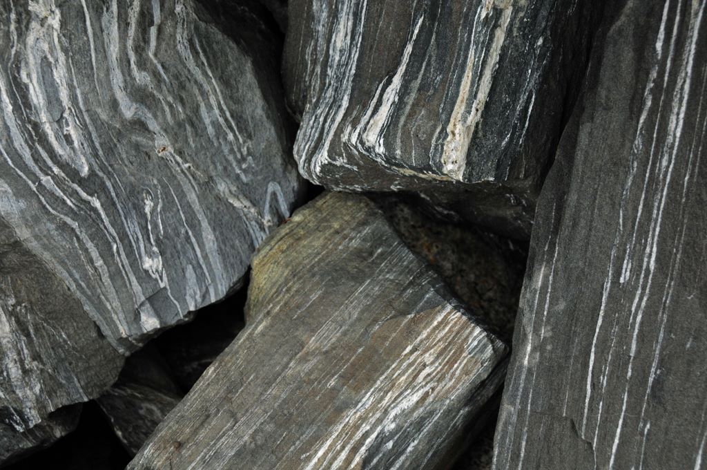
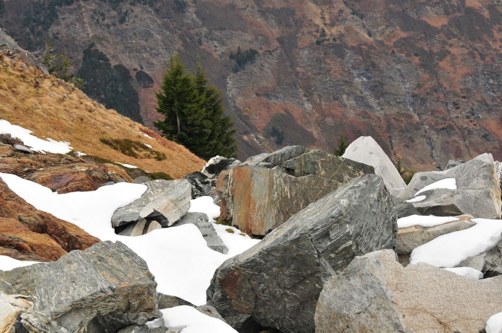
Blocks of schist
Photos from Clark Mt backpacking trip, October 28-30, 2008
Brianpen...Hiking | Journal | Gallery
Clark Mt Backpack, Oct 28-30 2008 25 / 53 (Start seq 0; Curr file dsc_6156.jpg)
When a window of good weather unexpectedly materialized in late October I took the opportunity to return to an area which has always intrigued me - Clark Mountain and the Napeequa valley. I caught the tail-end of the good weather so couldn't stay as long as I would have liked, but I did make it up Clark. The next day I hiked up to Boulder Pass, then on up to a 7200' high point above Boulder Basin instead of dropping 2000' down into the Napeequa valley. That will have to wait for the next trip. Click here for my account of the trip.
View east above Boulder Pass
Photos from Clark Mt backpacking trip, October 28-30, 2008
Brianpen...Hiking | Journal | Gallery
Clark Mt Backpack, Oct 28-30 2008 26 / 53 (Start seq 0; Curr file dsc_6173.jpg)
When a window of good weather unexpectedly materialized in late October I took the opportunity to return to an area which has always intrigued me - Clark Mountain and the Napeequa valley. I caught the tail-end of the good weather so couldn't stay as long as I would have liked, but I did make it up Clark. The next day I hiked up to Boulder Pass, then on up to a 7200' high point above Boulder Basin instead of dropping 2000' down into the Napeequa valley. That will have to wait for the next trip. Click here for my account of the trip.
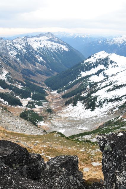
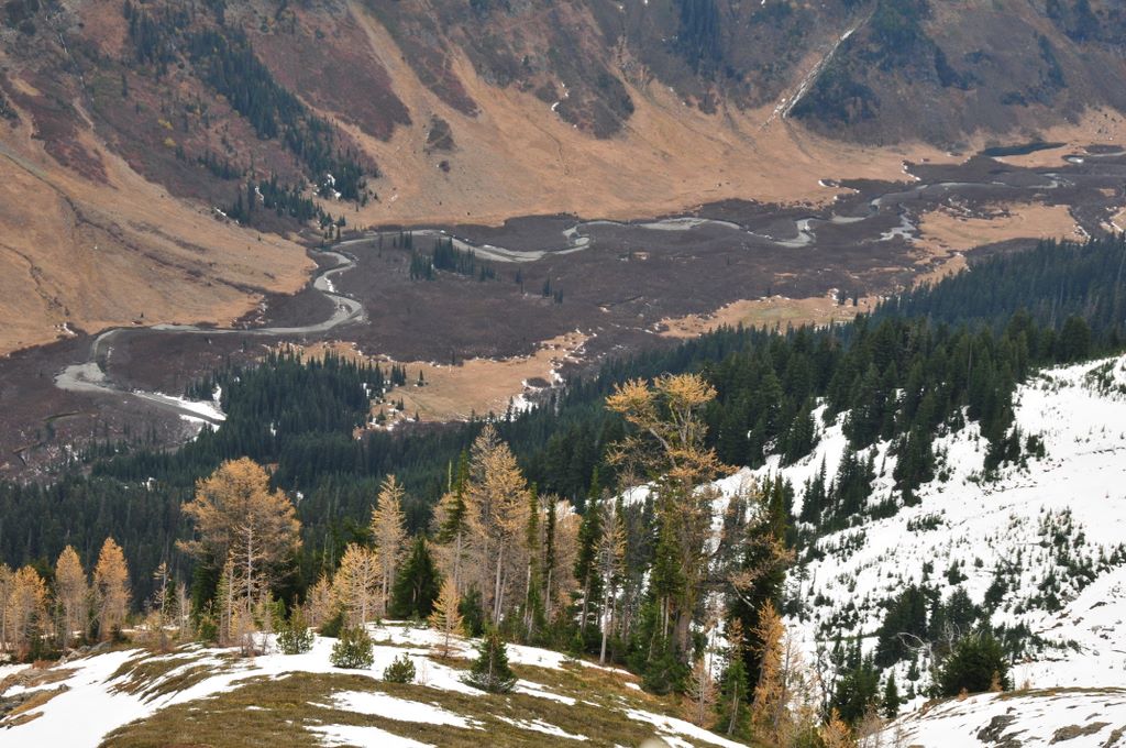
Napeequa Valley. Little Giant Pass is just right of center on the far side of the valley, above the diagonal line of snow. Boulder Pass is on the far right of the photo. Those two passes are the easiest routes into the remote valley.
Photos from Clark Mt backpacking trip, October 28-30, 2008
Brianpen...Hiking | Journal | Gallery
Clark Mt Backpack, Oct 28-30 2008 27 / 53 (Start seq 0; Curr file dsc_6221.jpg)
When a window of good weather unexpectedly materialized in late October I took the opportunity to return to an area which has always intrigued me - Clark Mountain and the Napeequa valley. I caught the tail-end of the good weather so couldn't stay as long as I would have liked, but I did make it up Clark. The next day I hiked up to Boulder Pass, then on up to a 7200' high point above Boulder Basin instead of dropping 2000' down into the Napeequa valley. That will have to wait for the next trip. Click here for my account of the trip.
Granite and snow east of the 7200' point
Photos from Clark Mt backpacking trip, October 28-30, 2008
Brianpen...Hiking | Journal | Gallery
Clark Mt Backpack, Oct 28-30 2008 28 / 53 (Start seq 0; Curr file dsc_6180.jpg)
When a window of good weather unexpectedly materialized in late October I took the opportunity to return to an area which has always intrigued me - Clark Mountain and the Napeequa valley. I caught the tail-end of the good weather so couldn't stay as long as I would have liked, but I did make it up Clark. The next day I hiked up to Boulder Pass, then on up to a 7200' high point above Boulder Basin instead of dropping 2000' down into the Napeequa valley. That will have to wait for the next trip. Click here for my account of the trip.
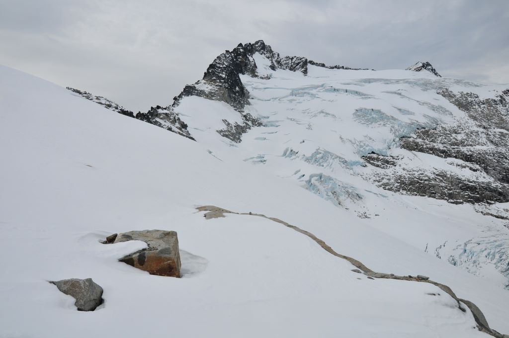
East of the 7200' point, Clark Glacier on the right
Photos from Clark Mt backpacking trip, October 28-30, 2008
Brianpen...Hiking | Journal | Gallery
Clark Mt Backpack, Oct 28-30 2008 29 / 53 (Start seq 0; Curr file dsc_6184.jpg)
When a window of good weather unexpectedly materialized in late October I took the opportunity to return to an area which has always intrigued me - Clark Mountain and the Napeequa valley. I caught the tail-end of the good weather so couldn't stay as long as I would have liked, but I did make it up Clark. The next day I hiked up to Boulder Pass, then on up to a 7200' high point above Boulder Basin instead of dropping 2000' down into the Napeequa valley. That will have to wait for the next trip. Click here for my account of the trip.
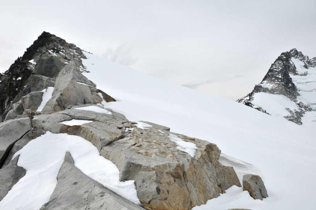
7200' point on the left, crags on the east ridge of Clark on the right
Photos from Clark Mt backpacking trip, October 28-30, 2008
Brianpen...Hiking | Journal | Gallery
Clark Mt Backpack, Oct 28-30 2008 30 / 53 (Start seq 0; Curr file dsc_6187.jpg)
When a window of good weather unexpectedly materialized in late October I took the opportunity to return to an area which has always intrigued me - Clark Mountain and the Napeequa valley. I caught the tail-end of the good weather so couldn't stay as long as I would have liked, but I did make it up Clark. The next day I hiked up to Boulder Pass, then on up to a 7200' high point above Boulder Basin instead of dropping 2000' down into the Napeequa valley. That will have to wait for the next trip. Click here for my account of the trip.
Hiking up to the 7200' point. Buck Mt to the left and behind the craggy ridge
Photos from Clark Mt backpacking trip, October 28-30, 2008
Brianpen...Hiking | Journal | Gallery
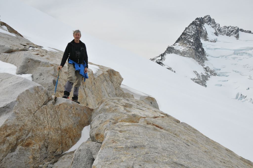
Clark Mt Backpack, Oct 28-30 2008 31 / 53 (Start seq 0; Curr file dsc_6209.jpg)
When a window of good weather unexpectedly materialized in late October I took the opportunity to return to an area which has always intrigued me - Clark Mountain and the Napeequa valley. I caught the tail-end of the good weather so couldn't stay as long as I would have liked, but I did make it up Clark. The next day I hiked up to Boulder Pass, then on up to a 7200' high point above Boulder Basin instead of dropping 2000' down into the Napeequa valley. That will have to wait for the next trip. Click here for my account of the trip.
On top of the 7200' point
Photos from Clark Mt backpacking trip, October 28-30, 2008
Brianpen...Hiking | Journal | Gallery
Clark Mt Backpack, Oct 28-30 2008 32 / 53 (Start seq 0; Curr file dsc_6205.jpg)
When a window of good weather unexpectedly materialized in late October I took the opportunity to return to an area which has always intrigued me - Clark Mountain and the Napeequa valley. I caught the tail-end of the good weather so couldn't stay as long as I would have liked, but I did make it up Clark. The next day I hiked up to Boulder Pass, then on up to a 7200' high point above Boulder Basin instead of dropping 2000' down into the Napeequa valley. That will have to wait for the next trip. Click here for my account of the trip.
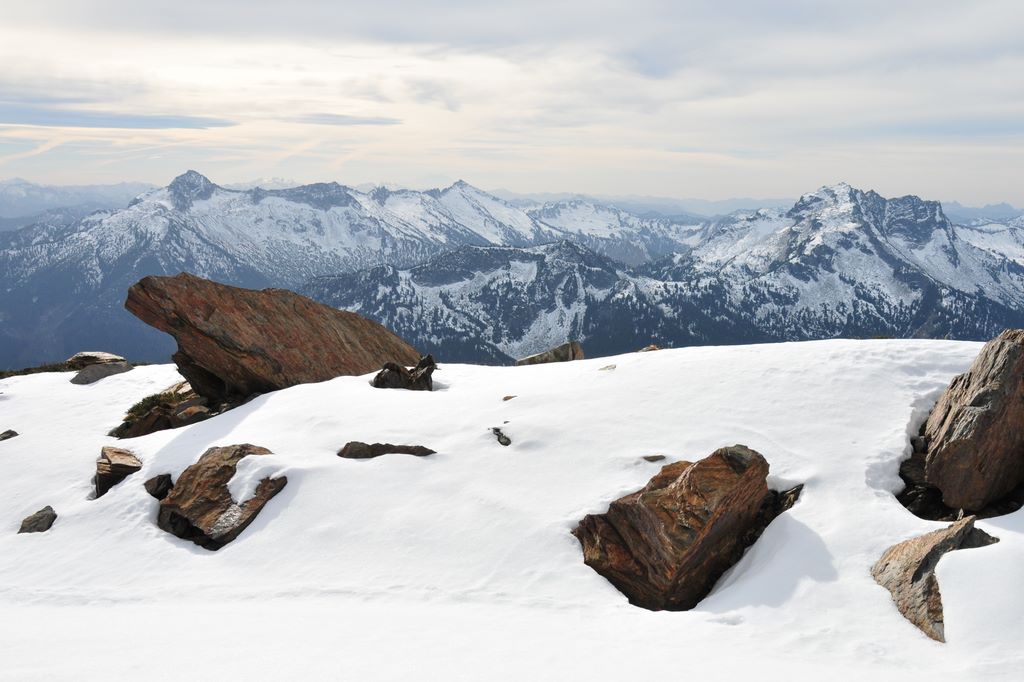
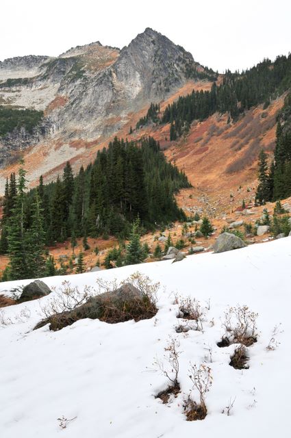
White River mountains south of Boulder Pass
Photos from Clark Mt backpacking trip, October 28-30, 2008
Brianpen...Hiking | Journal | Gallery
Clark Mt Backpack, Oct 28-30 2008 33 / 53 (Start seq 0; Curr file dsc_6194.jpg)
When a window of good weather unexpectedly materialized in late October I took the opportunity to return to an area which has always intrigued me - Clark Mountain and the Napeequa valley. I caught the tail-end of the good weather so couldn't stay as long as I would have liked, but I did make it up Clark. The next day I hiked up to Boulder Pass, then on up to a 7200' high point above Boulder Basin instead of dropping 2000' down into the Napeequa valley. That will have to wait for the next trip. Click here for my account of the trip.
Boulder Basin and Boulder River vallley from 7200' point
Photos from Clark Mt backpacking trip, October 28-30, 2008
Brianpen...Hiking | Journal | Gallery
Clark Mt Backpack, Oct 28-30 2008 34 / 53 (Start seq 0; Curr file dsc_6202.jpg)
When a window of good weather unexpectedly materialized in late October I took the opportunity to return to an area which has always intrigued me - Clark Mountain and the Napeequa valley. I caught the tail-end of the good weather so couldn't stay as long as I would have liked, but I did make it up Clark. The next day I hiked up to Boulder Pass, then on up to a 7200' high point above Boulder Basin instead of dropping 2000' down into the Napeequa valley. That will have to wait for the next trip. Click here for my account of the trip.
Crags on east ridge of Clark above the Clark Glacier
Photos from Clark Mt backpacking trip, October 28-30, 2008
Brianpen...Hiking | Journal | Gallery
Clark Mt Backpack, Oct 28-30 2008 35 / 53 (Start seq 0; Curr file dsc_6213.jpg)
When a window of good weather unexpectedly materialized in late October I took the opportunity to return to an area which has always intrigued me - Clark Mountain and the Napeequa valley. I caught the tail-end of the good weather so couldn't stay as long as I would have liked, but I did make it up Clark. The next day I hiked up to Boulder Pass, then on up to a 7200' high point above Boulder Basin instead of dropping 2000' down into the Napeequa valley. That will have to wait for the next trip. Click here for my account of the trip.
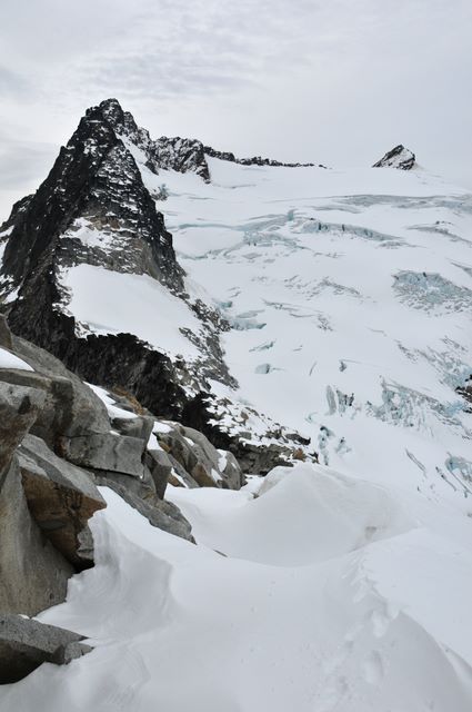
East ridge of Clark, Clark Mt summit at right behind the Clark Glacier
Photos from Clark Mt backpacking trip, October 28-30, 2008
Brianpen...Hiking | Journal | Gallery
Clark Mt Backpack, Oct 28-30 2008 36 / 53 (Start seq 0; Curr file dsc_6224.jpg)
When a window of good weather unexpectedly materialized in late October I took the opportunity to return to an area which has always intrigued me - Clark Mountain and the Napeequa valley. I caught the tail-end of the good weather so couldn't stay as long as I would have liked, but I did make it up Clark. The next day I hiked up to Boulder Pass, then on up to a 7200' high point above Boulder Basin instead of dropping 2000' down into the Napeequa valley. That will have to wait for the next trip. Click here for my account of the trip.
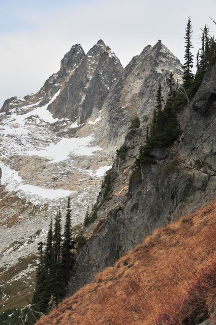
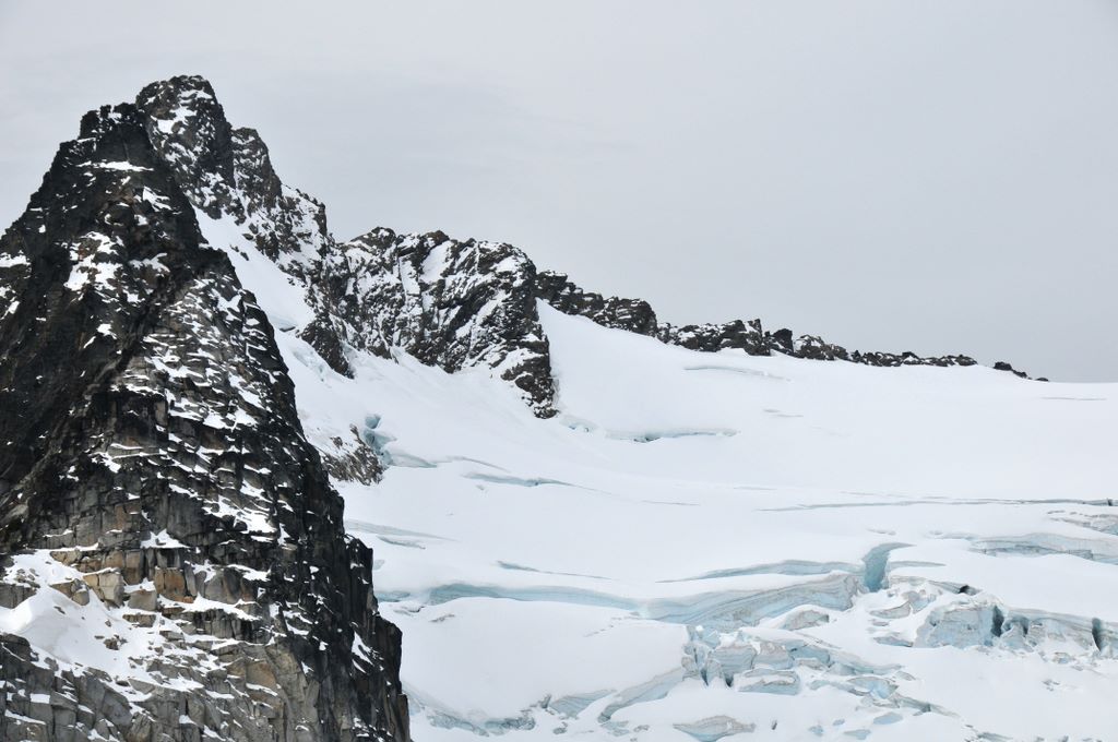
Clark Glacier
Photos from Clark Mt backpacking trip, October 28-30, 2008
Brianpen...Hiking | Journal | Gallery
Clark Mt Backpack, Oct 28-30 2008 37 / 53 (Start seq 0; Curr file dsc_6241.jpg)
When a window of good weather unexpectedly materialized in late October I took the opportunity to return to an area which has always intrigued me - Clark Mountain and the Napeequa valley. I caught the tail-end of the good weather so couldn't stay as long as I would have liked, but I did make it up Clark. The next day I hiked up to Boulder Pass, then on up to a 7200' high point above Boulder Basin instead of dropping 2000' down into the Napeequa valley. That will have to wait for the next trip. Click here for my account of the trip.
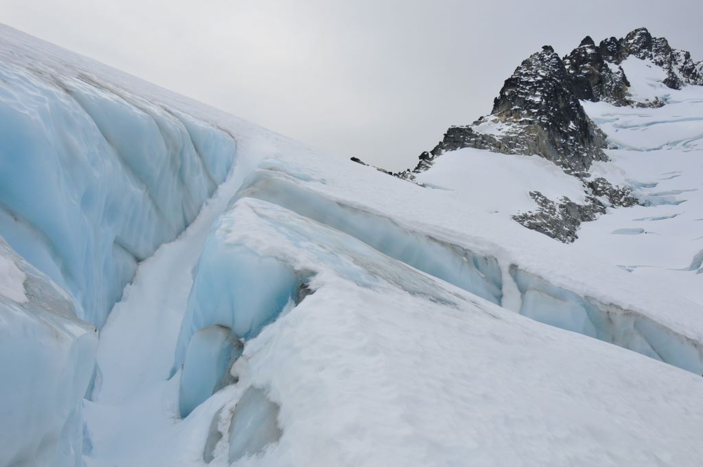
Crevasses in the eastern end of the Clark Glacier
Photos from Clark Mt backpacking trip, October 28-30, 2008
Brianpen...Hiking | Journal | Gallery
Clark Mt Backpack, Oct 28-30 2008 38 / 53 (Start seq 0; Curr file dsc_6229d.jpg)
When a window of good weather unexpectedly materialized in late October I took the opportunity to return to an area which has always intrigued me - Clark Mountain and the Napeequa valley. I caught the tail-end of the good weather so couldn't stay as long as I would have liked, but I did make it up Clark. The next day I hiked up to Boulder Pass, then on up to a 7200' high point above Boulder Basin instead of dropping 2000' down into the Napeequa valley. That will have to wait for the next trip. Click here for my account of the trip.
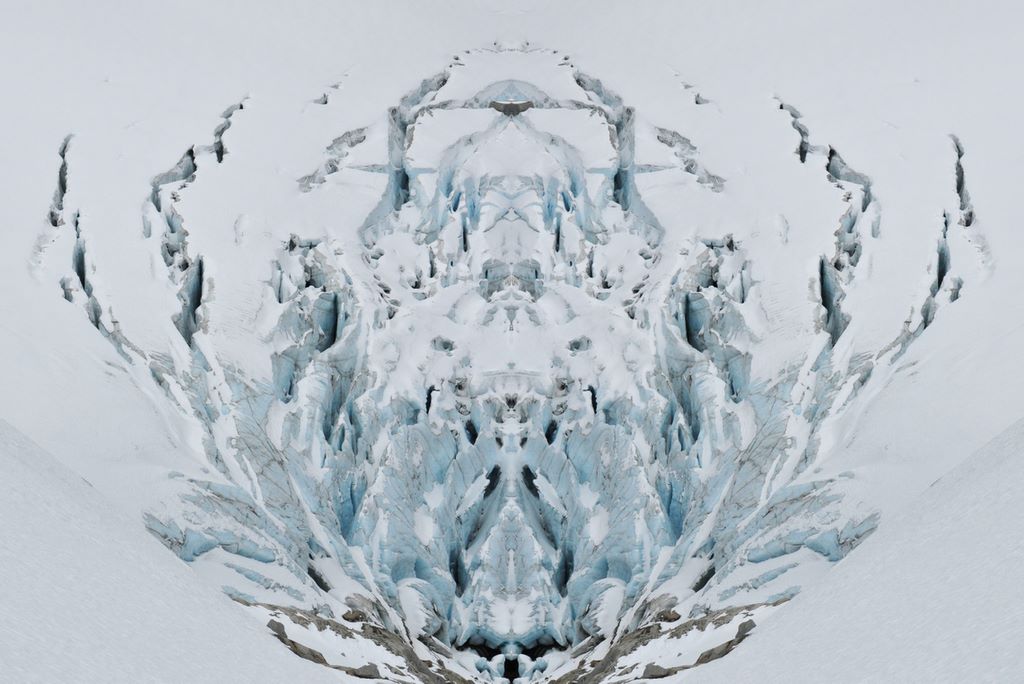
Symmetric crevasses
Photos from Clark Mt backpacking trip, October 28-30, 2008
Brianpen...Hiking | Journal | Gallery
Clark Mt Backpack, Oct 28-30 2008 39 / 53 (Start seq 0; Curr file dsc_6253c1.jpg)
When a window of good weather unexpectedly materialized in late October I took the opportunity to return to an area which has always intrigued me - Clark Mountain and the Napeequa valley. I caught the tail-end of the good weather so couldn't stay as long as I would have liked, but I did make it up Clark. The next day I hiked up to Boulder Pass, then on up to a 7200' high point above Boulder Basin instead of dropping 2000' down into the Napeequa valley. That will have to wait for the next trip. Click here for my account of the trip.
Sun, altostratus, snow and granite
Photos from Clark Mt backpacking trip, October 28-30, 2008
Brianpen...Hiking | Journal | Gallery
Clark Mt Backpack, Oct 28-30 2008 40 / 53 (Start seq 0; Curr file dsc_6277.jpg)
When a window of good weather unexpectedly materialized in late October I took the opportunity to return to an area which has always intrigued me - Clark Mountain and the Napeequa valley. I caught the tail-end of the good weather so couldn't stay as long as I would have liked, but I did make it up Clark. The next day I hiked up to Boulder Pass, then on up to a 7200' high point above Boulder Basin instead of dropping 2000' down into the Napeequa valley. That will have to wait for the next trip. Click here for my account of the trip.
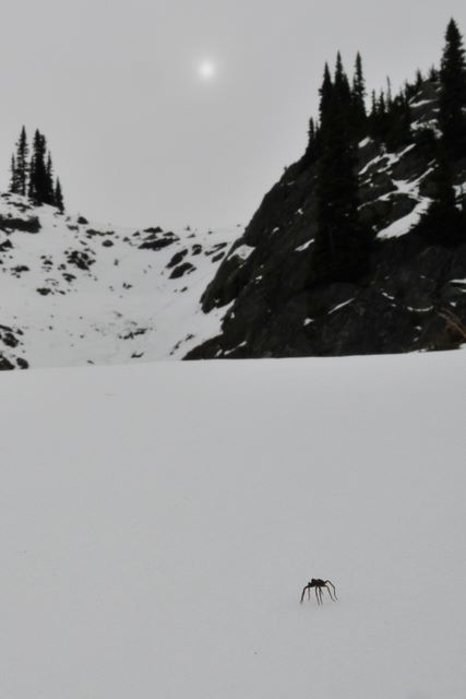
Spider on snowbank below Boulder Pass
Photos from Clark Mt backpacking trip, October 28-30, 2008
Brianpen...Hiking | Journal | Gallery
Clark Mt Backpack, Oct 28-30 2008 41 / 53 (Start seq 0; Curr file dsc_6254.jpg)
When a window of good weather unexpectedly materialized in late October I took the opportunity to return to an area which has always intrigued me - Clark Mountain and the Napeequa valley. I caught the tail-end of the good weather so couldn't stay as long as I would have liked, but I did make it up Clark. The next day I hiked up to Boulder Pass, then on up to a 7200' high point above Boulder Basin instead of dropping 2000' down into the Napeequa valley. That will have to wait for the next trip. Click here for my account of the trip.
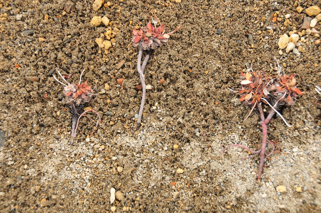
Buckwheats on drift of pumice soil
Photos from Clark Mt backpacking trip, October 28-30, 2008
Brianpen...Hiking | Journal | Gallery
Clark Mt Backpack, Oct 28-30 2008 42 / 53 (Start seq 0; Curr file dsc_6286.jpg)
When a window of good weather unexpectedly materialized in late October I took the opportunity to return to an area which has always intrigued me - Clark Mountain and the Napeequa valley. I caught the tail-end of the good weather so couldn't stay as long as I would have liked, but I did make it up Clark. The next day I hiked up to Boulder Pass, then on up to a 7200' high point above Boulder Basin instead of dropping 2000' down into the Napeequa valley. That will have to wait for the next trip. Click here for my account of the trip.
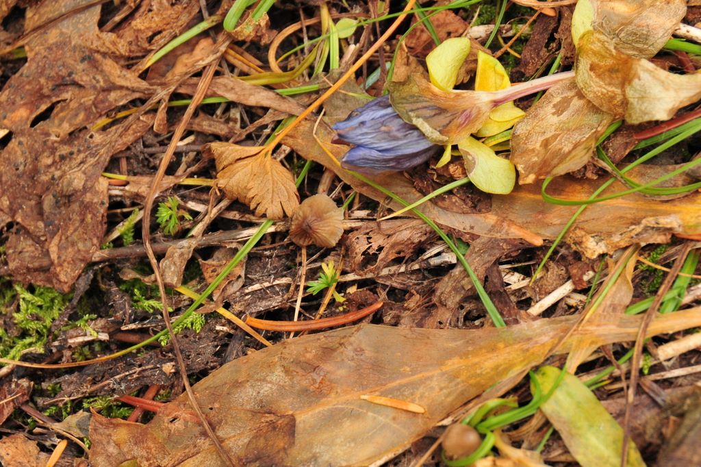
Gentian and late fall foliage
Photos from Clark Mt backpacking trip, October 28-30, 2008
Brianpen...Hiking | Journal | Gallery
Clark Mt Backpack, Oct 28-30 2008 43 / 53 (Start seq 0; Curr file dsc_6263.jpg)
When a window of good weather unexpectedly materialized in late October I took the opportunity to return to an area which has always intrigued me - Clark Mountain and the Napeequa valley. I caught the tail-end of the good weather so couldn't stay as long as I would have liked, but I did make it up Clark. The next day I hiked up to Boulder Pass, then on up to a 7200' high point above Boulder Basin instead of dropping 2000' down into the Napeequa valley. That will have to wait for the next trip. Click here for my account of the trip.
Napeequa River below Boulder Pass
Photos from Clark Mt backpacking trip, October 28-30, 2008
Brianpen...Hiking | Journal | Gallery
Clark Mt Backpack, Oct 28-30 2008 44 / 53 (Start seq 0; Curr file dsc_6274.jpg)
When a window of good weather unexpectedly materialized in late October I took the opportunity to return to an area which has always intrigued me - Clark Mountain and the Napeequa valley. I caught the tail-end of the good weather so couldn't stay as long as I would have liked, but I did make it up Clark. The next day I hiked up to Boulder Pass, then on up to a 7200' high point above Boulder Basin instead of dropping 2000' down into the Napeequa valley. That will have to wait for the next trip. Click here for my account of the trip.
Boulders below Boulder Pass
Photos from Clark Mt backpacking trip, October 28-30, 2008
Brianpen...Hiking | Journal | Gallery
Clark Mt Backpack, Oct 28-30 2008 45 / 53 (Start seq 0; Curr file dsc_6020.jpg)
When a window of good weather unexpectedly materialized in late October I took the opportunity to return to an area which has always intrigued me - Clark Mountain and the Napeequa valley. I caught the tail-end of the good weather so couldn't stay as long as I would have liked, but I did make it up Clark. The next day I hiked up to Boulder Pass, then on up to a 7200' high point above Boulder Basin instead of dropping 2000' down into the Napeequa valley. That will have to wait for the next trip. Click here for my account of the trip.
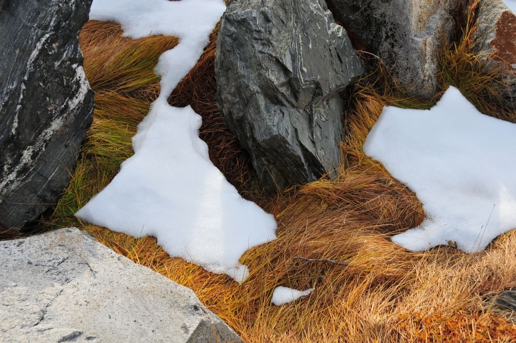
Grass, rocks and snow in Boulder Basin
Photos from Clark Mt backpacking trip, October 28-30, 2008
Brianpen...Hiking | Journal | Gallery
Clark Mt Backpack, Oct 28-30 2008 46 / 53 (Start seq 0; Curr file dsc_6293.jpg)
When a window of good weather unexpectedly materialized in late October I took the opportunity to return to an area which has always intrigued me - Clark Mountain and the Napeequa valley. I caught the tail-end of the good weather so couldn't stay as long as I would have liked, but I did make it up Clark. The next day I hiked up to Boulder Pass, then on up to a 7200' high point above Boulder Basin instead of dropping 2000' down into the Napeequa valley. That will have to wait for the next trip. Click here for my account of the trip.
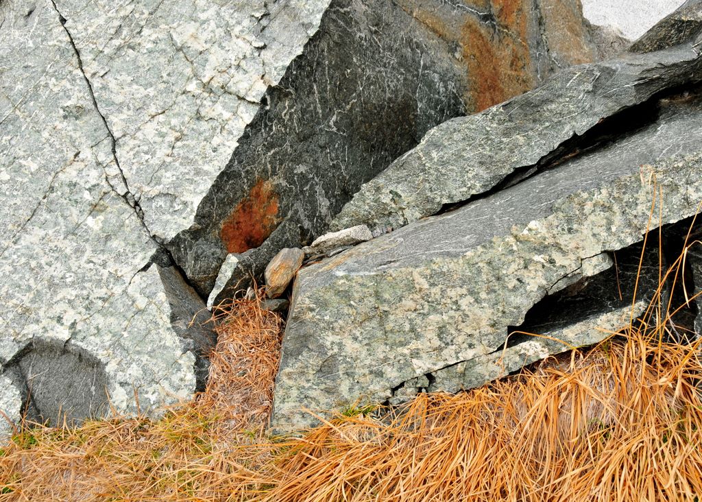
Fractured boulder in Boulder Basin
Photos from Clark Mt backpacking trip, October 28-30, 2008
Brianpen...Hiking | Journal | Gallery
Clark Mt Backpack, Oct 28-30 2008 47 / 53 (Start seq 0; Curr file dsc_6296.jpg)
When a window of good weather unexpectedly materialized in late October I took the opportunity to return to an area which has always intrigued me - Clark Mountain and the Napeequa valley. I caught the tail-end of the good weather so couldn't stay as long as I would have liked, but I did make it up Clark. The next day I hiked up to Boulder Pass, then on up to a 7200' high point above Boulder Basin instead of dropping 2000' down into the Napeequa valley. That will have to wait for the next trip. Click here for my account of the trip.
Boulder River trail below Boulder Basin
Photos from Clark Mt backpacking trip, October 28-30, 2008
Brianpen...Hiking | Journal | Gallery
Clark Mt Backpack, Oct 28-30 2008 48 / 53 (Start seq 0; Curr file dsc_6294.jpg)
When a window of good weather unexpectedly materialized in late October I took the opportunity to return to an area which has always intrigued me - Clark Mountain and the Napeequa valley. I caught the tail-end of the good weather so couldn't stay as long as I would have liked, but I did make it up Clark. The next day I hiked up to Boulder Pass, then on up to a 7200' high point above Boulder Basin instead of dropping 2000' down into the Napeequa valley. That will have to wait for the next trip. Click here for my account of the trip.
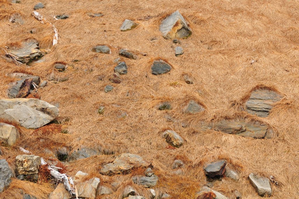
Rocks on sedge meadow slope in Boulder Basin
Photos from Clark Mt backpacking trip, October 28-30, 2008
Brianpen...Hiking | Journal | Gallery
Clark Mt Backpack, Oct 28-30 2008 49 / 53 (Start seq 0; Curr file dsc_6304.jpg)
When a window of good weather unexpectedly materialized in late October I took the opportunity to return to an area which has always intrigued me - Clark Mountain and the Napeequa valley. I caught the tail-end of the good weather so couldn't stay as long as I would have liked, but I did make it up Clark. The next day I hiked up to Boulder Pass, then on up to a 7200' high point above Boulder Basin instead of dropping 2000' down into the Napeequa valley. That will have to wait for the next trip. Click here for my account of the trip.
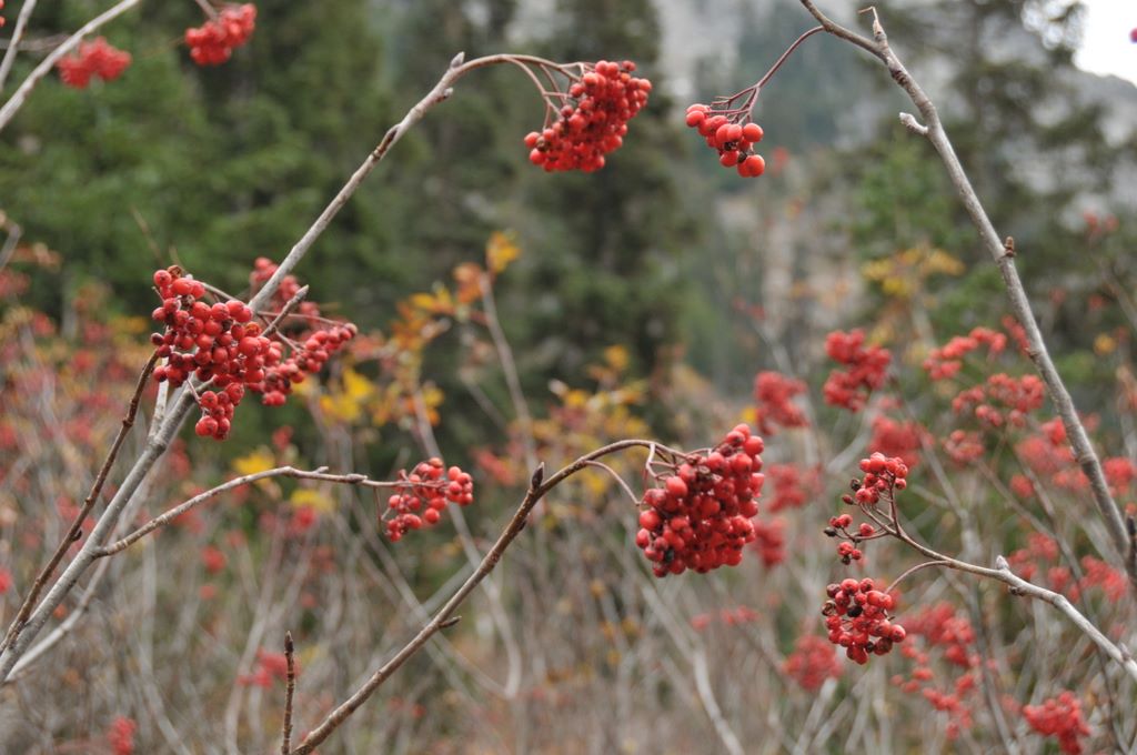
Mountain ash berries along Boulder River trail
Photos from Clark Mt backpacking trip, October 28-30, 2008
Brianpen...Hiking | Journal | Gallery
Clark Mt Backpack, Oct 28-30 2008 50 / 53 (Start seq 0; Curr file dsc_6312.jpg)
When a window of good weather unexpectedly materialized in late October I took the opportunity to return to an area which has always intrigued me - Clark Mountain and the Napeequa valley. I caught the tail-end of the good weather so couldn't stay as long as I would have liked, but I did make it up Clark. The next day I hiked up to Boulder Pass, then on up to a 7200' high point above Boulder Basin instead of dropping 2000' down into the Napeequa valley. That will have to wait for the next trip. Click here for my account of the trip.
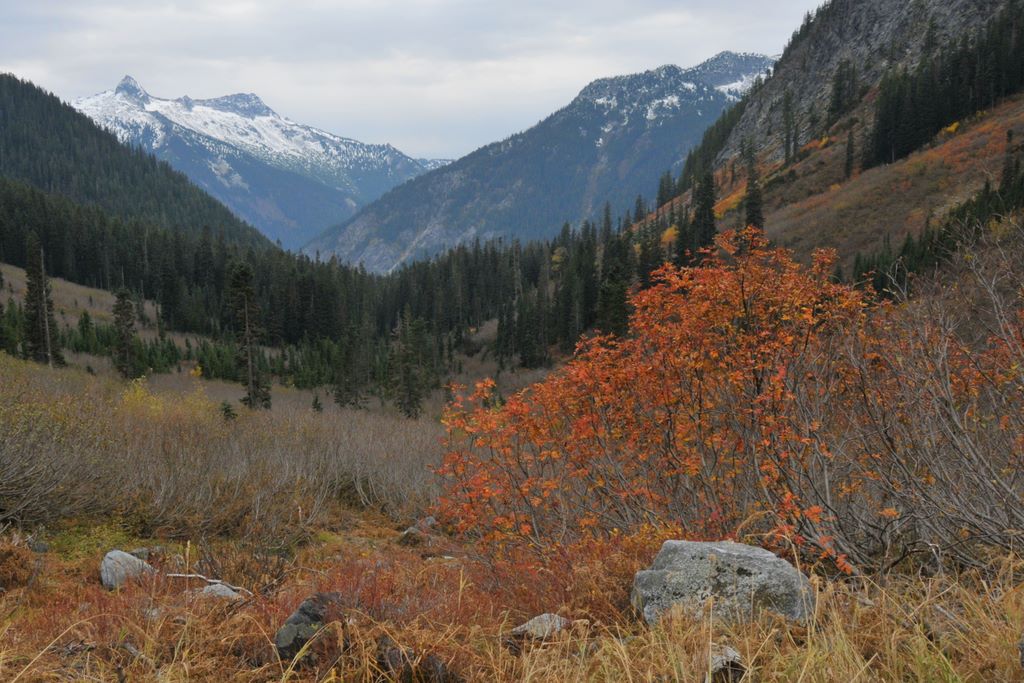
Mt Ash and Slide Alder in Boulder River valley, Mt David at upper right
Photos from Clark Mt backpacking trip, October 28-30, 2008
Brianpen...Hiking | Journal | Gallery
Clark Mt Backpack, Oct 28-30 2008 51 / 53 (Start seq 0; Curr file dsc_6317.jpg)
When a window of good weather unexpectedly materialized in late October I took the opportunity to return to an area which has always intrigued me - Clark Mountain and the Napeequa valley. I caught the tail-end of the good weather so couldn't stay as long as I would have liked, but I did make it up Clark. The next day I hiked up to Boulder Pass, then on up to a 7200' high point above Boulder Basin instead of dropping 2000' down into the Napeequa valley. That will have to wait for the next trip. Click here for my account of the trip.
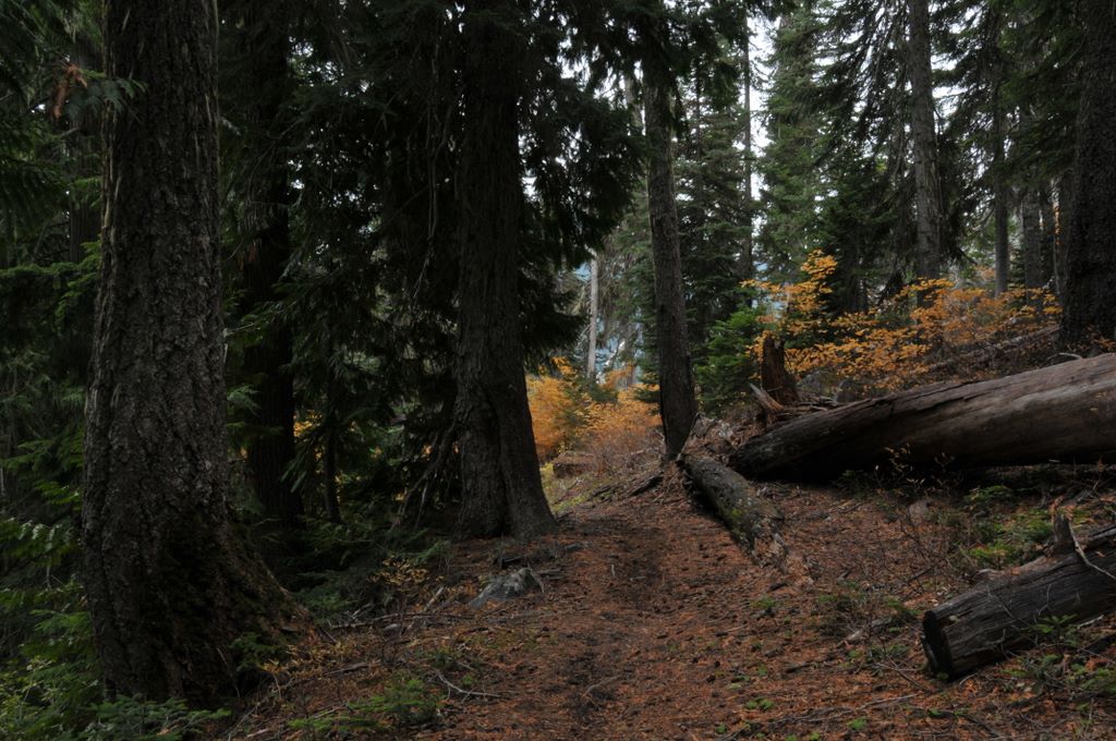
Forest in Boulder River valley, around 4000'
Photos from Clark Mt backpacking trip, October 28-30, 2008
Brianpen...Hiking | Journal | Gallery
Clark Mt Backpack, Oct 28-30 2008 52 / 53 (Start seq 0; Curr file dsc_6318.jpg)
When a window of good weather unexpectedly materialized in late October I took the opportunity to return to an area which has always intrigued me - Clark Mountain and the Napeequa valley. I caught the tail-end of the good weather so couldn't stay as long as I would have liked, but I did make it up Clark. The next day I hiked up to Boulder Pass, then on up to a 7200' high point above Boulder Basin instead of dropping 2000' down into the Napeequa valley. That will have to wait for the next trip. Click here for my account of the trip.
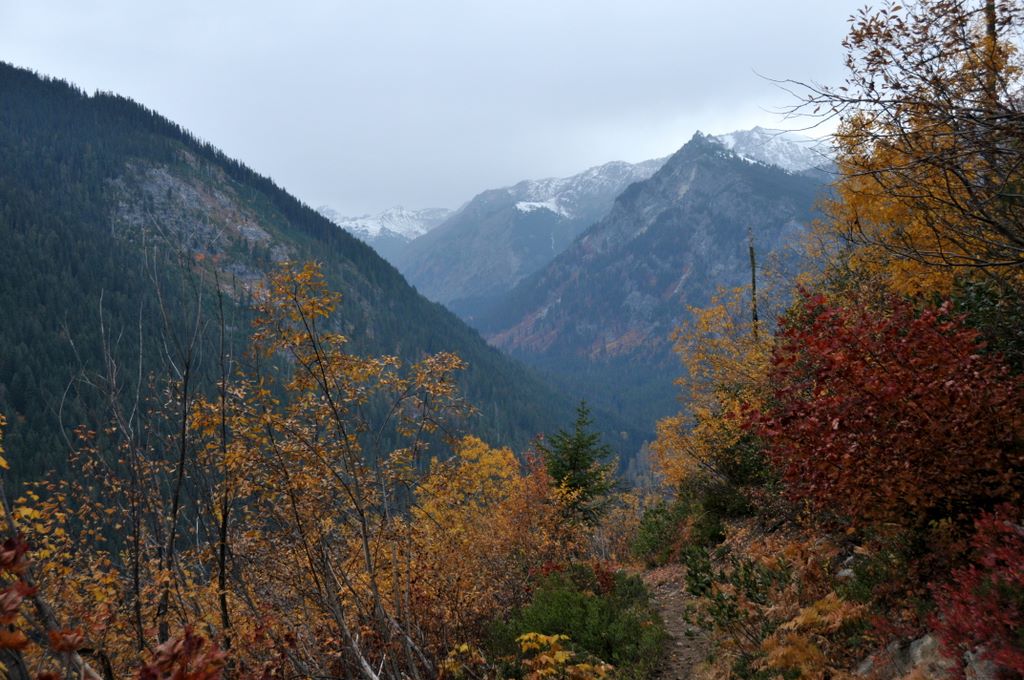
Late foliage along the Boulder River trail
Photos from Clark Mt backpacking trip, October 28-30, 2008
Brianpen...Hiking | Journal | Gallery
Clark Mt Backpack, Oct 28-30 2008 53 / 53 (Start seq 0; Curr file dsc_6316.jpg)
When a window of good weather unexpectedly materialized in late October I took the opportunity to return to an area which has always intrigued me - Clark Mountain and the Napeequa valley. I caught the tail-end of the good weather so couldn't stay as long as I would have liked, but I did make it up Clark. The next day I hiked up to Boulder Pass, then on up to a 7200' high point above Boulder Basin instead of dropping 2000' down into the Napeequa valley. That will have to wait for the next trip. Click here for my account of the trip.
Forest along the Boulder River trail